
Tarbes (Tarbes)

- commune in Hautes-Pyrénées, France
- Country:

- Postal Code: 65000
- Coordinates: 43° 13' 58" N, 0° 4' 28" E


- GPS tracks (wikiloc): [Link]
- Area: 15.33 sq km
- Population: 40593
- Web site: http://www.tarbes.fr
- Wikipedia en: wiki(en)
- Wikipedia: wiki(fr)
- Wikidata storage: Wikidata: Q184023
- Wikipedia Commons Gallery: [Link]
- Wikipedia Commons Category: [Link]
- Freebase ID: [/m/02lvdw]
- Freebase ID: [/m/02lvdw]
- Freebase ID: [/m/02lvdw]
- Freebase ID: [/m/02lvdw]
- Freebase ID: [/m/02lvdw]
- Freebase ID: [/m/02lvdw]
- GeoNames ID: Alt: [2973385]
- GeoNames ID: Alt: [2973385]
- GeoNames ID: Alt: [2973385]
- GeoNames ID: Alt: [2973385]
- GeoNames ID: Alt: [2973385]
- GeoNames ID: Alt: [2973385]
- SIREN number: [216504407]
- SIREN number: [216504407]
- SIREN number: [216504407]
- SIREN number: [216504407]
- SIREN number: [216504407]
- SIREN number: [216504407]
- BnF ID: [15241009c]
- BnF ID: [15241009c]
- BnF ID: [15241009c]
- BnF ID: [15241009c]
- BnF ID: [15241009c]
- BnF ID: [15241009c]
- VIAF ID: Alt: [123155681]
- VIAF ID: Alt: [123155681]
- VIAF ID: Alt: [123155681]
- VIAF ID: Alt: [123155681]
- VIAF ID: Alt: [123155681]
- VIAF ID: Alt: [123155681]
- GND ID: Alt: [4117166-4]
- GND ID: Alt: [4117166-4]
- GND ID: Alt: [4117166-4]
- GND ID: Alt: [4117166-4]
- GND ID: Alt: [4117166-4]
- GND ID: Alt: [4117166-4]
- Library of Congress authority ID: Alt: [n80104549]
- Library of Congress authority ID: Alt: [n80104549]
- Library of Congress authority ID: Alt: [n80104549]
- Library of Congress authority ID: Alt: [n80104549]
- Library of Congress authority ID: Alt: [n80104549]
- Library of Congress authority ID: Alt: [n80104549]
- PACTOLS thesaurus ID: [pcrt0IM6c8jjWn]
- PACTOLS thesaurus ID: [pcrt0IM6c8jjWn]
- PACTOLS thesaurus ID: [pcrt0IM6c8jjWn]
- PACTOLS thesaurus ID: [pcrt0IM6c8jjWn]
- PACTOLS thesaurus ID: [pcrt0IM6c8jjWn]
- PACTOLS thesaurus ID: [pcrt0IM6c8jjWn]
- MusicBrainz area ID: [47323edc-ff1e-4d2e-95c2-15d2f3230004]
- MusicBrainz area ID: [47323edc-ff1e-4d2e-95c2-15d2f3230004]
- MusicBrainz area ID: [47323edc-ff1e-4d2e-95c2-15d2f3230004]
- MusicBrainz area ID: [47323edc-ff1e-4d2e-95c2-15d2f3230004]
- MusicBrainz area ID: [47323edc-ff1e-4d2e-95c2-15d2f3230004]
- MusicBrainz area ID: [47323edc-ff1e-4d2e-95c2-15d2f3230004]
- Quora topic ID: [Tarbes]
- Quora topic ID: [Tarbes]
- Quora topic ID: [Tarbes]
- Quora topic ID: [Tarbes]
- Quora topic ID: [Tarbes]
- Quora topic ID: [Tarbes]
- SUDOC authorities ID: [059821388]
- SUDOC authorities ID: [059821388]
- SUDOC authorities ID: [059821388]
- SUDOC authorities ID: [059821388]
- SUDOC authorities ID: [059821388]
- SUDOC authorities ID: [059821388]
- Encyclopædia Britannica Online ID: [place/Tarbes]
- Encyclopædia Britannica Online ID: [place/Tarbes]
- Encyclopædia Britannica Online ID: [place/Tarbes]
- Encyclopædia Britannica Online ID: [place/Tarbes]
- Encyclopædia Britannica Online ID: [place/Tarbes]
- Encyclopædia Britannica Online ID: [place/Tarbes]
- Encyclopædia Universalis ID: [tarbes]
- Encyclopædia Universalis ID: [tarbes]
- Encyclopædia Universalis ID: [tarbes]
- Encyclopædia Universalis ID: [tarbes]
- Encyclopædia Universalis ID: [tarbes]
- Encyclopædia Universalis ID: [tarbes]
- Digital Atlas of the Roman Empire ID: [396]
- Digital Atlas of the Roman Empire ID: [396]
- Digital Atlas of the Roman Empire ID: [396]
- Digital Atlas of the Roman Empire ID: [396]
- Digital Atlas of the Roman Empire ID: [396]
- Digital Atlas of the Roman Empire ID: [396]
- INSEE municipality code: 65440
- INSEE municipality code: 65440
- INSEE municipality code: 65440
- INSEE municipality code: 65440
- INSEE municipality code: 65440
- INSEE municipality code: 65440
Shares border with regions:


Bours
- commune in Hautes-Pyrénées, France
- Country:
- Postal Code: 65460
- Coordinates: 43° 16' 35" N, 0° 5' 37" E
- GPS tracks (wikiloc): [Link]
- Area: 4.68 sq km
- Population: 800
- Web site: [Link]


Bordères-sur-l'Échez
- commune in Hautes-Pyrénées, France
- Country:
- Postal Code: 65320
- Coordinates: 43° 15' 33" N, 0° 2' 57" E
- GPS tracks (wikiloc): [Link]
- Area: 15.95 sq km
- Population: 5015
- Web site: [Link]


Séméac
- commune in Hautes-Pyrénées, France
- Country:
- Postal Code: 65600
- Coordinates: 43° 13' 41" N, 0° 6' 24" E
- GPS tracks (wikiloc): [Link]
- Area: 6.29 sq km
- Population: 4893
- Web site: [Link]


Juillan
- commune in Hautes-Pyrénées, France
- Country:
- Postal Code: 65290
- Coordinates: 43° 12' 5" N, 0° 1' 24" E
- GPS tracks (wikiloc): [Link]
- Area: 8.2 sq km
- Population: 4139
- Web site: [Link]

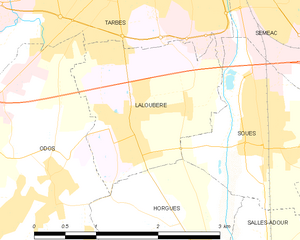
Laloubère
- commune in Hautes-Pyrénées, France
- Country:
- Postal Code: 65310
- Coordinates: 43° 12' 24" N, 0° 4' 22" E
- GPS tracks (wikiloc): [Link]
- Area: 4.05 sq km
- Population: 1902
- Web site: [Link]


Ibos
- commune in Hautes-Pyrénées, France
- Country:
- Postal Code: 65420
- Coordinates: 43° 13' 59" N, 0° 0' 6" E
- GPS tracks (wikiloc): [Link]
- AboveSeaLevel: 321 м m
- Area: 32.88 sq km
- Population: 2887
- Web site: [Link]


Soues
- commune in Hautes-Pyrénées, France
- Country:
- Postal Code: 65430
- Coordinates: 43° 12' 18" N, 0° 5' 57" E
- GPS tracks (wikiloc): [Link]
- Area: 3.9 sq km
- Population: 3048
- Web site: [Link]


Aureilhan
- commune in Hautes-Pyrénées, France
- Country:
- Postal Code: 65800
- Coordinates: 43° 14' 38" N, 0° 5' 48" E
- GPS tracks (wikiloc): [Link]
- Area: 9.44 sq km
- Population: 7831


Odos
- commune in Hautes-Pyrénées, France
- Country:
- Postal Code: 65310
- Coordinates: 43° 11' 45" N, 0° 3' 28" E
- GPS tracks (wikiloc): [Link]
- Area: 8.77 sq km
- Population: 3201
- Web site: [Link]


Andrest
- commune in Hautes-Pyrénées, France
- Country:
- Postal Code: 65390
- Coordinates: 43° 19' 0" N, 0° 3' 40" E
- GPS tracks (wikiloc): [Link]
- AboveSeaLevel: 254 м m
- Area: 6.19 sq km
- Population: 1402