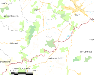
Tazilly (Tazilly)
- commune in Nièvre, France
- Country:

- Postal Code: 58170
- Coordinates: 46° 45' 57" N, 3° 54' 52" E


- GPS tracks (wikiloc): [Link]
- Area: 25.81 sq km
- Population: 215
- Wikipedia en: wiki(en)
- Wikipedia: wiki(fr)
- Wikidata storage: Wikidata: Q33865
- Wikipedia Commons Category: [Link]
- Freebase ID: [/m/03qfg0g]
- GeoNames ID: Alt: [6438105]
- SIREN number: [215802877]
- BnF ID: [15266552h]
- PACTOLS thesaurus ID: [pcrt60R7m1egGj]
- INSEE municipality code: 58287
Shares border with regions:


Cressy-sur-Somme
- commune in Saône-et-Loire, France
- Country:

- Postal Code: 71760
- Coordinates: 46° 41' 41" N, 3° 52' 5" E


- GPS tracks (wikiloc): [Link]
- Area: 28.13 sq km
- Population: 190


Marly-sous-Issy
- commune in Saône-et-Loire, France
- Country:

- Postal Code: 71760
- Coordinates: 46° 43' 20" N, 3° 55' 42" E


- GPS tracks (wikiloc): [Link]
- Area: 21.42 sq km
- Population: 89
Savigny-Poil-Fol
- commune in Nièvre, France
- Country:

- Postal Code: 58170
- Coordinates: 46° 46' 55" N, 3° 51' 29" E


- GPS tracks (wikiloc): [Link]
- Area: 17.3 sq km
- Population: 128


Ternant
- commune in Nièvre, France
- Country:

- Postal Code: 58250
- Coordinates: 46° 45' 1" N, 3° 50' 20" E


- GPS tracks (wikiloc): [Link]
- AboveSeaLevel: 280 м m
- Area: 19.38 sq km
- Population: 203


Luzy
- commune in Nièvre, France
- Country:

- Postal Code: 58170
- Coordinates: 46° 47' 22" N, 3° 58' 12" E


- GPS tracks (wikiloc): [Link]
- Area: 41.67 sq km
- Population: 1981
- Web site: [Link]
Fléty
- commune in Nièvre, France
- Country:

- Postal Code: 58170
- Coordinates: 46° 47' 24" N, 3° 54' 12" E


- GPS tracks (wikiloc): [Link]
- Area: 20.06 sq km
- Population: 108
