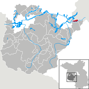
Teltow (Teltow)


- town in Brandenburg, Germany
 Hiking in Teltow
Teltow is a charming town located in the state of Brandenburg, Germany, just south of Berlin. It offers several opportunities for hiking and outdoor activities, thanks to its scenic landscapes and proximity to various natural reserves and parks. Here are some highlights for hiking in the Teltow area:
Hiking Trails
-
Teltow Canal Trail: This scenic trail follows the Teltow Canal and is perfect for both walking and cycling. It offers beautiful views along the waterway, and you can enjoy the serene atmosphere with plenty of spots for a break.
-
Paths through the Teltow Forest: The nearby Teltow Forest (Teltower Forst) features numerous trails that wind through lush woods. This area is perfect for nature lovers, offering an opportunity to observe diverse wildlife and plant species.
-
Landschaftspark Teltow: This park features well-maintained paths and serves as a perfect place for leisurely hikes. It combines nature with art installations, making your hike both scenic and culturally enriching.
Nearby Nature Reserves
-
Potsdam Forest and Havel River Region: A short distance from Teltow, this area provides extensive hiking opportunities with its winding paths alongside the river, offering picturesque views and a variety of flora and fauna.
-
Zeesen Lake: Located just a few kilometers away, this area is a great spot for hiking and enjoying the lakeside scenery. Moving through this area, you'll find peaceful trails and the chance to spot local wildlife.
Tips for Hiking in Teltow
- Best Time to Visit: Late spring and early autumn are ideal times for hiking, as the weather is generally pleasant, and you can enjoy vibrant foliage.
- Preparation: Always wear appropriate footwear and clothing, and carry plenty of water, snacks, and a map or navigation device.
- Local Amenities: Teltow has several cafes and restaurants where you can rest and enjoy local cuisine after a hike.
- Respect Nature: Follow Leave No Trace principles by not littering and being mindful of wildlife.
With its combination of natural beauty and accessible trails, Teltow is a wonderful destination for hiking enthusiasts of all levels. Enjoy your hiking adventure!
- Country:

- Postal Code: 14513
- Local Dialing Code: 03328
- Coordinates: 52° 24' 8" N, 13° 16' 14" E


- GPS tracks (wikiloc): [Link]
- AboveSeaLevel: 39 м m
- Area: 21.54 sq km
- Population: 25761
- Web site: https://www.teltow.de/
- Wikipedia en: wiki(en)
- Wikipedia: wiki(de)
- Wikidata storage: Wikidata: Q572512
- Wikipedia Commons Gallery: [Link]
- Wikipedia Commons Category: [Link]
- Freebase ID: [/m/0dml26]
- GeoNames ID: Alt: [2823567]
- BnF ID: [12408870f]
- VIAF ID: Alt: [154924096]
- OSM relation ID: [447979]
- GND ID: Alt: [4059408-7]
- archINFORM location ID: [11488]
- Library of Congress authority ID: Alt: [n94043695]
- MusicBrainz area ID: [293ec788-25a4-4acc-bb2b-36774cd4bc36]
- WOEID: [698817]
- Historical Gazetteer (GOV) ID: [TELTOWJO62PJ]
- German municipality key: 12069616
Includes regions:
Ruhlsdorf
- human settlement in Germany
Hiking in Ruhlsdorf
Ruhlsdorf, located in the Teltow district of Brandenburg, Germany, offers a charming environment for hiking enthusiasts. While it might not be as widely known as some other hiking destinations in Germany, it provides an opportunity to enjoy the natural beauty typical of the region....
- Country:
- Postal Code: 14513
- Local Dialing Code: 03328
- Licence Plate Code: PM
- Coordinates: 52° 22' 30" N, 13° 15' 47" E
- GPS tracks (wikiloc): [Link]
- AboveSeaLevel: 39 м m
Shares border with regions:

Kleinmachnow
- municipality in Brandenburg, Germany
Hiking in Kleinmachnow
Kleinmachnow, located near Berlin, Germany, offers a variety of hiking opportunities amidst its picturesque landscapes. The area is characterized by its lush forests, tranquil lakes, and diverse wildlife, making it an attractive spot for outdoor enthusiasts....
- Country:
- Postal Code: 14532
- Local Dialing Code: 033203
- Licence Plate Code: PM
- Coordinates: 52° 24' 13" N, 13° 13' 13" E
- GPS tracks (wikiloc): [Link]
- AboveSeaLevel: 45 м m
- Area: 11.91 sq km
- Population: 20562
- Web site: [Link]


Stahnsdorf
- municipality in Brandenburg, Germany
Hiking in Stahnsdorf
Stahnsdorf, located in Brandenburg, Germany, is a charming area known for its scenic beauty and proximity to Berlin. While it may not be as widely recognized as some of the larger national parks, it offers some excellent opportunities for hiking and enjoying nature....
- Country:
- Postal Code: 14532
- Local Dialing Code: 03329
- Licence Plate Code: PM
- Coordinates: 52° 23' 32" N, 13° 13' 0" E
- GPS tracks (wikiloc): [Link]
- AboveSeaLevel: 44 м m
- Area: 49.07 sq km
- Population: 15270
- Web site: [Link]