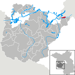
Potsdam-Mittelmark District (Landkreis Potsdam-Mittelmark)

- district in Brandenburg state, Germany
 Hiking in Potsdam-Mittelmark District
Potsdam-Mittelmark, located in the state of Brandenburg, Germany, offers a rich variety of hiking opportunities amidst picturesque landscapes and historical sites. Here are some key points to consider when hiking in this beautiful region:
Scenic Trails
-
Hiking Trails: The region features numerous well-marked trails that traverse through forests, meadows, and around lakes. Popular trails include sections of the Brandenburg Trail (Brandenburgenweg) and the Fläming-Höhenweg, known for their diverse landscapes.
-
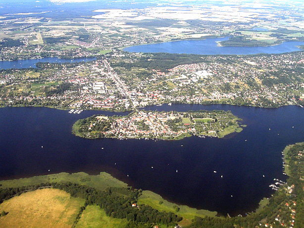
Lake Areas: The region is home to several lakes, including the Templiner See and the Schmerwitzsee, which provide stunning scenery and opportunities for swimming and picnicking along the way.
Nature and Wildlife
-
Biosphere Reserve: The area is partially within the Schorfheide-Chorin Biosphere Reserve, a UNESCO-designated site. Hikers can expect to encounter a variety of flora and fauna, making it ideal for nature enthusiasts.
-
Wildlife Watching: Keep an eye out for local wildlife, including deer, various bird species, and other animals that thrive in the region's forests and wetlands.
Historical and Cultural Sites
-
Historical Landmarks: The region has numerous historical sites, including castles, churches, and monuments. The Biosphäre Potsdam offers a unique indoor rainforest experience, while Sanssouci Park in nearby Potsdam showcases stunning gardens and palatial structures.
-
Cultural Routes: Many hiking trails also pass through quaint villages, allowing you to explore local architecture, traditions, and cuisine.
Practical Tips
-
Best Time to Hike: Spring and autumn are particularly pleasant for hiking, as temperatures are mild and nature is in full bloom or showcasing beautiful fall colors.
-
Equipment: Ensure you have proper hiking gear, including sturdy footwear, weather-appropriate clothing, and a reliable map or GPS device.
-
Local Regulations: Respect nature and follow local guidelines, particularly in protected areas, to preserve the beauty and biodiversity of the region.
-
Hydration and Nutrition: Carry enough water and snacks, especially on longer hikes, as amenities can be sparse in more remote areas.
Conclusion
Whether you're a local resident or a visitor, hiking in Potsdam-Mittelmark offers a wonderful way to experience the natural beauty and cultural richness of Brandenburg. Plan your route, immerse yourself in the surroundings, and enjoy the trail!
- Country:

- Capital: Bad Belzig
- Postal Code: 14806
- Licence Plate Code: PM
- Coordinates: 52° 13' 10" N, 12° 40' 30" E


- GPS tracks (wikiloc): [Link]
- AboveSeaLevel: 40 м m
- Population: 204388
- Web site: http://www.potsdam-mittelmark.de/
- Wikipedia en: wiki(en)
- Wikipedia: wiki(de)
- Wikidata storage: Wikidata: Q6142
- Wikipedia Commons Gallery: [Link]
- Wikipedia Commons Category: [Link]
- Wikipedia Commons Maps Category: [Link]
- Freebase ID: [/m/0168_j]
- GeoNames ID: Alt: [2852456]
- VIAF ID: Alt: [134496004]
- OSM relation ID: [62353]
- GND ID: Alt: [4371045-1]
- archINFORM location ID: [3228]
- TGN ID: [7120830]
- ISNI: Alt: [0000 0004 0473 2751]
- NUTS code: [DE40E]
- Ringgold ID: [249782]
- German district key: 12069
Includes regions:

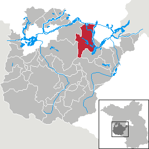
Kleinmachnow
- municipality in Brandenburg, Germany
Hiking in Kleinmachnow
Kleinmachnow, located near Berlin, Germany, offers a variety of hiking opportunities amidst its picturesque landscapes. The area is characterized by its lush forests, tranquil lakes, and diverse wildlife, making it an attractive spot for outdoor enthusiasts....
- Country:
- Postal Code: 14532
- Local Dialing Code: 033203
- Licence Plate Code: PM
- Coordinates: 52° 24' 13" N, 13° 13' 13" E
- GPS tracks (wikiloc): [Link]
- AboveSeaLevel: 45 м m
- Area: 11.91 sq km
- Population: 20562
- Web site: [Link]


Ziesar
- country subdivision of Potsdam-Mittelmark, Germany
Hiking in Ziesar
Ziesar, located in the state of Brandenburg, Germany, is a picturesque area for hiking enthusiasts. This region is characterized by a mix of forests, meadows, and charming villages, providing a variety of hiking options suitable for different skill levels....
- Country:
- Postal Code: 14793
- Coordinates: 52° 16' 0" N, 12° 16' 0" E
- GPS tracks (wikiloc): [Link]
- Population: 6269
- Web site: [Link]


Beetzsee (Amt)
- country subdivision of Potsdam-Mittelmark, Germany
Hiking in Beetzsee (Amt)
Beetzsee is a scenic area located in Brandenburg, Germany, known for its beautiful landscapes and outdoor recreational opportunities. Hiking in the Beetzsee region offers a chance to explore nature, enjoy the tranquility of the forests, and take in views of the lakes and waterways that characterize the landscape....
- Country:
- Postal Code: 14778
- Coordinates: 52° 28' 0" N, 12° 33' 0" E
- GPS tracks (wikiloc): [Link]
- Population: 8136
- Web site: [Link]

Brück
- country subdivision of Potsdam-Mittelmark, Germany
Hiking in Brück
Brück (Amt) is a scenic area in the German state of Brandenburg, known for its picturesque landscapes, forests, and lakes. Hiking in this region offers a delightful blend of natural beauty, tranquility, and cultural sites. Here are some highlights and tips for hiking in Brück (Amt):...
- Country:
- Postal Code: 14822
- Population: 10290
- Web site: [Link]
Niemegk
- country subdivision of Potsdam-Mittelmark, Germany
Hiking in Niemegk
Niemegk is a small town located in the state of Brandenburg, Germany, known for its picturesque landscapes and rural charm. While not as globally recognized as some hiking destinations, it offers several opportunities for outdoor enthusiasts to explore nature....

Amt Wusterwitz
- collective municipality in Brandenburg state, Germany
Hiking in Amt Wusterwitz
Wusterwitz is a small municipality located in the state of Brandenburg, Germany, within the district of Potsdam-Mittelmark. While the area isn't widely known as a hiking hotspot compared to larger national parks or more famous trails, it still offers opportunities for nature lovers and hikers looking for serene landscapes and a chance to explore the countryside....


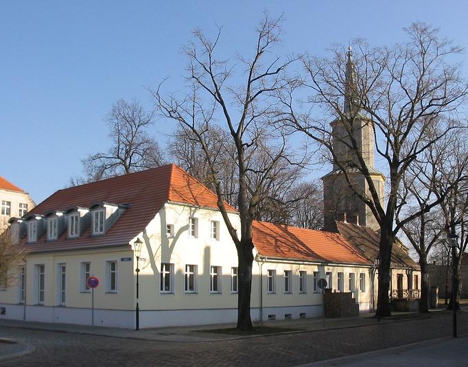
Bad Belzig
- town in Germany
Hiking in Bad Belzig
Bad Belzig is a charming town located in the state of Brandenburg, Germany, and it offers some beautiful hiking opportunities in the surrounding areas. Here’s what you can expect when hiking in and around Bad Belzig:...
- Country:
- Postal Code: 14806
- Local Dialing Code: 033841
- Coordinates: 52° 8' 32" N, 12° 35' 44" E
- GPS tracks (wikiloc): [Link]
- AboveSeaLevel: 88 м m
- Area: 236.07 sq km
- Population: 11126
- Web site: [Link]
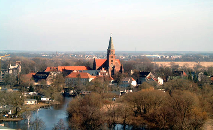
Werder/Havel
- Municipality in Brandenburg state, Germany
Hiking in Werder/Havel
Werder (Havel) is a charming town located in Brandenburg, Germany, just a short distance from Berlin. It's known for its picturesque landscapes, beautiful lakes, and natural settings, making it a wonderful destination for hiking. Here are some key points to consider if you’re planning a hiking trip in and around Werder (Havel):...
- Country:
- Postal Code: 14542
- Local Dialing Code: 03327; 033202
- Licence Plate Code: PM
- Coordinates: 52° 22' 41" N, 12° 56' 6" E
- GPS tracks (wikiloc): [Link]
- AboveSeaLevel: 31 м m
- Area: 115.99 sq km
- Population: 25695
- Web site: [Link]


Beelitz
- town in Germany
Hiking in Beelitz
Beelitz, located just outside Berlin in Germany, is known for its picturesque landscapes and rich history, making it a great destination for hiking enthusiasts. Here are some highlights and tips for hiking in Beelitz:...
- Country:
- Postal Code: 14547
- Local Dialing Code: 033204
- Coordinates: 52° 14' 0" N, 12° 58' 0" E
- GPS tracks (wikiloc): [Link]
- AboveSeaLevel: 40 м m
- Area: 181.3 sq km
- Population: 12175
- Web site: [Link]
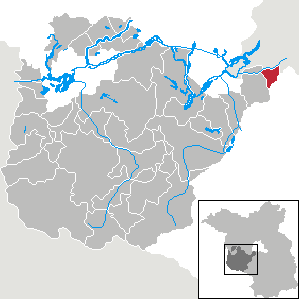
Teltow
- town in Brandenburg, Germany
Hiking in Teltow
Teltow is a charming town located in the state of Brandenburg, Germany, just south of Berlin. It offers several opportunities for hiking and outdoor activities, thanks to its scenic landscapes and proximity to various natural reserves and parks. Here are some highlights for hiking in the Teltow area:...
- Country:
- Postal Code: 14513
- Local Dialing Code: 03328
- Coordinates: 52° 24' 8" N, 13° 16' 14" E
- GPS tracks (wikiloc): [Link]
- AboveSeaLevel: 39 м m
- Area: 21.54 sq km
- Population: 25761
- Web site: [Link]


Michendorf
- municipality of Germany
Hiking in Michendorf
Michendorf, located in Brandenburg, Germany, offers a variety of hiking opportunities for nature enthusiasts. The region is characterized by its scenic landscapes, including forests, lakes, and meadows, making it an excellent destination for outdoor activities....
- Country:
- Postal Code: 14552
- Local Dialing Code: 033205; 033204
- Licence Plate Code: PM
- Coordinates: 52° 18' 0" N, 13° 1' 0" E
- GPS tracks (wikiloc): [Link]
- AboveSeaLevel: 45 м m
- Area: 68.51 sq km
- Population: 12437
- Web site: [Link]


Nuthetal
- municipality of Germany
Hiking in Nuthetal
Nuthetal, located in Brandenburg, Germany, offers a serene landscape perfect for hiking enthusiasts. The area is characterized by its beautiful nature reserves, forests, and tranquil paths that cater to various skill levels, making it an excellent destination for both casual walkers and more experienced hikers....
- Country:
- Postal Code: 14558
- Local Dialing Code: 033205; 033200
- Licence Plate Code: PM
- Coordinates: 52° 21' 0" N, 13° 5' 59" E
- GPS tracks (wikiloc): [Link]
- AboveSeaLevel: 34 м m
- Area: 47.56 sq km
- Population: 9077
- Web site: [Link]


Wiesenburg
- municipality of Germany
Hiking in Wiesenburg
Wiesenburg, located in the state of Brandenburg, Germany, is known for its picturesque landscapes and tranquil nature. It provides an excellent setting for hiking enthusiasts looking to explore the natural beauty of the area. Here are some highlights of hiking in Wiesenburg:...
- Country:
- Postal Code: 14827
- Local Dialing Code: 033849
- Licence Plate Code: PM
- Coordinates: 52° 7' 0" N, 12° 26' 59" E
- GPS tracks (wikiloc): [Link]
- AboveSeaLevel: 176 м m
- Area: 218.20 sq km
- Population: 4271
- Web site: [Link]


Seddiner See
- municipality of Germany
Hiking in Seddiner See
Seddiner See, located in Brandenburg, Germany, is a beautiful area that offers a range of outdoor activities, including hiking. Here are some key points to consider if you're planning a hiking trip in and around Seddiner See:...
- Country:
- Postal Code: 14554
- Local Dialing Code: 033205
- Licence Plate Code: PM
- Coordinates: 52° 16' 0" N, 13° 1' 0" E
- GPS tracks (wikiloc): [Link]
- AboveSeaLevel: 49 м m
- Area: 24.03 sq km
- Population: 4606
- Web site: [Link]


Treuenbrietzen
- town in Germany
Hiking in Treuenbrietzen
Treuenbrietzen, located in the Brandenburg region of Germany, offers a unique mix of natural beauty and historical sites, making it a great destination for hiking enthusiasts. Here are some highlights about hiking in the area:...
- Country:
- Postal Code: 14929
- Local Dialing Code: 033748
- Coordinates: 52° 5' 50" N, 12° 52' 16" E
- GPS tracks (wikiloc): [Link]
- AboveSeaLevel: 59 м m
- Area: 211.33 sq km
- Population: 7475
- Web site: [Link]


Schwielowsee
- municipality of Germany
Hiking in Schwielowsee
Schwielowsee is a picturesque municipality located in the state of Brandenburg, Germany, just a short distance from Berlin. It features stunning natural landscapes, including lush forests, serene lakes, and charming villages, making it a great destination for hiking enthusiasts....
- Country:
- Postal Code: 14548
- Local Dialing Code: 03327; 033209; 033205
- Licence Plate Code: PM
- Coordinates: 52° 20' 0" N, 12° 58' 0" E
- GPS tracks (wikiloc): [Link]
- AboveSeaLevel: 68 м m
- Area: 58.15 sq km
- Population: 10624
- Web site: [Link]


Groß Kreutz
- municipality of Germany
Hiking in Groß Kreutz
Groß Kreutz, located in the state of Brandenburg, Germany, is a charming area suitable for hiking enthusiasts. The region offers a variety of trails that take hikers through picturesque landscapes, including forests, fields, and along the Havel River....
- Country:
- Postal Code: 14550
- Local Dialing Code: 033207
- Licence Plate Code: PM
- Coordinates: 52° 23' 59" N, 12° 46' 59" E
- GPS tracks (wikiloc): [Link]
- AboveSeaLevel: 33 м m
- Area: 98.95 sq km
- Population: 8381
- Web site: [Link]


Kloster Lehnin
- municipality of Germany
Hiking in Kloster Lehnin
Kloster Lehnin, located in Brandenburg, Germany, offers a variety of scenic hiking opportunities that allow you to immerse yourself in nature while exploring the area's unique historical and cultural heritage....
- Country:
- Postal Code: 14797
- Local Dialing Code: 033835; 03382; 033207
- Licence Plate Code: PM
- Coordinates: 52° 19' 0" N, 12° 45' 0" E
- GPS tracks (wikiloc): [Link]
- AboveSeaLevel: 36 м m
- Area: 199.30 sq km
- Population: 10848
- Web site: [Link]


Stahnsdorf
- municipality in Brandenburg, Germany
Hiking in Stahnsdorf
Stahnsdorf, located in Brandenburg, Germany, is a charming area known for its scenic beauty and proximity to Berlin. While it may not be as widely recognized as some of the larger national parks, it offers some excellent opportunities for hiking and enjoying nature....
- Country:
- Postal Code: 14532
- Local Dialing Code: 03329
- Licence Plate Code: PM
- Coordinates: 52° 23' 32" N, 13° 13' 0" E
- GPS tracks (wikiloc): [Link]
- AboveSeaLevel: 44 м m
- Area: 49.07 sq km
- Population: 15270
- Web site: [Link]
Shares border with regions:


Potsdam
- capital city of the German state of Brandenburg
Hiking in Potsdam
Potsdam, Germany, is known more for its historical landmarks and beautiful parks than for traditional hiking trails. However, there are plenty of opportunities for walking and enjoying the outdoors in and around the city. Here are some suggestions for hiking and walking experiences in Potsdam:...
- Country:
- Postal Code: 14480; 14478; 14476; 14473; 14471; 14469; 14482; 14467
- Local Dialing Code: 0331; 033201; 033208
- Licence Plate Code: P
- Coordinates: 52° 24' 0" N, 13° 4' 0" E
- GPS tracks (wikiloc): [Link]
- AboveSeaLevel: 35 м m
- Area: 188.26 sq km
- Population: 171810
- Web site: [Link]

Brandenburg an der Havel
- town in Brandenburg, Germany
Hiking in Brandenburg an der Havel
Brandenburg an der Havel, located in the state of Brandenburg in Germany, offers a wonderful setting for hiking enthusiasts. The area is known for its beautiful landscapes, picturesque waterways, and rich history, making it a great destination for both casual walkers and serious hikers....
- Country:
- Postal Code: 14776; 14774; 14772; 14770
- Local Dialing Code: 03381
- Licence Plate Code: BRB
- Coordinates: 52° 24' 42" N, 12° 33' 22" E
- GPS tracks (wikiloc): [Link]
- AboveSeaLevel: 32 м m
- Area: 228.8 sq km
- Population: 71664
- Web site: [Link]
Jerichower Land
- German district of Saxony-Anhalt
Hiking in Jerichower Land
Jerichower Land is a picturesque area in the eastern part of Germany, situated in the state of Saxony-Anhalt. It’s known for its varied landscapes, historical sites, and a network of hiking trails that offer opportunities for both casual walkers and more seasoned hikers....
- Country:
- Licence Plate Code: JL; GNT; BRG
- Coordinates: 52° 20' 0" N, 12° 4' 0" E
- GPS tracks (wikiloc): [Link]
- AboveSeaLevel: 57 м m
- Web site: [Link]
Anhalt-Bitterfeld
- German district in Saxony-Anhalt
Hiking in Anhalt-Bitterfeld
Anhalt-Bitterfeld is a district in the state of Saxony-Anhalt in Germany, which offers a variety of hiking opportunities amidst a blend of natural landscapes and historical sites. Here are some highlights for hiking in the region:...
- Country:
- Licence Plate Code: ZE; KÖT; BTF; AZE; ABI
- Coordinates: 51° 43' 0" N, 12° 4' 0" E
- GPS tracks (wikiloc): [Link]
- AboveSeaLevel: 87 м m
- Area: 1452.80 sq km
- Population: 168475
- Web site: [Link]
Wittenberg
- German district in Saxony-Anhalt
Hiking in Wittenberg
Wittenberg, located in the state of Saxony-Anhalt, Germany, is not just known for its historical significance but also for its beautiful landscapes and opportunities for hiking. The region is rich in natural beauty, with a mix of woodlands, rivers, and rolling hills, making it an excellent destination for outdoor enthusiasts....
- Country:
- Licence Plate Code: WB; JE; GHC
- Coordinates: 51° 48' 0" N, 12° 41' 0" E
- GPS tracks (wikiloc): [Link]
- AboveSeaLevel: 66 м m
- Area: 1929.96 sq km
- Population: 130699
- Web site: [Link]
Havelland District
- District in Brandenburg state, Germany
Hiking in Havelland District
Havelland, located in the Brandenburg region of Germany, offers a rich tapestry of hiking opportunities for nature enthusiasts and outdoor adventurers. Here’s what you can expect when hiking in this picturesque district:...
- Country:
- Licence Plate Code: HVL
- Coordinates: 52° 38' 0" N, 12° 38' 0" E
- GPS tracks (wikiloc): [Link]
- AboveSeaLevel: 32 м m
- Area: 1717.00 sq km
- Population: 153294
- Web site: [Link]


Teltow-Fläming District
- district in Brandenburg state, Germany
Hiking in Teltow-Fläming District
Teltow-Fläming is a picturesque region in Germany, located just south of Berlin. Known for its diverse landscapes, charming villages, and rich history, it offers a range of hiking opportunities suitable for varying skill levels. Here are some key aspects to consider when hiking in Teltow-Fläming:...
- Country:
- Capital: Luckenwalde
- Licence Plate Code: TF
- Coordinates: 52° 5' 0" N, 13° 18' 0" E
- GPS tracks (wikiloc): [Link]
- Population: 160448
- Web site: [Link]


Berlin
- capital and largest city of Germany
Hiking in Berlin
Hiking in and around Berlin offers a unique blend of urban exploration and access to nature. While Berlin itself is a bustling metropolis, there are various parks, forested areas, and nearby trails that provide excellent opportunities for hiking. Here are some highlights:...
- Country:
- Postal Code: 10115–14199
- Local Dialing Code: 030
- Licence Plate Code: B; I
- Coordinates: 52° 31' 0" N, 13° 23' 0" E
- GPS tracks (wikiloc): [Link]
- AboveSeaLevel: 34 м m
- Area: 891.12 sq km
- Population: 3611222
- Web site: [Link]