
Brandenburg (Brandenburg)
- state of Germany
Brandenburg, a state in northeastern Germany, is an excellent destination for hiking enthusiasts. It's known for its diverse landscapes, which include vast forests, serene lakes, and rolling hills. Here are some key highlights and tips for hiking in Brandenburg:
1.
- Märkische Schweiz Nature Park: This park features rugged hills, deep valleys, and lakes. The terrain is varied, making it ideal for both casual strolls and more challenging hikes.
- Spreewald Biosphere Reserve: Famous for its unique waterways, the Spreewald offers picturesque trails alongside rivers and through wetlands. The area is perfect for combining hiking with canoeing or cycling.
- Havelsee and Fehrbelliner See: Both lakes are surrounded by scenic trails, offering opportunities for hiking and enjoying the natural beauty.
2.
- The Brandenburg Long-Distance Trail: This extensive trail system allows hikers to explore the region’s diverse nature over multiple days. It connects various towns and natural landmarks.
- Local Trails: Many towns have designated walking routes. The trails are well-marked and range in difficulty, catering to hikers of all skill levels.
3.
- Castle Hikes: The area is dotted with historical sites, including castles and fortifications. For example, the hike to the impressive Sanssouci Palace in Potsdam offers both culture and nature.
- Historic Towns: Hike through charming towns like Brandenburg an der Havel, where you can explore the city's rich history while enjoying the relaxing lake views.
4.
- Brandenburg’s parks are home to diverse flora and fauna, including various bird species, deer, and wild boar. Keep your camera handy for wildlife spotting!
- The region’s forests consist primarily of pine and beech trees, providing a serene environment for your hikes.
5.
- Best Time to Visit: Spring and early autumn are ideal for hiking, as the weather is pleasant, and the landscapes are particularly beautiful during these seasons.
- Safety: Make sure to wear proper hiking boots, carry enough water, and check the weather forecast before heading out. Mobile coverage can be spotty in remote areas, so consider downloading maps beforehand.
- Local Regulations: Respect local wildlife and plants. Stay on marked trails to protect the environment.
6.
- Brandenburg is easily accessible from Berlin, with regular public transport options including train connections to various towns and trailheads.
Whether you're looking for a peaceful nature walk or a challenging hike, Brandenburg offers a variety of options for all outdoor lovers. Enjoy the stunning scenery and take advantage of the peaceful trails in this beautiful part of Germany!
- Country:

- Capital: Potsdam
- Coordinates: 52° 21' 43" N, 13° 0' 29" E


- GPS tracks (wikiloc): [Link]
- AboveSeaLevel: 0 м m
- Area: 29478.63 sq km
- Population: 2449193
- Web site: http://www.brandenburg.de
- Wikipedia en: wiki(en)
- Wikipedia: wiki(de)
- Wikidata storage: Wikidata: Q1208
- Wikipedia Commons Gallery: [Link]
- Wikipedia Commons Category: [Link]
- Wikipedia Commons Maps Category: [Link]
- Freebase ID: [/m/017wh]
- GeoNames ID: Alt: [2945356]
- BnF ID: [119553645]
- VIAF ID: Alt: [246066379]
- OSM relation ID: [62504]
- GND ID: Alt: [4007955-7]
- archINFORM location ID: [2708]
- Library of Congress authority ID: Alt: [n91075824]
- MusicBrainz area ID: [6adffea3-b78f-4670-ab6e-cff834a41bde]
- Quora topic ID: [Brandenburg]
- TGN ID: [7000096]
- Encyclopædia Britannica Online ID: [place/Brandenburg-state-Germany]
- Encyclopædia Universalis ID: [brandebourg]
- EMLO location ID: [594d3fcf-7d10-4128-8cf0-c4c8ff75a7d3]
- NKCR AUT ID: [ge128413]
- DMOZ ID: Alt: [Regional/Europe/Germany/States/Brandenburg/]
- NUTS code: [DE4]
- YSO ID: [206525]
- Klexikon article ID: [Brandenburg]
- BabelNet ID: [00012765n]
- FAST ID: [1259114]
- NDL Auth ID: [01104497]
- STW Thesaurus for Economics ID: [18132-0]
- OmegaWiki Defined Meaning: [414546]
- ISO 3166-2 code: DE-BB
- German regional key: 12
- FIPS 10-4 (countries and regions): GM11
- GACS ID: 13300
Includes regions:


Potsdam
- capital city of the German state of Brandenburg
Potsdam, Germany, is known more for its historical landmarks and beautiful parks than for traditional hiking trails. However, there are plenty of opportunities for walking and enjoying the outdoors in and around the city. Here are some suggestions for hiking and walking experiences in Potsdam:...
- Country:

- Postal Code: 14480; 14478; 14476; 14473; 14471; 14469; 14482; 14467
- Local Dialing Code: 0331; 033201; 033208
- Licence Plate Code: P
- Coordinates: 52° 24' 0" N, 13° 4' 0" E


- GPS tracks (wikiloc): [Link]
- AboveSeaLevel: 35 м m
- Area: 188.26 sq km
- Population: 171810
- Web site: [Link]
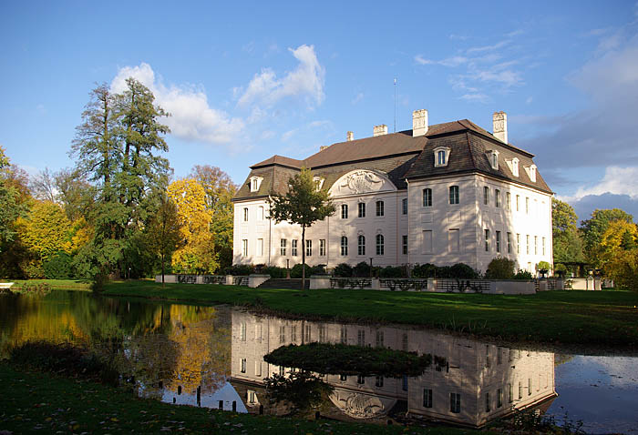

Cottbus
- city in Brandenburg, Germany
Cottbus is a city in the state of Brandenburg, Germany, known for its picturesque landscapes and natural surroundings. While Cottbus itself is an urban area, there are several opportunities for hiking and enjoying the outdoors in the vicinity. Here are some highlights for hiking around Cottbus:...
- Country:

- Postal Code: 03055; 03054; 03053; 03052; 03051; 03050; 03048; 03046; 03044; 03042
- Local Dialing Code: 0355
- Licence Plate Code: CB
- Coordinates: 51° 45' 38" N, 14° 20' 3" E


- GPS tracks (wikiloc): [Link]
- AboveSeaLevel: 76 м m
- Area: 164.28 sq km
- Population: 100534
- Web site: [Link]
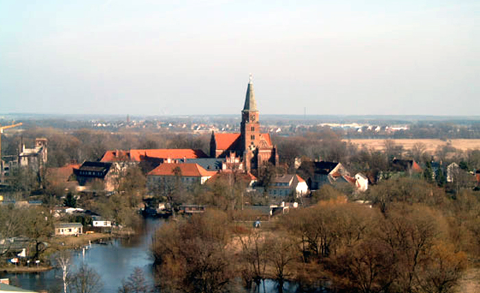

Brandenburg an der Havel
- town in Brandenburg, Germany
 Hiking in Brandenburg an der Havel
Brandenburg an der Havel, located in the state of Brandenburg in Germany, offers a wonderful setting for hiking enthusiasts. The area is known for its beautiful landscapes, picturesque waterways, and rich history, making it a great destination for both casual walkers and serious hikers....
- Country:

- Postal Code: 14776; 14774; 14772; 14770
- Local Dialing Code: 03381
- Licence Plate Code: BRB
- Coordinates: 52° 24' 42" N, 12° 33' 22" E


- GPS tracks (wikiloc): [Link]
- AboveSeaLevel: 32 м m
- Area: 228.8 sq km
- Population: 71664
- Web site: [Link]


Frankfurt (Oder)
- town in Brandenburg, Germany
Frankfurt (Oder), located in eastern Germany near the Polish border, offers some unique hiking opportunities amidst its picturesque landscapes and rich cultural heritage. While the city itself may not be as renowned for hiking as some other German cities, there are several trails and areas worth exploring in and around the region....
- Country:

- Postal Code: 15236; 15234; 15232; 15230
- Local Dialing Code: 033605; 0335
- Licence Plate Code: FF
- Coordinates: 52° 21' 0" N, 14° 33' 0" E


- GPS tracks (wikiloc): [Link]
- AboveSeaLevel: 40 м m
- Area: 147610000 sq km
- Population: 58018
- Web site: [Link]

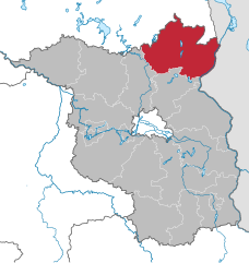
Uckermark District
- District in Brandenburg state, Germany
Hiking in the Uckermark district, located in the northeastern part of Germany, is a delight for nature enthusiasts. This picturesque region is characterized by its rolling landscapes, serene lakes, and lush forests, making it an ideal destination for outdoor exploration....
- Country:

- Capital: Prenzlau
- Licence Plate Code: ANG; PZ; SDT; TP; UM
- Coordinates: 53° 15' 0" N, 13° 52' 0" E


- GPS tracks (wikiloc): [Link]
- AboveSeaLevel: 20 м m
- Area: 3058.08 sq km
- Population: 121326
- Web site: [Link]
Barnim District
- District in Brandenburg, Germany
Barnim, located in Brandenburg, Germany, offers a great variety of hiking opportunities, thanks to its stunning natural landscapes, forests, and historical sites. Here are some key highlights of hiking in the Barnim region:...
- Country:

- Licence Plate Code: EW; BER; BAR
- Coordinates: 52° 50' 0" N, 13° 45' 0" E


- GPS tracks (wikiloc): [Link]
- AboveSeaLevel: 32 м m
- Area: 1.49 sq km
- Population: 173193
- Web site: [Link]
Oberhavel District
- district in Brandenburg state, Germany
Oberhavel is a beautiful district located in the state of Brandenburg, Germany, known for its picturesque landscapes, lush forests, and numerous lakes. It's a fantastic destination for hiking enthusiasts. Here are some key points to consider when hiking in Oberhavel:...
- Country:

- Licence Plate Code: OHV
- Coordinates: 52° 53' 0" N, 13° 15' 0" E


- GPS tracks (wikiloc): [Link]
- AboveSeaLevel: 67 м m
- Area: 1795.77 sq km
- Population: 202162
- Web site: [Link]
Ostprignitz-Ruppin District
- district in Brandenburg state, Germany
 Hiking in Ostprignitz-Ruppin District
Ostprignitz-Ruppin, located in the northeastern part of Brandenburg, Germany, offers a unique and picturesque hiking experience. The region is characterized by its diverse landscapes, which include sprawling forests, rolling hills, glacial lakes, and historical sites. Here are some highlights and tips for hiking in this area:...
- Country:

- Licence Plate Code: WK; OPR; NP; KY
- Coordinates: 52° 58' 0" N, 12° 40' 0" E


- GPS tracks (wikiloc): [Link]
- AboveSeaLevel: 53 м m
- Area: 2509.22 sq km
- Population: 99125
- Web site: [Link]
Prignitz District
- district in Brandenburg, Germany
Prignitz, located in the state of Brandenburg, Germany, offers a variety of hiking opportunities in a largely rural and picturesque landscape. Known for its diverse nature, including forests, meadows, and rivers, Prignitz provides a tranquil escape for outdoor enthusiasts. Here are some highlights for hiking in the region:...
- Country:

- Licence Plate Code: PR
- Coordinates: 53° 0' 0" N, 12° 0' 0" E


- GPS tracks (wikiloc): [Link]
- AboveSeaLevel: 41 м m
- Area: 2123.31 sq km
- Web site: [Link]
Havelland District
- District in Brandenburg state, Germany
Havelland, located in the Brandenburg region of Germany, offers a rich tapestry of hiking opportunities for nature enthusiasts and outdoor adventurers. Here’s what you can expect when hiking in this picturesque district:...
- Country:

- Licence Plate Code: HVL
- Coordinates: 52° 38' 0" N, 12° 38' 0" E


- GPS tracks (wikiloc): [Link]
- AboveSeaLevel: 32 м m
- Area: 1717.00 sq km
- Population: 153294
- Web site: [Link]


Potsdam-Mittelmark District
- district in Brandenburg state, Germany
 Hiking in Potsdam-Mittelmark District
Potsdam-Mittelmark, located in the state of Brandenburg, Germany, offers a rich variety of hiking opportunities amidst picturesque landscapes and historical sites. Here are some key points to consider when hiking in this beautiful region:...
- Country:

- Capital: Bad Belzig
- Postal Code: 14806
- Licence Plate Code: PM
- Coordinates: 52° 13' 10" N, 12° 40' 30" E


- GPS tracks (wikiloc): [Link]
- AboveSeaLevel: 40 м m
- Population: 204388
- Web site: [Link]


Teltow-Fläming District
- district in Brandenburg state, Germany
 Hiking in Teltow-Fläming District
Teltow-Fläming is a picturesque region in Germany, located just south of Berlin. Known for its diverse landscapes, charming villages, and rich history, it offers a range of hiking opportunities suitable for varying skill levels. Here are some key aspects to consider when hiking in Teltow-Fläming:...
- Country:

- Capital: Luckenwalde
- Licence Plate Code: TF
- Coordinates: 52° 5' 0" N, 13° 18' 0" E


- GPS tracks (wikiloc): [Link]
- Population: 160448
- Web site: [Link]
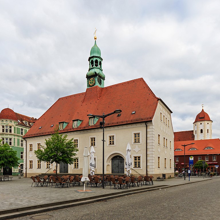

Elbe-Elster District
- District in Brandenburg state, Germany
 Hiking in Elbe-Elster District
Elbe-Elster is a picturesque district located in the state of Brandenburg, Germany, known for its beautiful landscapes, rivers, and a variety of outdoor activities, including hiking. The region offers a mix of natural scenery, cultural attractions, and well-maintained hiking trails....
- Country:

- Licence Plate Code: LIB; FI; EE
- Coordinates: 51° 36' 0" N, 13° 26' 0" E


- GPS tracks (wikiloc): [Link]
- AboveSeaLevel: 120 м m
- Area: 1889.34 sq km
- Population: 107649
- Web site: [Link]


Oberspreewald-Lausitz District
- district in Brandenburg state, Germany
 Hiking in Oberspreewald-Lausitz District
Oberspreewald-Lausitz is a beautiful region located in the state of Brandenburg, Germany, known for its unique natural landscapes, rich cultural heritage, and extensive network of hiking trails. This area is characterized by its marshy areas, forests, and waterways, making it an ideal destination for nature lovers and hiking enthusiasts....
- Country:

- Licence Plate Code: SFB; OSL; CA
- Coordinates: 51° 35' 0" N, 14° 0' 0" E


- GPS tracks (wikiloc): [Link]
- AboveSeaLevel: 132 м m
- Area: 1216.65 sq km
- Population: 115212
- Web site: [Link]
Spree-Neiße District
- district in Brandenburg state, Germany
 Hiking in Spree-Neiße District
Spree-Neiße is a scenic district located in the state of Brandenburg, Germany, known for its beautiful landscapes, rich history, and numerous outdoor activities. If you're considering hiking in this area, here are some key points to keep in mind:...
- Country:

- Licence Plate Code: SPN; SPB; GUB; FOR
- Coordinates: 51° 41' 0" N, 14° 24' 0" E


- GPS tracks (wikiloc): [Link]
- AboveSeaLevel: 70 м m
- Area: 1647.89 sq km
- Population: 118899
- Web site: [Link]
Dahme-Spreewald District
- district in Brandenburg, Germany
 Hiking in Dahme-Spreewald District
Dahme-Spreewald, located in Brandenburg, Germany, offers stunning landscapes, rich biodiversity, and a variety of hiking trails that cater to both casual walkers and experienced hikers. Here are some key points to consider when hiking in this beautiful region:...
- Country:

- Licence Plate Code: LDS
- Coordinates: 52° 2' 0" N, 13° 54' 0" E


- GPS tracks (wikiloc): [Link]
- AboveSeaLevel: 46 м m
- Area: 2.26 sq km
- Population: 160314
- Web site: [Link]

Oder-Spree District
- District in Brandenburg state, Germany
The Oder-Spree region in Germany offers a variety of hiking opportunities set in a picturesque landscape of lakes, rivers, and forests. Here are some key points about hiking in this area:...
- Country:

- Capital: Beeskow
- Licence Plate Code: LOS
- Coordinates: 52° 13' 0" N, 14° 17' 0" E


- GPS tracks (wikiloc): [Link]
- AboveSeaLevel: 60 м m
- Area: 2242.00 sq km
- Population: 177047
- Web site: [Link]
Märkisch-Oderland District
- District of Brandenburg state, Germany
 Hiking in Märkisch-Oderland District
Märkisch-Oderland, located in the state of Brandenburg, Germany, offers a diverse and captivating environment for hiking enthusiasts. The region is characterized by its scenic landscapes, which include forests, lakes, rivers, and rolling hills....
- Country:

- Licence Plate Code: SRB; SEE; MOL; FRW
- Coordinates: 52° 38' 0" N, 14° 8' 0" E


- GPS tracks (wikiloc): [Link]
- AboveSeaLevel: 9 м m
- Area: 2127.99 sq km
- Population: 186925
- Web site: [Link]
Shares border with regions:

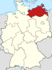
Mecklenburg-Vorpommern
- state of Germany
 Hiking in Mecklenburg-Vorpommern
Mecklenburg-Vorpommern, a picturesque state in northeastern Germany, offers a wealth of hiking opportunities for enthusiasts of all levels. This region is known for its diverse landscapes, which include vast forests, serene lakes, and a stunning coastline along the Baltic Sea. Here are some highlights and tips for hiking in this beautiful area:...
- Country:

- Capital: Schwerin
- Coordinates: 53° 37' 0" N, 12° 42' 0" E


- GPS tracks (wikiloc): [Link]
- AboveSeaLevel: 0 м m
- Area: 23174.0 sq km
- Population: 1596500
- Web site: [Link]


Lower Saxony
- state of Germany
Lower Saxony, located in northwestern Germany, offers a diverse range of hiking opportunities appealing to both novice and experienced hikers. Here are some of the highlights of hiking in Lower Saxony:...
- Country:

- Capital: Hanover
- Coordinates: 52° 45' 22" N, 9° 23' 35" E


- GPS tracks (wikiloc): [Link]
- AboveSeaLevel: 13 м m
- Area: 47614.07 sq km
- Population: 7945685
- Web site: [Link]


Saxony
- state in Germany
Saxony, located in the eastern part of Germany, is a fantastic destination for hiking enthusiasts due to its diverse landscapes, rich natural beauty, and well-maintained trails. Here are some highlights and tips for hiking in Saxony:...
- Country:

- Capital: Dresden
- Coordinates: 51° 1' 37" N, 13° 21' 32" E


- GPS tracks (wikiloc): [Link]
- AboveSeaLevel: 342 м m
- Area: 18415.66 sq km
- Population: 4055274
- Web site: [Link]


Saxony-Anhalt
- state of Germany
Saxony-Anhalt, located in central Germany, offers a diverse range of hiking trails and natural landscapes that cater to outdoor enthusiasts. Here are some key highlights for hiking in this region:...
- Country:

- Capital: Magdeburg
- Coordinates: 51° 58' 16" N, 11° 28' 12" E


- GPS tracks (wikiloc): [Link]
- AboveSeaLevel: 51 м m
- Area: 20451.58 sq km
- Population: 2245470
- Web site: [Link]


Bautzen District
- district in the state of Saxony in Germany
Bautzen, located in the eastern part of Germany, specifically in Saxony, offers a rich landscape for hiking enthusiasts. The district is characterized by its picturesque scenery, which includes rolling hills, dense forests, and winding rivers, particularly the Spree River. Here are some key highlights about hiking in Bautzen and its surroundings:...
- Country:

- Licence Plate Code: KM; HY; BZ; BIW
- Coordinates: 51° 17' 0" N, 14° 16' 0" E


- GPS tracks (wikiloc): [Link]
- AboveSeaLevel: 178 м m
- Area: 2390.70 sq km
- Population: 304691
- Web site: [Link]
Nordsachsen
- district in Saxony, Germany
Nordsachsen, or North Saxony, is a beautiful region in Germany that offers a variety of hiking opportunities for enthusiasts of all levels. Known for its diverse landscape, which includes forests, rivers, hills, and even some cultural sites, Nordsachsen is an ideal destination for outdoor activities....
- Country:

- Licence Plate Code: TDO; TO; TG; OZ; EB; DZ
- Coordinates: 51° 30' 0" N, 12° 45' 0" E


- GPS tracks (wikiloc): [Link]
- AboveSeaLevel: 203 м m
- Area: 2.02 sq km
- Population: 198629
- Web site: [Link]

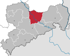
Meissen
- district of Saxony, Germany
Meissen, located in the state of Saxony in Germany, is known for its picturesque landscapes, historic towns, and charming vineyards. Hiking in the Meissen district offers a variety of trails that cater to different experience levels and interests, with beautiful scenery ranging from rolling hills to the banks of the Elbe River....
- Country:

- Licence Plate Code: RIE; RG; MEI; GRH
- Coordinates: 51° 13' 0" N, 13° 31' 0" E


- GPS tracks (wikiloc): [Link]
- AboveSeaLevel: 177 м m
- Area: 1454.59 sq km
- Population: 244717
- Web site: [Link]


Görlitz
- German district of Saxony
Görlitz district in Germany offers a variety of hiking opportunities, thanks to its beautiful landscapes and diverse terrains. Here are some highlights and tips for hiking in the Görlitz area:...
- Country:

- Licence Plate Code: ZI; WSW; NY; NOL; LÖB; GR
- Coordinates: 51° 16' 48" N, 14° 49' 12" E


- GPS tracks (wikiloc): [Link]
- Area: 2106.1 sq km
- Population: 258337
- Web site: [Link]


Berlin
- capital and largest city of Germany
Hiking in and around Berlin offers a unique blend of urban exploration and access to nature. While Berlin itself is a bustling metropolis, there are various parks, forested areas, and nearby trails that provide excellent opportunities for hiking. Here are some highlights:...
- Country:

- Postal Code: 10115–14199
- Local Dialing Code: 030
- Licence Plate Code: B; I
- Coordinates: 52° 31' 0" N, 13° 23' 0" E


- GPS tracks (wikiloc): [Link]
- AboveSeaLevel: 34 м m
- Area: 891.12 sq km
- Population: 3611222
- Web site: [Link]

