Termes (Termes)

- commune in Lozère, France
- Country:

- Postal Code: 48310
- Coordinates: 44° 48' 47" N, 3° 10' 0" E


- GPS tracks (wikiloc): [Link]
- AboveSeaLevel: 1122 м m
- Area: 17.65 sq km
- Population: 204
- Wikipedia en: wiki(en)
- Wikipedia: wiki(fr)
- Wikidata storage: Wikidata: Q722262
- Wikipedia Commons Category: [Link]
- Freebase ID: [/m/02z0t8q]
- Freebase ID: [/m/02z0t8q]
- GeoNames ID: Alt: [6616896]
- GeoNames ID: Alt: [6616896]
- SIREN number: [214801904]
- SIREN number: [214801904]
- BnF ID: [15261593w]
- BnF ID: [15261593w]
- INSEE municipality code: 48190
- INSEE municipality code: 48190
Shares border with regions:


Les Monts-Verts
- commune in Lozère, France
- Country:
- Postal Code: 48200
- Coordinates: 44° 51' 28" N, 3° 12' 19" E
- GPS tracks (wikiloc): [Link]
- AboveSeaLevel: 1100 м m
- Area: 29.13 sq km
- Population: 344

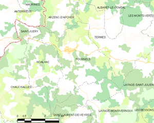
Fournels
- commune in Lozère, France
- Country:
- Postal Code: 48310
- Coordinates: 44° 48' 59" N, 3° 7' 15" E
- GPS tracks (wikiloc): [Link]
- Area: 15.76 sq km
- Population: 366


Arzenc-d'Apcher
- commune in Lozère, France
- Country:
- Postal Code: 48310
- Coordinates: 44° 51' 5" N, 3° 7' 7" E
- GPS tracks (wikiloc): [Link]
- Area: 7.88 sq km
- Population: 50

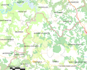
Albaret-le-Comtal
- commune in Lozère, France
- Country:
- Postal Code: 48310
- Coordinates: 44° 52' 30" N, 3° 7' 38" E
- GPS tracks (wikiloc): [Link]
- Area: 29.56 sq km
- Population: 176
Noalhac
- commune in Lozère, France
- Country:
- Postal Code: 48310
- Coordinates: 44° 48' 41" N, 3° 6' 24" E
- GPS tracks (wikiloc): [Link]
- Area: 13.51 sq km
- Population: 94
La Fage-Saint-Julien
- commune in Lozère, France
- Country:
- Postal Code: 48200
- Coordinates: 44° 48' 11" N, 3° 11' 28" E
- GPS tracks (wikiloc): [Link]
- Area: 18.06 sq km
- Population: 293