Thimert-Gâtelles (Thimert-Gâtelles)

- commune in Eure-et-Loir, France
- Country:

- Postal Code: 28170
- Coordinates: 48° 34' 10" N, 1° 15' 5" E


- GPS tracks (wikiloc): [Link]
- AboveSeaLevel: 200 м m
- Area: 42.67 sq km
- Population: 1278
- Web site: http://www.thimert-gatelles.fr
- Wikipedia en: wiki(en)
- Wikipedia: wiki(fr)
- Wikidata storage: Wikidata: Q1137910
- Wikipedia Commons Category: [Link]
- Freebase ID: [/m/03nrm_q]
- GeoNames ID: Alt: [2972820]
- SIREN number: [212803860]
- BnF ID: [15254316d]
- PACTOLS thesaurus ID: [pcrtMVZVkOrNa6]
- INSEE municipality code: 28386
Shares border with regions:

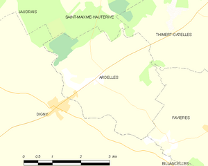
Ardelles
- commune in Eure-et-Loir, France
- Country:
- Postal Code: 28170
- Coordinates: 48° 32' 44" N, 1° 10' 21" E
- GPS tracks (wikiloc): [Link]
- Area: 10.4 sq km
- Population: 197
- Web site: [Link]


Vérigny
- former commune in Eure-et-Loir, France
- Country:
- Postal Code: 28190
- Coordinates: 48° 31' 13" N, 1° 19' 20" E
- GPS tracks (wikiloc): [Link]
- Area: 13.04 sq km
- Population: 302

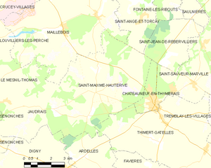
Saint-Maixme-Hauterive
- commune in Eure-et-Loir, France
- Country:
- Postal Code: 28170
- Coordinates: 48° 35' 18" N, 1° 10' 55" E
- GPS tracks (wikiloc): [Link]
- Area: 31.95 sq km
- Population: 431
- Web site: [Link]


Tremblay-les-Villages
- commune in Eure-et-Loir, France
- Country:
- Postal Code: 28170
- Coordinates: 48° 36' 3" N, 1° 22' 52" E
- GPS tracks (wikiloc): [Link]
- AboveSeaLevel: 198 м m
- Area: 63.31 sq km
- Population: 2287
- Web site: [Link]

Favières
- commune in Eure-et-Loir, France
- Country:
- Postal Code: 28170
- Coordinates: 48° 31' 47" N, 1° 13' 41" E
- GPS tracks (wikiloc): [Link]
- Area: 12.69 sq km
- Population: 608


Saint-Arnoult-des-Bois
- commune in Eure-et-Loir, France
- Country:
- Postal Code: 28190
- Coordinates: 48° 29' 33" N, 1° 15' 47" E
- GPS tracks (wikiloc): [Link]
- Area: 20.67 sq km
- Population: 891
- Web site: [Link]


Mittainvilliers-Vérigny
- commune in Eure-et-Loir, France
- Country:
- Postal Code: 28170
- Coordinates: 48° 29' 56" N, 1° 18' 39" E
- GPS tracks (wikiloc): [Link]
- Area: 24.76 sq km


Châteauneuf-en-Thymerais
- commune in Eure-et-Loir, France
- Country:
- Postal Code: 28170
- Coordinates: 48° 34' 50" N, 1° 14' 28" E
- GPS tracks (wikiloc): [Link]
- Area: 4.07 sq km
- Population: 2664
- Web site: [Link]

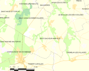
Saint-Sauveur-Marville
- commune in Eure-et-Loir, France
- Country:
- Postal Code: 28170
- Coordinates: 48° 35' 43" N, 1° 16' 45" E
- GPS tracks (wikiloc): [Link]
- AboveSeaLevel: 187 м m
- Area: 18.84 sq km
- Population: 920
- Web site: [Link]