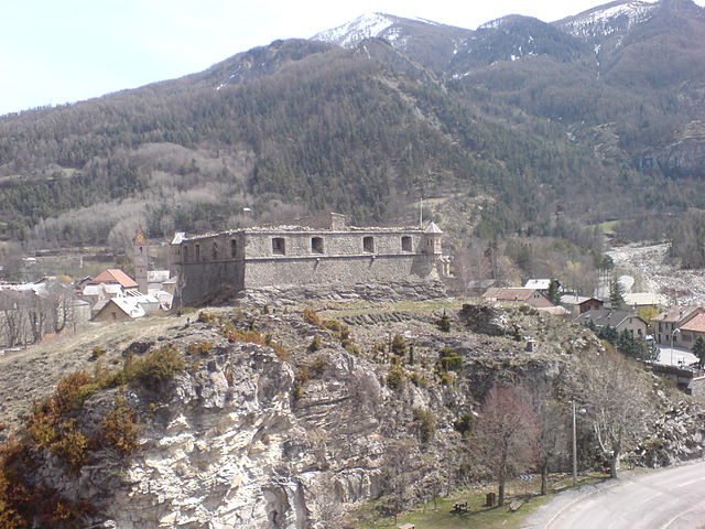
Thorame-Haute (Thorame-Haute)
- commune in Alpes-de-Haute-Provence, France
Thorame-Haute is a picturesque village located in the Alpes-de-Haute-Provence region of France. It is surrounded by stunning natural landscapes, including mountain ranges, valleys, and forests, making it an excellent destination for hiking enthusiasts. Here are some highlights of hiking in Thorame-Haute:
1.
- The area offers a variety of hiking trails that cater to different skill levels, from gentle strolls to challenging hikes.
- Many trails provide stunning views of the surrounding mountains and valleys, with opportunities to experience the unique flora and fauna of the region.
2.
- This nearby mountain is popular for hiking and offers trails with magnificent vistas. The summit can provide a rewarding panorama of the landscape below.
3.
- The region is part of the Parc Naturel Régional du Verdon, known for its diverse ecosystems and wildlife. Hikers may encounter various species of plants and animals along the trails.
4.
- Some hikes may lead you to historical sites, including old chapels, ancient ruins, or traditional villages, allowing hikers to immerse themselves in the local culture.
5.
- Ensure to check the weather conditions before your hike, as mountain weather can change rapidly. Late spring to early autumn is generally the best time for hiking in this region.
6.
- Always wear appropriate footwear, bring enough water and snacks, and consider carrying a map or GPS device. Local maps can often be found at tourist information centers.
7.
- If you’re a beginner or prefer to have a more structured experience, local guides may offer organized hikes, providing valuable insights into the area’s flora, fauna, and geology.
Whether you're seeking solitude in nature or a challenging climb, hiking in Thorame-Haute can provide a memorable outdoor experience. Happy hiking!
- Country:

- Postal Code: 04170
- Coordinates: 44° 5' 49" N, 6° 33' 20" E


- GPS tracks (wikiloc): [Link]
- Area: 108.35 sq km
- Population: 233
- Web site: http://www.thorame-haute.fr
- Wikipedia en: wiki(en)
- Wikipedia: wiki(fr)
- Wikidata storage: Wikidata: Q1017899
- Wikipedia Commons Category: [Link]
- Freebase ID: [/m/03m7xrv]
- Freebase ID: [/m/03m7xrv]
- GeoNames ID: Alt: [2972736]
- GeoNames ID: Alt: [2972736]
- SIREN number: [210402194]
- SIREN number: [210402194]
- VIAF ID: Alt: [246330904]
- VIAF ID: Alt: [246330904]
- PACTOLS thesaurus ID: [pcrtAfhm9HuQVI]
- PACTOLS thesaurus ID: [pcrtAfhm9HuQVI]
- INSEE municipality code: 04219
- INSEE municipality code: 04219
Shares border with regions:

Méailles
- commune in Alpes-de-Haute-Provence, France
Méailles is a quaint mountain village located in the Alpes-de-Haute-Provence region of France, known for its stunning natural beauty and its proximity to the Mercantour National Park. Hiking in this area offers a range of trails suitable for various skill levels, with breathtaking views of the surrounding mountains, valleys, and forests....
- Country:

- Postal Code: 04240
- Coordinates: 44° 1' 24" N, 6° 37' 54" E


- GPS tracks (wikiloc): [Link]
- Area: 32.74 sq km
- Population: 111

La Mure-Argens
- commune in Alpes-de-Haute-Provence, France
La Mure-Argens, situated in the Alpes-de-Haute-Provence region of southeastern France, offers a variety of hiking opportunities for outdoor enthusiasts. The area is characterized by its beautiful landscapes, including rugged terrains, forests, rivers, and picturesque mountain views....
- Country:

- Postal Code: 04170
- Coordinates: 43° 58' 46" N, 6° 31' 14" E


- GPS tracks (wikiloc): [Link]
- AboveSeaLevel: 918 м m
- Area: 34.73 sq km
- Population: 336
- Web site: [Link]

Colmars
- commune in Alpes-de-Haute-Provence, France
Colmars is a charming village located in the Alpes-de-Haute-Provence region of France. It's an excellent destination for hiking enthusiasts, offering stunning landscapes, rich biodiversity, and a taste of the local culture. Here are some highlights regarding hiking in Colmars:...
- Country:

- Postal Code: 04370
- Coordinates: 44° 10' 52" N, 6° 37' 36" E


- GPS tracks (wikiloc): [Link]
- Area: 81.82 sq km
- Population: 431

Thorame-Basse
- commune in Alpes-de-Haute-Provence, France
Thorame-Basse is a charming village located in the Alpes-de-Haute-Provence region of France. Nestled in the foothills of the Alps, it offers a variety of hiking opportunities that cater to different skill levels....
- Country:

- Postal Code: 04170
- Coordinates: 44° 5' 29" N, 6° 30' 4" E


- GPS tracks (wikiloc): [Link]
- Area: 97.72 sq km
- Population: 221
- Web site: [Link]

Allons
- commune in Alpes-de-Haute-Provence, France
Allons, located in the Alpes-de-Haute-Provence region of southeastern France, offers a variety of hiking opportunities amidst stunning natural landscapes. This area is characterized by its diverse terrain, including rocky hills, lush forests, and picturesque valleys, making it ideal for both casual walkers and more experienced hikers....
- Country:

- Postal Code: 04170
- Coordinates: 43° 58' 39" N, 6° 35' 42" E


- GPS tracks (wikiloc): [Link]
- Area: 41.71 sq km
- Population: 154
- Web site: [Link]

Castellet-lès-Sausses
- commune in Alpes-de-Haute-Provence, France
 Hiking in Castellet-lès-Sausses
Castellet-lès-Sausses is a small village located in the Alpes-de-Haute-Provence region of France, and it offers a range of hiking opportunities that showcase the beautiful natural scenery of the area. This region is characterized by its rugged terrain, lush landscapes, and stunning views of the surrounding mountains and valleys....
- Country:

- Postal Code: 04320
- Coordinates: 43° 59' 40" N, 6° 45' 48" E


- GPS tracks (wikiloc): [Link]
- Area: 53.91 sq km
- Population: 132

Beauvezer
- commune in Alpes-de-Haute-Provence, France
Beauvezer is a charming village located in the Alpes-de-Haute-Provence region of France, known for its stunning landscapes, picturesque surroundings, and outdoor recreational opportunities, particularly hiking. Here are some key points about hiking in Beauvezer:...
- Country:

- Postal Code: 04370
- Coordinates: 44° 8' 37" N, 6° 35' 29" E


- GPS tracks (wikiloc): [Link]
- Area: 26.98 sq km
- Population: 372