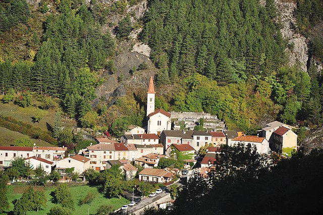
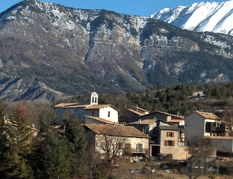
Thorame-Basse (Thorame-Basse)
- commune in Alpes-de-Haute-Provence, France
Thorame-Basse is a charming village located in the Alpes-de-Haute-Provence region of France. Nestled in the foothills of the Alps, it offers a variety of hiking opportunities that cater to different skill levels.
Hiking Trails
-
Le Sentier de la Clue: This is a popular trail that takes you through scenic landscapes characterized by cliffs, rivers, and dense forests. It's a moderate hike suitable for families, with beautiful views along the way.
-
Col de la Cayolle: A slightly more challenging hike, this trail leads you to the stunning Col de la Cayolle, which offers breathtaking panoramic views of the surrounding mountains and valleys. The altitude can make this hike more strenuous, so ensure you're adequately prepared.
-
Tour du Pays de Thorame: For those looking for an extended hiking experience, this multi-day trek circles around the area. It takes you through various terrains, including high alpine pastures and past traditional hamlets. The route is well-marked, making it easier for hikers to navigate.
Best Time to Hike
- Spring (April to June): A great time for wildflowers and mild weather, although some trails might still be snow-covered early in the spring.
- Summer (July to August): Perfect for hiking as the weather is warm and stable, but trails can be busier during peak tourist season.
- Fall (September to October): Offers stunning autumn foliage, with cooler temperatures making for comfortable hiking conditions.
- Winter (November to March): Some trails may be suitable for snowshoeing or winter hiking, but always check local conditions and safety advice.
Preparation Tips
- Equipment: Always wear appropriate hiking boots to navigate uneven terrain. Bringing layers is essential, as temperatures can vary significantly.
- Water and Snacks: Pack sufficient water and energy snacks to keep you hydrated and energized during your hikes.
- Maps and GPS: While many trails are well-marked, having a map or GPS device can be beneficial, especially for less traveled routes.
- Local Regulations: Be mindful of local regulations concerning wildlife and environmental protection practices.
Safety
- Check the weather conditions before heading out.
- Inform someone about your hiking plans and estimated return time.
- If hiking alone, consider starting with well-trafficked trails.
Thorame-Basse offers a fantastic escape into nature for both novice and experienced hikers, with its stunning views, diverse wildlife, and chance to explore local culture. Enjoy your hiking adventure!
- Country:

- Postal Code: 04170
- Coordinates: 44° 5' 29" N, 6° 30' 4" E


- GPS tracks (wikiloc): [Link]
- Area: 97.72 sq km
- Population: 221
- Web site: http://www.thorame-basse.fr
- Wikipedia en: wiki(en)
- Wikipedia: wiki(fr)
- Wikidata storage: Wikidata: Q742336
- Wikipedia Commons Category: [Link]
- Freebase ID: [/m/03m7xrh]
- Freebase ID: [/m/03m7xrh]
- GeoNames ID: Alt: [2972737]
- GeoNames ID: Alt: [2972737]
- SIREN number: [210402186]
- SIREN number: [210402186]
- INSEE municipality code: 04218
- INSEE municipality code: 04218
Shares border with regions:

Tartonne
- commune in Alpes-de-Haute-Provence, France
Tartonne is a charming village located in the Alpes-de-Haute-Provence region of southeastern France. It's an excellent starting point for various hiking adventures due to its stunning natural landscapes and proximity to the Mercantour National Park. Here are some key points to consider for hiking in Tartonne:...
- Country:

- Postal Code: 04330
- Coordinates: 44° 4' 12" N, 6° 23' 17" E


- GPS tracks (wikiloc): [Link]
- Area: 44.88 sq km
- Population: 138
- Web site: [Link]

Thorame-Haute
- commune in Alpes-de-Haute-Provence, France
Thorame-Haute is a picturesque village located in the Alpes-de-Haute-Provence region of France. It is surrounded by stunning natural landscapes, including mountain ranges, valleys, and forests, making it an excellent destination for hiking enthusiasts. Here are some highlights of hiking in Thorame-Haute:...
- Country:

- Postal Code: 04170
- Coordinates: 44° 5' 49" N, 6° 33' 20" E


- GPS tracks (wikiloc): [Link]
- Area: 108.35 sq km
- Population: 233
- Web site: [Link]

Prads-Haute-Bléone
- commune in Alpes-de-Haute-Provence, France
Prads-Haute-Bléone, located in the Alpes-de-Haute-Provence region of France, is a beautiful area for hiking enthusiasts, offering a diverse range of landscapes, from lush valleys to stunning mountain vistas. Here are some highlights and tips for hiking in this region:...
- Country:

- Postal Code: 04390
- Coordinates: 44° 13' 12" N, 6° 26' 36" E


- GPS tracks (wikiloc): [Link]
- Area: 165.64 sq km
- Population: 186
- Web site: [Link]

Lambruisse
- commune in Alpes-de-Haute-Provence, France
Lambruisse, often referred to in relation to its breathtaking natural landscapes and diverse hiking trails, is located in the French Alps, specifically in the Savoie region of France. This area is known for its stunning views, alpine meadows, and rich biodiversity. Here’s what you need to know about hiking in Lambruisse:...
- Country:

- Postal Code: 04170
- Coordinates: 44° 2' 53" N, 6° 26' 33" E


- GPS tracks (wikiloc): [Link]
- Area: 21.78 sq km
- Population: 98
- Web site: [Link]

La Mure-Argens
- commune in Alpes-de-Haute-Provence, France
La Mure-Argens, situated in the Alpes-de-Haute-Provence region of southeastern France, offers a variety of hiking opportunities for outdoor enthusiasts. The area is characterized by its beautiful landscapes, including rugged terrains, forests, rivers, and picturesque mountain views....
- Country:

- Postal Code: 04170
- Coordinates: 43° 58' 46" N, 6° 31' 14" E


- GPS tracks (wikiloc): [Link]
- AboveSeaLevel: 918 м m
- Area: 34.73 sq km
- Population: 336
- Web site: [Link]

Draix
- commune in Alpes-de-Haute-Provence, France
Draix, a charming village in the Alpes-de-Haute-Provence region of France, offers a variety of hiking opportunities set against stunning natural backdrops. The area's mountainous terrain and lush surroundings make it an attractive destination for both novice and experienced hikers....
- Country:

- Postal Code: 04420
- Coordinates: 44° 8' 4" N, 6° 20' 35" E


- GPS tracks (wikiloc): [Link]
- Area: 23.04 sq km
- Population: 113

Villars-Colmars
- commune in Alpes-de-Haute-Provence, France
Villars-Colmars is a beautiful destination located in the French Alps, specifically in the Haute-Alpes region. It's known for its stunning landscapes, diverse wildlife, and a variety of hiking trails suitable for all levels of experience. Here are some highlights about hiking in this area:...
- Country:

- Postal Code: 04370
- Coordinates: 44° 10' 0" N, 6° 36' 16" E


- GPS tracks (wikiloc): [Link]
- Area: 40.59 sq km
- Population: 256

Saint-André-les-Alpes
- commune in Alpes-de-Haute-Provence, France
 Hiking in Saint-André-les-Alpes
Saint-André-les-Alpes is a charming village located in the Alpes-de-Haute-Provence region of France. Known for its stunning natural landscapes and outdoor activities, it's an excellent destination for hikers of all levels. Here are some key highlights about hiking in the area:...
- Country:

- Postal Code: 04170
- Coordinates: 43° 58' 5" N, 6° 30' 28" E


- GPS tracks (wikiloc): [Link]
- Area: 47.46 sq km
- Population: 983

Beauvezer
- commune in Alpes-de-Haute-Provence, France
Beauvezer is a charming village located in the Alpes-de-Haute-Provence region of France, known for its stunning landscapes, picturesque surroundings, and outdoor recreational opportunities, particularly hiking. Here are some key points about hiking in Beauvezer:...
- Country:

- Postal Code: 04370
- Coordinates: 44° 8' 37" N, 6° 35' 29" E


- GPS tracks (wikiloc): [Link]
- Area: 26.98 sq km
- Population: 372