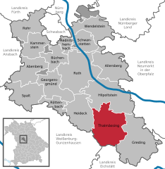
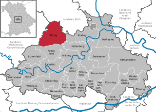
Titting (Titting)
- municipality of Germany
Titting is a small village located in Bavaria, Germany, which may not be widely known as a hiking destination, but it is surrounded by beautiful natural landscapes that can offer rewarding hiking experiences. While specific hiking trails in Titting itself may be less well-documented, you can explore various options in the nearby regions.
Hiking Opportunities in Titting and Surroundings
-
Scenic Views: The area around Titting features rolling hills, forests, and agricultural land, providing a chance for leisurely walks and hikes with beautiful countryside views.
-
Local Trails: Check with local tourist information centers for maps and guides to nearby trails. Many communities in Bavaria have well-marked paths that cater to different skill levels.
-
Nearby Nature Reserves: Explore areas like the Altmühl Valley Nature Park, which is not too far from Titting. This park features numerous hiking trails, with a mix of flat paths and more challenging routes, as well as stunning limestone cliffs and the Altmühl River.
-
Long-Distance Trails: If you’re up for an adventure, consider hiking segments of the Romantic Road or the Via Claudia Augusta, both of which pass through scenic landscapes in Bavaria and offer a mix of cultural experiences along with natural beauty.
-
Weather Considerations: As always when planning a hike, check the local weather forecast and trail conditions. In Bavaria, the weather can change quickly, so being prepared with appropriate gear is essential.
-
Local Tips: Engage with local hikers or join a community hiking group to get the best advice and perhaps discover hidden trails that aren’t as widely known.
Essential Hiking Tips
- Trail Maps: Always carry a map or a GPS device to navigate the trails.
- Proper Footwear: Wear sturdy hiking boots with good grip to avoid injuries.
- Water and Snacks: Bring enough water and energy-dense snacks to keep you fueled.
- Safety First: Let someone know your hiking plans and estimated return time, especially if you are hiking alone.
If you're in Titting or nearby, you can enjoy a peaceful retreat into nature while discovering the charm of the Bavarian countryside!
- Country:

- Postal Code: 85135
- Local Dialing Code: 08423
- Licence Plate Code: EI
- Coordinates: 49° 0' 0" N, 11° 13' 0" E


- GPS tracks (wikiloc): [Link]
- AboveSeaLevel: 447 м m
- Area: 71.09 sq km
- Population: 2433
- Web site: http://www.titting.de
- Wikipedia en: wiki(en)
- Wikipedia: wiki(de)
- Wikidata storage: Wikidata: Q504734
- Wikipedia Commons Category: [Link]
- Freebase ID: [/m/02q1hft]
- GeoNames ID: Alt: [2822078]
- VIAF ID: Alt: [246612646]
- OSM relation ID: [943549]
- GND ID: Alt: [4237192-2]
- archINFORM location ID: [232]
- Bavarikon ID: [ODB_A00001037]
- German municipality key: 09176164
Shares border with regions:


Nennslingen
- human settlement in Germany
Nennslingen is a small picturesque village in Bavaria, Germany, surrounded by beautiful nature that offers great hiking opportunities. The region is characterized by its rolling hills, lush forests, and well-marked trails that cater to various skill levels....
- Country:

- Postal Code: 91790
- Local Dialing Code: 09147
- Licence Plate Code: WUG
- Coordinates: 49° 3' 0" N, 11° 8' 0" E


- GPS tracks (wikiloc): [Link]
- AboveSeaLevel: 523 м m
- Area: 21.97 sq km
- Population: 1385
- Web site: [Link]


Thalmässing
- municipality in the district of Roth, in Bavaria, Germany
Thalmässing is a charming municipality located in Bavaria, Germany, offering a variety of hiking opportunities that cater to different skill levels and interests. The area is characterized by its picturesque landscapes, wooded hills, fertile fields, and quaint villages, making it a great destination for nature lovers and outdoor enthusiasts....
- Country:

- Postal Code: 91177
- Local Dialing Code: 09173
- Licence Plate Code: RH
- Coordinates: 49° 5' 0" N, 11° 13' 0" E


- GPS tracks (wikiloc): [Link]
- AboveSeaLevel: 418 м m
- Area: 80.57 sq km
- Population: 5010
- Web site: [Link]


Raitenbuch
- municipality of Germany
Raitenbuch is a picturesque village located in Bavaria, Germany, near the borders of the scenic Allgäu region. Hiking in and around Raitenbuch offers a range of trails, suitable for various skill levels, showcasing the natural beauty of the Bavarian countryside, including rolling hills, lush forests, and stunning views of the Alps....
- Country:

- Postal Code: 91790
- Local Dialing Code: 09147
- Licence Plate Code: WUG
- Coordinates: 49° 0' 53" N, 11° 7' 35" E


- GPS tracks (wikiloc): [Link]
- AboveSeaLevel: 559 м m
- Area: 38.2 sq km
- Population: 1206
- Web site: [Link]

