Nennslingen (Nennslingen)

- human settlement in Germany
 Hiking in Nennslingen
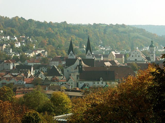
Nennslingen is a small picturesque village in Bavaria, Germany, surrounded by beautiful nature that offers great hiking opportunities. The region is characterized by its rolling hills, lush forests, and well-marked trails that cater to various skill levels.
Hiking Trails
-
Local Trails: There are several local hiking trails that connect to Nennslingen, allowing you to explore the scenic farmland and forests. These trails range from easy walks suitable for families to more challenging routes for experienced hikers.
-
Frankenhöhe Nature Park: Nearby, the Frankenhöhe Nature Park offers more extensive hiking options. You can find a network of trails that showcase the stunning landscapes, with routes passing through dense woods, open fields, and even along riverbanks.
-
Historical Paths: Some trails may also have historical significance, leading to old castles, ruins, or local landmarks that provide insight into the region's past.
Tips for Hiking in Nennslingen
-
Plan Your Route: Before heading out, it’s a good idea to pick a trail that matches your fitness level and interests. Use local maps or hiking apps to guide you.
-
Weather Preparedness: Check the weather forecast and dress in layers, as conditions can change. Bring rain gear if showers are expected, and wear sturdy, comfortable footwear.
-
Stay Hydrated and Energized: Carry enough water and snacks, especially if you're planning a longer hike.
-
Respect Nature: Stick to marked trails to protect the local flora and fauna. Observe wildlife from a distance and pack out any trash.
-
Explore Beyond Hikes: Take some time to visit the village of Nennslingen itself. Enjoy local cuisine, and immerse yourself in Bavarian culture.
Conclusion
Hiking in and around Nennslingen offers an excellent opportunity to experience the natural beauty of Bavaria. Whether you're looking for a leisurely walk or a more intense trek, you'll find something that suits your abilities and interests. Always remember to hike responsibly and enjoy the great outdoors!
- Country:

- Postal Code: 91790
- Local Dialing Code: 09147
- Licence Plate Code: WUG
- Coordinates: 49° 3' 0" N, 11° 8' 0" E


- GPS tracks (wikiloc): [Link]
- AboveSeaLevel: 523 м m
- Area: 21.97 sq km
- Population: 1385
- Web site: http://www.nennslingen.de
- Wikipedia en: wiki(en)
- Wikipedia: wiki(de)
- Wikidata storage: Wikidata: Q526087
- Wikipedia Commons Category: [Link]
- Freebase ID: [/m/02q94b8]
- GeoNames ID: Alt: [2866516]
- VIAF ID: Alt: [239038941]
- OSM relation ID: [1015143]
- GND ID: Alt: [4117807-5]
- Historical Gazetteer (GOV) ID: [NENGE1JN59NB]
- Bavarikon ID: [ODB_A00000213]
- German municipality key: 09577151
Includes regions:

Gersdorf
Hiking in Gersdorf
Gersdorf, located in the municipality of Nennslingen in Bavaria, Germany, is a beautiful area for hiking, characterized by its scenic landscapes and tranquil rural environment. Here are some highlights and tips for hiking in this region:...
- Country:
- Postal Code: 91790
- Local Dialing Code: 09147
- Coordinates: 49° 1' 56" N, 11° 9' 54" E
- GPS tracks (wikiloc): [Link]
- Area: 5.471 sq km

Wengen
Hiking in Wengen
Wengen is a charming village in the Swiss Alps, located in the region of Lauterbrunnen and known for its stunning views and outdoor activities. However, Nennslingen appears to be a different location, likely in Germany, and it seems there might be some confusion. If you meant Wengen in Switzerland, I'll focus on that....
- Country:
- Postal Code: 91790
- Local Dialing Code: 09147
- Coordinates: 49° 3' 25" N, 11° 10' 21" E
- GPS tracks (wikiloc): [Link]
- AboveSeaLevel: 559 м m
Biburg
Hiking in Biburg
Biburg, located in the municipality of Nennslingen in Bavaria, Germany, offers a pleasant backdrop for hiking enthusiasts. The picturesque landscapes of the region, characterized by rolling hills, scenic meadows, and tranquil forests, make it ideal for various outdoor activities....
- Country:
- Postal Code: 91790
- Local Dialing Code: 09147
- Coordinates: 49° 2' 20" N, 11° 10' 57" E
- GPS tracks (wikiloc): [Link]
- AboveSeaLevel: 560 м m
Kohlmühle
- human settlement
Hiking in Kohlmühle
Kohlmühle in Nennslingen is a picturesque area located in Bavaria, Germany, that offers great opportunities for hiking enthusiasts. The region is characterized by its scenic landscapes, lush forests, and rolling hills, making it a tranquil escape for nature lovers....
- Country:
- Postal Code: 91790
- Local Dialing Code: 09147
- Coordinates: 48° 2' 6" N, 11° 8' 59" E
- GPS tracks (wikiloc): [Link]
- AboveSeaLevel: 509 м m
Panzermühle
- human settlement in Germany
Hiking in Panzermühle
Panzermühle, situated near Nennslingen in Bavaria, Germany, is a beautiful area for hiking enthusiasts. The region features scenic landscapes, historical sites, and a variety of trails suitable for different skill levels. Here are some key points to consider when hiking in Panzermühle:...
- Country:
- Postal Code: 91790
- Local Dialing Code: 09147
- Coordinates: 49° 2' 36" N, 11° 8' 20" E
- GPS tracks (wikiloc): [Link]
- AboveSeaLevel: 514 м m
Schwabenmühle
- human settlement in Germany
Hiking in Schwabenmühle
Schwabenmühle in Nennslingen, located in the picturesque region of Bavaria, Germany, offers a variety of hiking opportunities for both beginners and experienced hikers. Here's an overview of what to expect when hiking in this area:...
- Country:
- Postal Code: 91790
- Local Dialing Code: 09147
- Coordinates: 49° 3' 1" N, 11° 7' 57" E
- GPS tracks (wikiloc): [Link]
- AboveSeaLevel: 519 м m

Steinmühle
- human settlement in Germany
Hiking in Steinmühle
Steinmühle, located in Nennslingen, Germany, is a picturesque area ideal for hiking enthusiasts. Nestled in the Franconian region, it offers a variety of trails that cater to different skill levels, surrounded by beautiful natural landscapes....
- Country:
- Postal Code: 91790
- Local Dialing Code: 09147
- Coordinates: 49° 2' 14" N, 11° 8' 37" E
- GPS tracks (wikiloc): [Link]
- AboveSeaLevel: 508 м m
Shares border with regions:

Roth
- district in Bavaria, Germany
Hiking in Roth
Roth district, located in Bavaria, Germany, offers a variety of beautiful landscapes and hiking opportunities that appeal to both novice and experienced hikers. The area is characterized by rolling hills, forests, and picturesque views. Here are some highlights and tips for hiking in Roth:...
- Country:
- Capital: Roth
- Licence Plate Code: RH; HIP
- Coordinates: 49° 15' 0" N, 11° 4' 48" E
- GPS tracks (wikiloc): [Link]
- AboveSeaLevel: 355 м m
- Area: 895.00 sq km
- Population: 103944
- Web site: [Link]
Eichstätt
- district of Bavaria, Germany
Hiking in Eichstätt
Eichstätt, located in Bavaria, Germany, is known for its scenic landscapes, historical towns, and rich natural beauty, making it a fantastic destination for hiking enthusiasts. Here are some highlights and tips for hiking in the Eichstätt district:...
- Country:
- Capital: Eichstätt
- Licence Plate Code: EI
- Coordinates: 48° 55' 12" N, 11° 19' 48" E
- GPS tracks (wikiloc): [Link]
- AboveSeaLevel: 475 м m
- Area: 1214.00 sq km
- Population: 97347
- Web site: [Link]

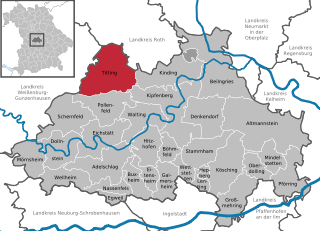
Titting
- municipality of Germany
Hiking in Titting
Titting is a small village located in Bavaria, Germany, which may not be widely known as a hiking destination, but it is surrounded by beautiful natural landscapes that can offer rewarding hiking experiences. While specific hiking trails in Titting itself may be less well-documented, you can explore various options in the nearby regions....
- Country:
- Postal Code: 85135
- Local Dialing Code: 08423
- Licence Plate Code: EI
- Coordinates: 49° 0' 0" N, 11° 13' 0" E
- GPS tracks (wikiloc): [Link]
- AboveSeaLevel: 447 м m
- Area: 71.09 sq km
- Population: 2433
- Web site: [Link]


Burgsalach
- municipality of Germany
Hiking in Burgsalach
Burgsalach is a picturesque area located in Germany, often noted for its beautiful landscapes and hiking opportunities, especially surrounded by nature reserves and scenic trails. While I don't have specific updated trail information, here are some general insights and tips for hiking in that region:...
- Country:
- Postal Code: 91790
- Local Dialing Code: 09147
- Licence Plate Code: WUG
- Coordinates: 49° 2' 0" N, 11° 6' 0" E
- GPS tracks (wikiloc): [Link]
- AboveSeaLevel: 583 м m
- Area: 19.31 sq km
- Population: 1143
- Web site: [Link]

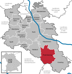
Thalmässing
- municipality in the district of Roth, in Bavaria, Germany
Hiking in Thalmässing
Thalmässing is a charming municipality located in Bavaria, Germany, offering a variety of hiking opportunities that cater to different skill levels and interests. The area is characterized by its picturesque landscapes, wooded hills, fertile fields, and quaint villages, making it a great destination for nature lovers and outdoor enthusiasts....
- Country:
- Postal Code: 91177
- Local Dialing Code: 09173
- Licence Plate Code: RH
- Coordinates: 49° 5' 0" N, 11° 13' 0" E
- GPS tracks (wikiloc): [Link]
- AboveSeaLevel: 418 м m
- Area: 80.57 sq km
- Population: 5010
- Web site: [Link]


Bergen
- municipality in the Weißenburg-Gunzenhausen district, in Bavaria, Germany
Hiking in Bergen
Bergen, located in the Middle Franconia region of Germany, offers a variety of hiking opportunities for all levels of experience. The picturesque landscape is characterized by rolling hills, wooded areas, and charming rural vistas, making it an ideal spot for hiking enthusiasts....
- Country:
- Postal Code: 91790
- Local Dialing Code: 09148; 09147
- Licence Plate Code: WUG
- Coordinates: 49° 5' 0" N, 11° 7' 0" E
- GPS tracks (wikiloc): [Link]
- AboveSeaLevel: 540 м m
- Area: 19.91 sq km
- Population: 1082
- Web site: [Link]


Raitenbuch
- municipality of Germany
Hiking in Raitenbuch
Raitenbuch is a picturesque village located in Bavaria, Germany, near the borders of the scenic Allgäu region. Hiking in and around Raitenbuch offers a range of trails, suitable for various skill levels, showcasing the natural beauty of the Bavarian countryside, including rolling hills, lush forests, and stunning views of the Alps....
- Country:
- Postal Code: 91790
- Local Dialing Code: 09147
- Licence Plate Code: WUG
- Coordinates: 49° 0' 53" N, 11° 7' 35" E
- GPS tracks (wikiloc): [Link]
- AboveSeaLevel: 559 м m
- Area: 38.2 sq km
- Population: 1206
- Web site: [Link]