
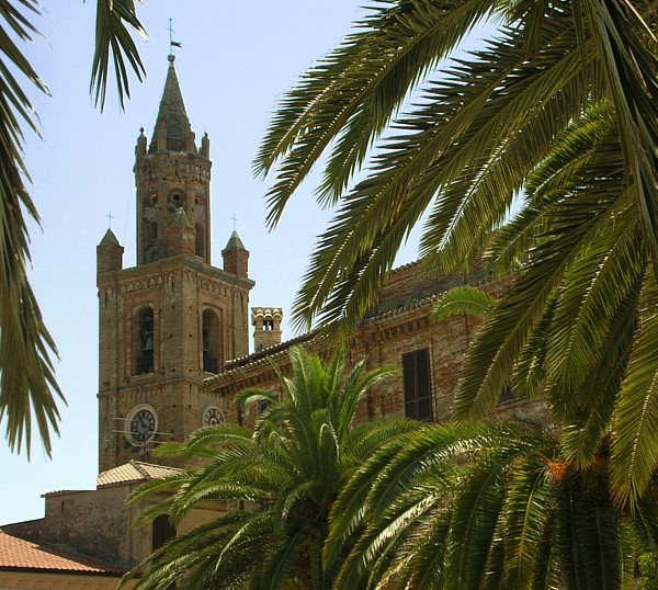
Tortoreto (Tortoreto)
.svg)
- Italian comune
 Hiking in Tortoreto
Tortoreto is a charming coastal town located in the Abruzzo region of Italy, known for its beautiful beaches and scenic landscapes. While it's primarily recognized for its seaside activities, there are also hiking opportunities in the surrounding areas that showcase the stunning natural beauty of the region.
Hiking Opportunities Around Tortoreto:
-
Gran Sasso e Monti della Laga National Park:
- A bit further inland, this national park offers numerous trails that vary in difficulty and length. You can explore breathtaking mountain landscapes, ancient forests, and diverse wildlife.
- Popular hiking routes include those leading to the Corno Grande, the highest peak in the Apennines, and the scenic paths around the Lago di Campotosto.
-
The Hills of Teramo:
- The hills surrounding Tortoreto are ideal for more leisurely hikes. You can find tracks that take you through olive groves, vineyards, and charming villages, allowing you to enjoy both nature and local culture.
- Look for trails that connect to nearby towns such as Martinsicuro and Alba Adriatica for a mix of coastal and hilly terrains.
-
Coastal Walking Paths:
- While not traditional hiking, there are lovely walking paths along the coastline. The Lungomare of Tortoreto offers beautiful views of the Adriatic Sea, ideal for a flat, scenic stroll.
Tips for Hiking in the Area:
- Timing: The best times to hike in this region are during spring (April to June) and fall (September to October) when temperatures are milder and the views are stunning.
- Preparation: Always check the weather forecast and bring adequate supplies, including water, snacks, proper footwear, and a map or navigation app.
- Local Guidance: Consider hiring a local guide for a more enriching experience, especially in the national park, as they can provide insights into the flora, fauna, and history of the area.
Attractions Near Tortoreto:
- After a day of hiking, take some time to relax on the beautiful beaches or explore the historic center of Tortoreto, which boasts charming architecture and lovely local eateries serving delicious Abruzzese cuisine.
In summary, while Tortoreto itself is more known for its beach activities, there are plenty of hiking opportunities in the nearby national parks and hills that will cater to outdoor enthusiasts.
- Country:

- Postal Code: 64018
- Local Dialing Code: 0861
- Licence Plate Code: TE
- Coordinates: 42° 48' 0" N, 13° 55' 0" E


- GPS tracks (wikiloc): [Link]
- AboveSeaLevel: 239 м m
- Area: 22.97 sq km
- Population: 11622
- Web site: http://www.comune.tortoreto.te.it/
- Wikipedia en: wiki(en)
- Wikipedia: wiki(it)
- Wikidata storage: Wikidata: Q51470
- Wikipedia Commons Gallery: [Link]
- Wikipedia Commons Category: [Link]
- Freebase ID: [/m/0fs4d4]
- GeoNames ID: Alt: [6540722]
- VIAF ID: Alt: [156407287]
- OSM relation ID: [42164]
- WOEID: [725157]
- Quora topic ID: [Tortoreto]
- UN/LOCODE: [ITTTL]
- DMOZ ID: Alt: [Regional/Europe/Italy/Abruzzo/Localities/Tortoreto/]
- ISTAT ID: 067044
- Italian cadastre code: L307
Shares border with regions:

Alba Adriatica
- Italian comune
Hiking in Alba Adriatica
Alba Adriatica is primarily known as a beach resort town located on the Adriatic Sea in the Abruzzo region of Italy. While it is celebrated for its lovely sandy beaches and vibrant beachfront promenade, hiking in and around Alba Adriatica offers beautiful landscapes and opportunities to explore the natural beauty of the surrounding area....
- Country:
- Postal Code: 64011
- Local Dialing Code: 0861
- Licence Plate Code: TE
- Coordinates: 42° 50' 0" N, 13° 55' 0" E
- GPS tracks (wikiloc): [Link]
- AboveSeaLevel: 5 м m
- Area: 9.6 sq km
- Population: 12462
- Web site: [Link]
Corropoli
- Italian comune
Hiking in Corropoli
Corropoli is a charming town located in the Abruzzo region of Italy, known for its picturesque scenery, rich history, and access to beautiful hiking trails. Hiking in and around Corropoli offers a unique opportunity to explore the stunning landscapes of the Apennines and the coastal areas nearby....
- Country:
- Postal Code: 64013
- Local Dialing Code: 0861
- Licence Plate Code: TE
- Coordinates: 42° 50' 0" N, 13° 50' 0" E
- GPS tracks (wikiloc): [Link]
- AboveSeaLevel: 132 м m
- Area: 22.11 sq km
- Population: 5054
- Web site: [Link]

Giulianova
- Italian comune
Hiking in Giulianova
Giulianova, located along the Adriatic coast of Italy in the Abruzzo region, is a charming town known for its beautiful beaches and historical significance. While it is primarily a seaside resort, there are various hiking opportunities in the surrounding areas, particularly in the nearby Gran Sasso and Monti della Laga National Park and the Teramo province’s picturesque landscapes....
- Country:
- Postal Code: 64021
- Local Dialing Code: 085
- Licence Plate Code: TE
- Coordinates: 42° 45' 9" N, 13° 57' 24" E
- GPS tracks (wikiloc): [Link]
- AboveSeaLevel: 68 м m
- Area: 28 sq km
- Population: 23875
- Web site: [Link]

Mosciano Sant'Angelo
- Italian comune
Hiking in Mosciano Sant'Angelo
Mosciano Sant'Angelo is a charming town located in the Abruzzo region of Italy, which features a mix of beautiful landscapes, cultural heritage, and outdoor activities, including hiking. The area around Mosciano Sant'Angelo offers various hiking opportunities that cater to different skill levels and preferences....
- Country:
- Postal Code: 64023
- Local Dialing Code: 085
- Licence Plate Code: TE
- Coordinates: 42° 45' 0" N, 13° 53' 0" E
- GPS tracks (wikiloc): [Link]
- AboveSeaLevel: 227 м m
- Area: 48.45 sq km
- Population: 9316
- Web site: [Link]

Sant'Omero
- Italian comune
Hiking in Sant'Omero
Sant'Omero, located in the Abruzzo region of Italy, is a charming town known for its scenic beauty and proximity to the Monti della Laga National Park. Hiking in and around Sant'Omero offers a variety of trails that cater to different skill levels, giving you the opportunity to explore the stunning landscapes, rich biodiversity, and cultural heritage of the area....
- Country:
- Postal Code: 64027
- Local Dialing Code: 0861
- Licence Plate Code: TE
- Coordinates: 42° 47' 0" N, 13° 48' 0" E
- GPS tracks (wikiloc): [Link]
- AboveSeaLevel: 209 м m
- Area: 34.2 sq km
- Population: 5317
- Web site: [Link]