Tréhet (Tréhet)

- commune in Loir-et-Cher, France
- Country:

- Postal Code: 41800
- Coordinates: 47° 44' 3" N, 0° 37' 18" E


- GPS tracks (wikiloc): [Link]
- Area: 5.65 sq km
- Population: 113
- Wikipedia en: wiki(en)
- Wikipedia: wiki(fr)
- Wikidata storage: Wikidata: Q1170603
- Wikipedia Commons Category: [Link]
- Freebase ID: [/m/03nw2vn]
- GeoNames ID: Alt: [2971921]
- SIREN number: [214102634]
- INSEE municipality code: 41263
Shares border with regions:

Villedieu-le-Château
- commune in Loir-et-Cher, France
- Country:
- Postal Code: 41800
- Coordinates: 47° 43' 12" N, 0° 38' 53" E
- GPS tracks (wikiloc): [Link]
- Area: 29.65 sq km
- Population: 408
- Web site: [Link]


Couture-sur-Loir
- commune in Loir-et-Cher, France
- Country:
- Postal Code: 41800
- Coordinates: 47° 45' 13" N, 0° 41' 16" E
- GPS tracks (wikiloc): [Link]
- Area: 14.3 sq km
- Population: 413

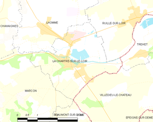
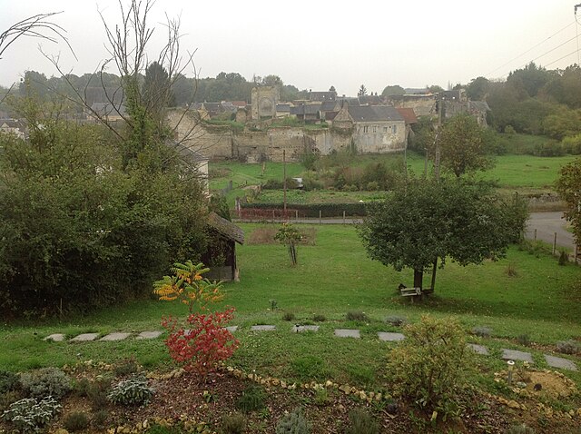
La Chartre-sur-le-Loir
- commune in Sarthe, France
- Country:
- Postal Code: 72340
- Coordinates: 47° 43' 44" N, 0° 34' 23" E
- GPS tracks (wikiloc): [Link]
- Area: 8.3 sq km
- Population: 1455
- Web site: [Link]


Ruillé-sur-Loir
- former commune in Sarthe, France
- Country:
- Postal Code: 72340
- Coordinates: 47° 45' 2" N, 0° 37' 14" E
- GPS tracks (wikiloc): [Link]
- Area: 39.48 sq km
- Population: 1207

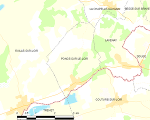
Poncé-sur-le-Loir
- former commune in Sarthe, France
- Country:
- Postal Code: 72340
- Coordinates: 47° 45' 43" N, 0° 39' 19" E
- GPS tracks (wikiloc): [Link]
- Area: 6.92 sq km
- Population: 342