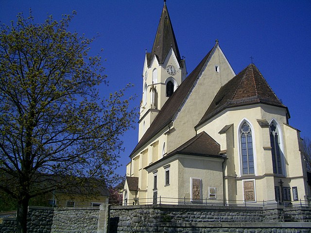
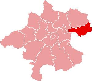
Tragwein (Tragwein)
- municipality in Austria
Tragwein, located in the Upper Austria region, offers some serene hiking opportunities amidst beautiful natural landscapes. The area is characterized by rolling hills, lush forests, and picturesque views of the surrounding countryside, making it an excellent choice for hikers of all levels.
Popular Hiking Trails:
-
Hiking through the Mühlviertel: This region offers various trails that showcase the diverse terrain of forests, fields, and small rivers. Some paths are suitable for leisurely walks, while others provide a more challenging experience.
-
Nebelstein Route: A popular trail that leads to Nebelstein Hill, offering stunning panoramic views at the summit. The trek includes a mix of forest paths and open spaces, providing a great opportunity to enjoy nature up close.
-
Local Nature Trails: Look for smaller, well-marked nature trails around Tragwein that highlight the local flora and fauna, making for an educational hiking experience.
General Hiking Tips:
- Check Weather Conditions: Before heading out, be sure to check the weather forecast, as conditions can change rapidly in mountainous areas.
- Wear Appropriate Gear: Good hiking boots are essential, along with layers of clothing that can adapt to changing temperatures.
- Stay Hydrated and Nourished: Bring enough water and some snacks to keep your energy levels up during your hike.
- Respect Nature: Follow local guidelines regarding wildlife and plant life to preserve the natural environment.
Accessibility:
Hiking trails in and around Tragwein are generally well-maintained, and many can be accessed from local roads or parking areas. Public transport options may also be available depending on your route.
Local Resources:
Consider visiting local visitor centers or tourism websites for specific trail maps, guided hikes, and additional information about the area. Connecting with local hiking groups or clubs can also enhance your experience.
Enjoy your hiking adventure in Tragwein, and take the time to appreciate the natural beauty and tranquility of this lovely region!
- Country:

- Postal Code: 4284
- Local Dialing Code: 07263
- Licence Plate Code: FR
- Coordinates: 48° 19' 50" N, 14° 37' 20" E


- GPS tracks (wikiloc): [Link]
- AboveSeaLevel: 491 м m
- Area: 39.5 sq km
- Population: 3082
- Web site: http://www.tragwein.at/
- Wikipedia en: wiki(en)
- Wikipedia: wiki(de)
- Wikidata storage: Wikidata: Q683108
- Wikipedia Commons Category: [Link]
- Freebase ID: [/m/03gv3m6]
- GeoNames ID: Alt: [7873128]
- BnF ID: [11939343r]
- VIAF ID: Alt: [246574885]
- GND ID: Alt: [4119678-8]
- archINFORM location ID: [10560]
- WOEID: [546964]
- Austrian municipality key: [40620]
Shares border with regions:

Pregarten
- municipality in Austria
Pregarten, located in Upper Austria, is a charming town that serves as a gateway for various outdoor activities, including hiking. The surrounding landscape is characterized by gently rolling hills, lush forests, and picturesque natural scenery, making it an excellent destination for both beginner and experienced hikers....
- Country:

- Postal Code: 4230
- Local Dialing Code: 07236
- Licence Plate Code: FR
- Coordinates: 48° 21' 20" N, 14° 31' 50" E


- GPS tracks (wikiloc): [Link]
- AboveSeaLevel: 425 м m
- Area: 27.8 sq km
- Population: 5293
- Web site: [Link]


Schwertberg
- municipality in Austria
Schwertberg, located in Upper Austria, is a great destination for hiking enthusiasts. The region is characterized by picturesque landscapes, lush forests, and rolling hills, making it suitable for various levels of hikers....
- Country:

- Postal Code: 4311
- Local Dialing Code: 07262
- Licence Plate Code: PE
- Coordinates: 48° 16' 18" N, 14° 35' 0" E


- GPS tracks (wikiloc): [Link]
- AboveSeaLevel: 268 м m
- Area: 18.78 sq km
- Population: 5365
- Web site: [Link]

Allerheiligen im Mühlkreis
- municipality in Austria
 Hiking in Allerheiligen im Mühlkreis
Allerheiligen im Mühlkreis is a charming village located in Upper Austria, surrounded by lush landscapes and offering a range of hiking opportunities. Here are some aspects to consider if you're planning to hike in this area:...
- Country:

- Postal Code: 4320
- Local Dialing Code: 07262
- Licence Plate Code: PE
- Coordinates: 48° 18' 1" N, 14° 38' 1" E


- GPS tracks (wikiloc): [Link]
- AboveSeaLevel: 568 м m
- Area: 20.2 sq km
- Population: 1261
- Web site: [Link]


Ried in der Riedmark
- municipality in Austria
 Hiking in Ried in der Riedmark
Ried in der Riedmark is a charming municipality located in Austria, nestled in the scenic landscape of Upper Austria. The area offers various hiking opportunities for both beginners and more experienced hikers, making it a great destination for outdoor enthusiasts....
- Country:

- Postal Code: 4312
- Local Dialing Code: 07238
- Licence Plate Code: PE
- Coordinates: 48° 16' 16" N, 14° 32' 44" E


- GPS tracks (wikiloc): [Link]
- AboveSeaLevel: 306 м m
- Area: 32.6 sq km
- Population: 4210
- Web site: [Link]

Bad Zell
- municipality in Austria
Bad Zell, located in the beautiful region of Upper Austria, offers a range of hiking opportunities for nature enthusiasts and adventure seekers. The area is characterized by its picturesque landscapes, lush forests, and rolling hills, making it a great destination for hikers of all skill levels....
- Country:

- Postal Code: 4283
- Local Dialing Code: 07263
- Licence Plate Code: FR
- Coordinates: 48° 21' 0" N, 14° 40' 0" E


- GPS tracks (wikiloc): [Link]
- AboveSeaLevel: 515 м m
- Area: 45.5 sq km
- Population: 2868
- Web site: [Link]


Gutau
- municipality in Austria
Gutau, located in the Mühlviertel region of Austria, is a lovely destination for hiking enthusiasts. The area is characterized by its beautiful landscapes, dense forests, rolling hills, and picturesque meadows, offering various trails suited for different skill levels....
- Country:

- Postal Code: 4293
- Local Dialing Code: 07946
- Coordinates: 48° 25' 0" N, 14° 36' 0" E


- GPS tracks (wikiloc): [Link]
- AboveSeaLevel: 589 м m
- Area: 45.44 sq km
- Population: 2724
- Web site: [Link]