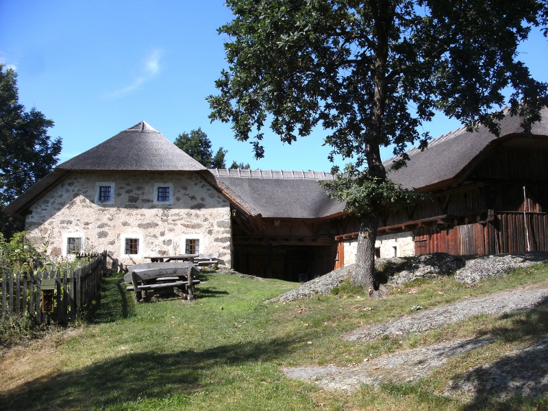
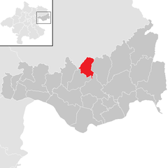
Bad Zell (Bad Zell)
- municipality in Austria
Bad Zell, located in the beautiful region of Upper Austria, offers a range of hiking opportunities for nature enthusiasts and adventure seekers. The area is characterized by its picturesque landscapes, lush forests, and rolling hills, making it a great destination for hikers of all skill levels.
Hiking Trails
-
Panoramaweg Bad Zell: This trail offers stunning views of the surrounding countryside and is suitable for families and casual hikers. The trail is well-marked and features several resting areas where you can enjoy the scenery.
-
The Valley of the River Aschach: This area provides a scenic hiking route along the river, with opportunities to spot local wildlife and enjoy the tranquility of the water.
-
Terrain around the Mühlviertel: The Mühlviertel region, which includes Bad Zell, offers more challenging trails with steeper elevations and rugged terrain for experienced hikers looking for a more strenuous workout.
Nature and Scenery
- The region is rich in biodiversity, and you may encounter various species of flora and fauna along your hike.
- The hills provide beautiful vistas, especially during the autumn when the foliage changes colors.
- Look out for historical sites or landmarks that can be found along the trails, adding a cultural experience to your hike.
Practical Tips
- Best Time to Hike: Late spring to early autumn is ideal for hiking, as the weather is generally mild and pleasant.
- Equipment: Wear sturdy hiking boots, and consider bringing a backpack with water, snacks, a map, and, depending on the season, appropriate clothing for changing weather conditions.
- Guided Tours: If you're unfamiliar with the area, consider joining a guided hike to learn more about the local landscape and biodiversity.
Always check local guidelines and trail conditions before heading out, and ensure that you respect nature and the environment during your hikes. Enjoy your adventure in Bad Zell!
- Country:

- Postal Code: 4283
- Local Dialing Code: 07263
- Licence Plate Code: FR
- Coordinates: 48° 21' 0" N, 14° 40' 0" E


- GPS tracks (wikiloc): [Link]
- AboveSeaLevel: 515 м m
- Area: 45.5 sq km
- Population: 2868
- Web site: http://www.badzell.at/
- Wikipedia en: wiki(en)
- Wikipedia: wiki(de)
- Wikidata storage: Wikidata: Q682850
- Wikipedia Commons Category: [Link]
- Freebase ID: [/m/03gv35y]
- GeoNames ID: Alt: [7873131]
- Austrian municipality key: [40627]
Shares border with regions:

Pierbach
- municipality in Austria
Pierbach is a charming village located in Austria, surrounded by beautiful natural landscapes, making it an excellent destination for hiking enthusiasts. Here are some highlights about hiking in the region:...
- Country:

- Postal Code: 4282
- Local Dialing Code: 07267
- Licence Plate Code: FR
- Coordinates: 48° 20' 50" N, 14° 45' 20" E


- GPS tracks (wikiloc): [Link]
- AboveSeaLevel: 494 м m
- Area: 22.7 sq km
- Population: 1011
- Web site: [Link]


Rechberg
- municipality in Austria
Rechberg is a beautiful hiking destination located in the Styria region of Austria. Known for its stunning landscapes, scenic views, and tranquil atmosphere, it offers various hiking trails suitable for different skill levels....
- Country:

- Postal Code: 4324
- Local Dialing Code: 07264
- Licence Plate Code: PE
- Coordinates: 48° 19' 19" N, 14° 42' 44" E


- GPS tracks (wikiloc): [Link]
- AboveSeaLevel: 576 м m
- Area: 13.8 sq km
- Population: 996
- Web site: [Link]

Allerheiligen im Mühlkreis
- municipality in Austria
 Hiking in Allerheiligen im Mühlkreis
Allerheiligen im Mühlkreis is a charming village located in Upper Austria, surrounded by lush landscapes and offering a range of hiking opportunities. Here are some aspects to consider if you're planning to hike in this area:...
- Country:

- Postal Code: 4320
- Local Dialing Code: 07262
- Licence Plate Code: PE
- Coordinates: 48° 18' 1" N, 14° 38' 1" E


- GPS tracks (wikiloc): [Link]
- AboveSeaLevel: 568 м m
- Area: 20.2 sq km
- Population: 1261
- Web site: [Link]

Windhaag bei Perg
- municipality in Austria
Windhaag bei Perg is a beautiful area in Austria that offers various hiking opportunities, ideal for outdoor enthusiasts. Nestled in the region of Upper Austria, this scenic locality is characterized by its rolling hills, forests, and charming landscapes....
- Country:

- Postal Code: 4322
- Local Dialing Code: 07264
- Licence Plate Code: PE
- Coordinates: 48° 17' 0" N, 14° 40' 49" E


- GPS tracks (wikiloc): [Link]
- AboveSeaLevel: 514 м m
- Area: 19.18 sq km
- Population: 1508
- Web site: [Link]
Tragwein
- municipality in Austria
Tragwein, located in the Upper Austria region, offers some serene hiking opportunities amidst beautiful natural landscapes. The area is characterized by rolling hills, lush forests, and picturesque views of the surrounding countryside, making it an excellent choice for hikers of all levels....
- Country:

- Postal Code: 4284
- Local Dialing Code: 07263
- Licence Plate Code: FR
- Coordinates: 48° 19' 50" N, 14° 37' 20" E


- GPS tracks (wikiloc): [Link]
- AboveSeaLevel: 491 м m
- Area: 39.5 sq km
- Population: 3082
- Web site: [Link]


Gutau
- municipality in Austria
Gutau, located in the Mühlviertel region of Austria, is a lovely destination for hiking enthusiasts. The area is characterized by its beautiful landscapes, dense forests, rolling hills, and picturesque meadows, offering various trails suited for different skill levels....
- Country:

- Postal Code: 4293
- Local Dialing Code: 07946
- Coordinates: 48° 25' 0" N, 14° 36' 0" E


- GPS tracks (wikiloc): [Link]
- AboveSeaLevel: 589 м m
- Area: 45.44 sq km
- Population: 2724
- Web site: [Link]
Schönau im Mühlkreis
- municipality in Austria
 Hiking in Schönau im Mühlkreis
Schönau im Mühlkreis is a picturesque area in Upper Austria, known for its stunning landscapes and natural beauty, making it an excellent destination for hiking enthusiasts. Nestled in the foothills of the Mühlviertel region, this area offers a variety of hiking trails catering to different skill levels, from leisurely walks to more challenging routes....
- Country:

- Postal Code: 4274
- Local Dialing Code: 07261
- Licence Plate Code: FR
- Coordinates: 48° 23' 40" N, 14° 43' 48" E


- GPS tracks (wikiloc): [Link]
- AboveSeaLevel: 635 м m
- Area: 38.5 sq km
- Population: 1941
- Web site: [Link]