Traversella (Traversella)
- Italian comune
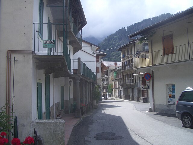
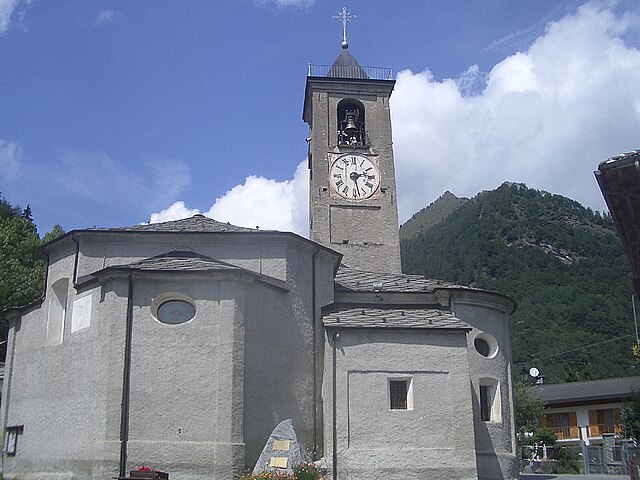
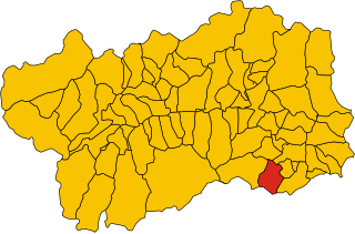
Traversella is a charming village located in the province of Turin, in the Piedmont region of northern Italy. It is nestled in a beautiful valley surrounded by the stunning peaks of the Gran Paradiso National Park, making it a great destination for hiking enthusiasts.
Hiking Opportunities:
-
Trails: Traversella offers a range of hiking trails suitable for various skill levels. You can find easy, family-friendly paths as well as more challenging routes for experienced hikers. Many trails take you through picturesque landscapes, including forests, alpine meadows, and breathtaking mountain views.
-
Gran Paradiso National Park: Being close to this national park provides access to numerous trails that showcase the region's natural beauty. The park is famous for its biodiversity, including a variety of wildlife such as ibex and chamois.
-
Local Routes: Some popular hiking routes around Traversella include:
- The Monte Serra Loop: A medium-difficulty trail that provides great views of the surrounding valleys and peaks.
- The Valley of the Orco: A slightly more challenging hike, it leads you through beautiful scenery and unique geological formations.
- The pathways to lakes: Several routes take you to beautiful alpine lakes, which are perfect for a picnic or a break during your hike.
Advice for Hikers:
- Preparation: Make sure to prepare adequately before you head out. Pack essentials like water, snacks, a map, and a first aid kit. It’s also wise to check the weather forecast.
- Timing: The best times for hiking in Traversella are usually from late spring to early autumn, when the trails are more accessible and the weather is generally pleasant.
- Local Regulations: Always follow local guidelines and regulations, especially regarding wildlife and environmental conservation.
Additional Activities:
Besides hiking, you can also explore the local culture and cuisine. The area is rich in history, with opportunities to visit traditional villages, sample local delicacies, and engage in other outdoor activities such as biking and climbing.
With its stunning landscapes and variety of hiking trails, Traversella is an excellent choice for outdoor enthusiasts looking to explore the natural beauty of the Piedmont region. Enjoy your adventure!
- Country:

- Postal Code: 10080
- Local Dialing Code: 0125
- Licence Plate Code: TO
- Coordinates: 45° 31' 0" N, 7° 45' 0" E


- GPS tracks (wikiloc): [Link]
- AboveSeaLevel: 827 м m
- Area: 39.36 sq km
- Population: 332
- Web site: http://www.comune.traversella.to.it
- Wikipedia en: wiki(en)
- Wikipedia: wiki(it)
- Wikidata storage: Wikidata: Q10323
- Wikipedia Commons Category: [Link]
- Freebase ID: [/m/0g8mg2]
- GeoNames ID: Alt: [6538087]
- VIAF ID: Alt: [245401152]
- OSM relation ID: [45181]
- WOEID: [725215]
- TGN ID: [1047182]
- ISTAT ID: 001278
- Italian cadastre code: L345
Shares border with regions:


Quincinetto
- Italian comune
Quincinetto, located in the Aosta Valley region of Italy, is a fantastic destination for hiking enthusiasts. Nestled in a picturesque valley surrounded by the impressive peaks of the Graian Alps, it offers a variety of trails suitable for different skill levels....
- Country:

- Postal Code: 10010
- Local Dialing Code: 0125
- Licence Plate Code: TO
- Coordinates: 45° 34' 0" N, 7° 48' 0" E


- GPS tracks (wikiloc): [Link]
- AboveSeaLevel: 295 м m
- Area: 17.79 sq km
- Population: 1019
- Web site: [Link]


Ronco Canavese
- Italian comune
Ronco Canavese is a charming village located in the Canavese region of northern Italy, nestled in the foothills of the Alps. The area offers a variety of hiking opportunities with stunning views, rich natural landscapes, and an abundance of cultural heritage....
- Country:

- Postal Code: 10080
- Local Dialing Code: 0124
- Licence Plate Code: TO
- Coordinates: 45° 30' 0" N, 7° 33' 0" E


- GPS tracks (wikiloc): [Link]
- Area: 96.27 sq km
- Population: 308
- Web site: [Link]


Tavagnasco
- Italian comune
Tavagnasco is a beautiful location for hiking, situated in the Aosta Valley region of Italy. This area is known for its stunning landscapes, rich natural beauty, and varied trails suitable for different skill levels, ranging from easy walks to more challenging hikes....
- Country:

- Postal Code: 10010
- Local Dialing Code: 0125
- Licence Plate Code: TO
- Coordinates: 45° 33' 0" N, 7° 49' 0" E


- GPS tracks (wikiloc): [Link]
- AboveSeaLevel: 270 м m
- Area: 8.68 sq km
- Population: 789
- Web site: [Link]


Valprato Soana
- Italian comune
Valprato Soana is a picturesque valley located in the Piedmont region of northern Italy, surrounded by the stunning backdrop of the Cottian Alps. It's a great destination for hiking enthusiasts, offering a range of trails suitable for various skill levels, from leisurely walks to more challenging hikes....
- Country:

- Postal Code: 10080
- Local Dialing Code: 0124
- Licence Plate Code: TO
- Coordinates: 45° 31' 0" N, 7° 33' 0" E


- GPS tracks (wikiloc): [Link]
- Area: 71.85 sq km
- Population: 101
- Web site: [Link]


Donnas
- Italian comune
Donnas, a small town located in the Aosta Valley region of Italy, is surrounded by stunning natural landscapes and offers several hiking opportunities for outdoor enthusiasts. Here are some highlights of hiking in and around Donnas:...
- Country:

- Postal Code: 11020
- Local Dialing Code: 0125
- Licence Plate Code: AO
- Coordinates: 45° 36' 0" N, 7° 46' 0" E


- GPS tracks (wikiloc): [Link]
- AboveSeaLevel: 322 м m
- Area: 33.97 sq km
- Population: 2520
- Web site: [Link]


Pontboset
- Italian comune
Pontboset is a charming destination for hiking enthusiasts, located in the Aosta Valley region of Italy. The area is known for its stunning natural landscapes, including mountains, valleys, and rich flora and fauna. Here are some key points and recommendations for hiking in Pontboset:...
- Country:

- Postal Code: 11020
- Local Dialing Code: 0125
- Licence Plate Code: AO
- Coordinates: 45° 36' 26" N, 7° 41' 11" E


- GPS tracks (wikiloc): [Link]
- AboveSeaLevel: 780 м m
- Area: 33.56 sq km
- Population: 180
- Web site: [Link]


Brosso
- Italian comune
Brosso, a charming village in the Aosta Valley of Italy, offers a wonderful setting for hiking enthusiasts looking to explore the beauty of the Italian Alps. The region is characterized by stunning landscapes, lush forests, and rugged mountains, providing opportunities for hikers of all skill levels. Here are some highlights and tips for hiking in Brosso:...
- Country:

- Postal Code: 10080
- Local Dialing Code: 0125
- Licence Plate Code: TO
- Coordinates: 45° 30' 0" N, 7° 48' 0" E


- GPS tracks (wikiloc): [Link]
- AboveSeaLevel: 797 м m
- Area: 11.14 sq km
- Population: 404
- Web site: [Link]


Castelnuovo Nigra
- Italian comune
Castelnuovo Nigra is a charming village located in the Piedmont region of Italy, surrounded by beautiful natural scenery, making it an excellent destination for hiking enthusiasts. The area offers a variety of trails that cater to different skill levels and preferences, showcasing the stunning landscapes, local flora, and the unique architecture of the region....
- Country:

- Postal Code: 10080
- Local Dialing Code: 0124
- Licence Plate Code: TO
- Coordinates: 45° 26' 0" N, 7° 42' 0" E


- GPS tracks (wikiloc): [Link]
- AboveSeaLevel: 828 м m
- Area: 28.38 sq km
- Population: 440
- Web site: [Link]


Frassinetto
- Municipality in Italy
Frassinetto is a charming village located in the Susa Valley of Italy, nestled in the Piedmont region of the Alps. It is a great starting point for outdoor enthusiasts looking to explore the stunning natural beauty of the surrounding area. Here’s some information on hiking in and around Frassinetto:...
- Country:

- Postal Code: 10080
- Local Dialing Code: 0124
- Licence Plate Code: TO
- Coordinates: 45° 26' 18" N, 7° 36' 32" E


- GPS tracks (wikiloc): [Link]
- AboveSeaLevel: 1050 м m
- Area: 24.82 sq km
- Population: 277
- Web site: [Link]


Ingria
- Italian comune
Ingria is a small town in the region of Piedmont, Italy, which is located in the Susa Valley close to the Alps. This picturesque area offers a variety of hiking opportunities, making it a great destination for outdoor enthusiasts. Here are some highlights and tips for hiking in Ingria and its nearby regions:...
- Country:

- Postal Code: 10080
- Local Dialing Code: 0124
- Licence Plate Code: TO
- Coordinates: 45° 28' 0" N, 7° 34' 0" E


- GPS tracks (wikiloc): [Link]
- AboveSeaLevel: 816 м m
- Area: 14.75 sq km
- Population: 46
- Web site: [Link]

