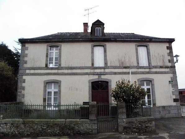
Tremblay (Tremblay)

- commune in Ille-et-Vilaine, France
- Country:

- Postal Code: 35460
- Coordinates: 48° 25' 20" N, 1° 28' 33" E


- GPS tracks (wikiloc): [Link]
- Area: 36.22 sq km
- Population: 1566
- Web site: http://www.mairie-de-tremblay.fr
- Wikipedia en: wiki(en)
- Wikipedia: wiki(fr)
- Wikidata storage: Wikidata: Q222799
- Wikipedia Commons Category: [Link]
- Freebase ID: [/m/03m8p1_]
- Freebase ID: [/m/03m8p1_]
- GeoNames ID: Alt: [6432882]
- GeoNames ID: Alt: [6432882]
- SIREN number: [213503410]
- SIREN number: [213503410]
- BnF ID: [15257282n]
- BnF ID: [15257282n]
- OSM relation ID: [146060]
- OSM relation ID: [146060]
- INSEE municipality code: 35341
- INSEE municipality code: 35341
Shares border with regions:


Chauvigné
- commune in Ille-et-Vilaine, France
- Country:
- Postal Code: 35490
- Coordinates: 48° 22' 33" N, 1° 27' 37" E
- GPS tracks (wikiloc): [Link]
- Area: 17.71 sq km
- Population: 854


Saint-Brice-en-Coglès
- former commune in Ille-et-Vilaine, France
- Country:
- Postal Code: 35460
- Coordinates: 48° 24' 38" N, 1° 22' 1" E
- GPS tracks (wikiloc): [Link]
- Area: 16.46 sq km
- Population: 2963
- Web site: [Link]


Romazy
- commune in Ille-et-Vilaine, France
- Country:
- Postal Code: 35490
- Coordinates: 48° 22' 32" N, 1° 29' 49" E
- GPS tracks (wikiloc): [Link]
- Area: 7.18 sq km
- Population: 273
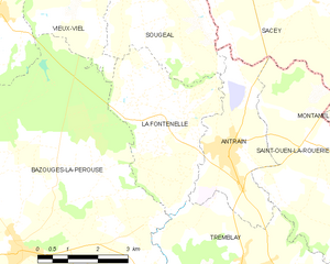
La Fontenelle
- commune in Ille-et-Vilaine, France
- Country:
- Postal Code: 35560
- Coordinates: 48° 28' 4" N, 1° 30' 10" E
- GPS tracks (wikiloc): [Link]
- Area: 12.36 sq km
- Population: 539

Bazouges-la-Pérouse
- commune in Ille-et-Vilaine, France
- Country:
- Postal Code: 35560
- Coordinates: 48° 25' 34" N, 1° 34' 27" E
- GPS tracks (wikiloc): [Link]
- Area: 58.18 sq km
- Population: 1794
- Web site: [Link]

Saint-Ouen-la-Rouërie
- commune in Ille-et-Vilaine, France
- Country:
- Postal Code: 35460
- Coordinates: 48° 27' 46" N, 1° 26' 27" E
- GPS tracks (wikiloc): [Link]
- AboveSeaLevel: 83 м m
- Area: 21.12 sq km
- Population: 822
- Web site: [Link]


Saint-Marc-le-Blanc
- commune in Ille-et-Vilaine, France
- Country:
- Postal Code: 35460
- Coordinates: 48° 21' 52" N, 1° 24' 34" E
- GPS tracks (wikiloc): [Link]
- Area: 17.53 sq km
- Population: 1376


Coglès
- former commune in Ille-et-Vilaine, France
- Country:
- Postal Code: 35460
- Coordinates: 48° 27' 35" N, 1° 21' 51" E
- GPS tracks (wikiloc): [Link]
- Area: 17.21 sq km
- Population: 652
- Web site: [Link]

Antrain
- commune in Ille-et-Vilaine, France
- Country:
- Postal Code: 35560
- Coordinates: 48° 27' 38" N, 1° 29' 5" E
- GPS tracks (wikiloc): [Link]
- Area: 9.31 sq km
- Population: 1319
- Web site: [Link]


Rimou
- commune in Ille-et-Vilaine, France
- Country:
- Postal Code: 35560
- Coordinates: 48° 23' 58" N, 1° 30' 45" E
- GPS tracks (wikiloc): [Link]
- AboveSeaLevel: 43 м m
- Area: 13.28 sq km
- Population: 335