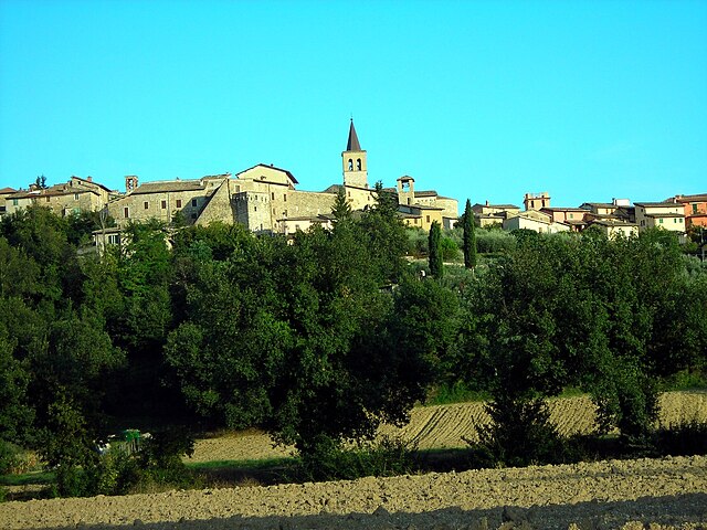
Trevi (Trevi)
.svg)
- Italian comune
 Hiking in Trevi
Trevi, located in the Umbria region of Italy, is a charming town known for its picturesque landscapes, olive groves, and scenic hills. It offers several excellent hiking opportunities, suitable for different skill levels. Here are some highlights and suggestions for hiking in and around Trevi:
Hiking Trails
-
Sentiero degli Ulivi (Olive Grove Trail):
- This trail takes you through the beautiful olive groves that the region is famous for. It offers stunning views of the surrounding landscape and is generally easy to moderate in difficulty. The route is well-marked and perfect for a leisurely walk, with plenty of spots for taking photographs.
-
Monte Serrano:
- For a more challenging hike, you can tackle the routes leading up to Monte Serrano. The trails vary in difficulty, but the views from the summit are breathtaking, providing a panoramic look at the Umbrian countryside.
-
Pieve San Fabiano to Trevi:
- This is a scenic route that connects the church of Pieve San Fabiano to the town of Trevi. It’s a relatively easy hike, where you can enjoy the tranquility of the countryside and learn about the rich history of the area.
Essential Tips
- Wear Appropriate Footwear: Good hiking boots are recommended, as some paths can be rocky or uneven.
- Stay Hydrated: Always carry enough water, especially during warmer months.
- Check Weather Conditions: Weather in the Umbrian hills can change quickly, so it’s important to check forecasts before heading out.
- Start Early: If you're planning a longer hike, start early in the day to make the most of daylight.
- Local Guides: Consider hiring a local guide for insider knowledge on the best trails and to ensure safety, especially if you’re unfamiliar with the area.
Nearby Attractions
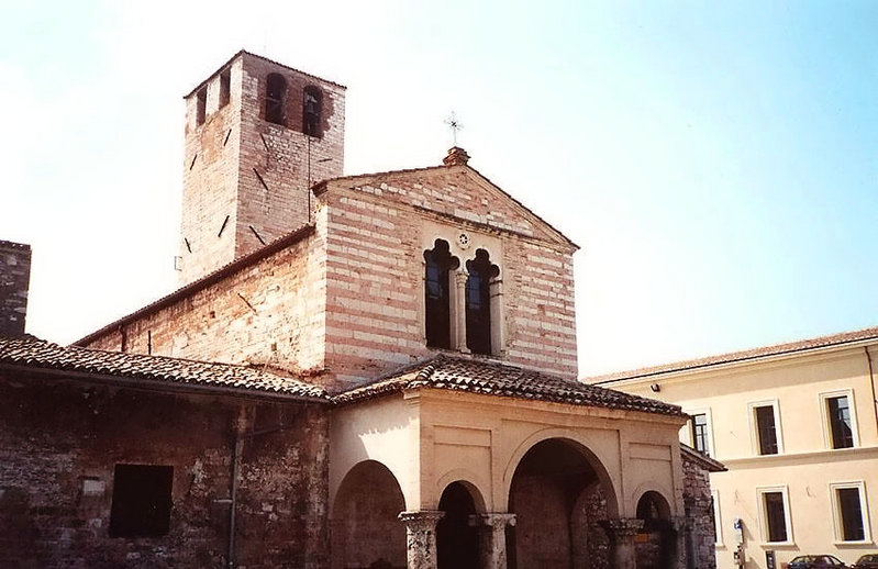
- Trevi: Explore the town itself, with its charming historical center, beautiful churches, and local olive oil production.
- Assisi: A short drive from Trevi, Assisi offers both cultural and hiking opportunities, notably along the path of St. Francis.
Cultural Notes
Hiking in Trevi is not just about the trails; it's also about immersing yourself in the local culture. Take time to enjoy the local cuisine, especially the region's famous olive oil, and consider visiting during one of Trevi's many festivals.
Overall, hiking in Trevi, Umbria, provides a wonderful blend of outdoor activity, cultural experience, and stunning natural beauty! Enjoy your adventure!
- Country:

- Postal Code: 06039
- Local Dialing Code: 0742
- Licence Plate Code: PG
- Coordinates: 42° 53' 36" N, 12° 45' 42" E


- GPS tracks (wikiloc): [Link]
- AboveSeaLevel: 412 м m
- Area: 71.19 sq km
- Population: 8363
- Web site: http://www.comune.trevi.pg.it/
- Wikipedia en: wiki(en)
- Wikipedia: wiki(it)
- Wikidata storage: Wikidata: Q20604
- Wikipedia Commons Category: [Link]
- Freebase ID: [/m/03zm_m]
- GeoNames ID: Alt: [6540493]
- VIAF ID: Alt: [247366618]
- OSM relation ID: [42195]
- MusicBrainz area ID: [4adc82d1-1c37-4757-928d-1722433e8d08]
- Quora topic ID: [Trevi]
- UN/LOCODE: [ITREV]
- Digital Atlas of the Roman Empire ID: [16795]
- DMOZ ID: Alt: [Regional/Europe/Italy/Umbria/Localities/Trevi/]
- Pleiades ID: [413349]
- Treccani ID: [trevi]
- ISTAT ID: 054054
- Italian cadastre code: L397
Shares border with regions:


Campello sul Clitunno
- Italian comune
Hiking in Campello sul Clitunno
Campello sul Clitunno is a picturesque village located in the province of Perugia, in the Umbria region of Italy. Known for its stunning landscapes and rich natural environment, it offers several opportunities for hiking and exploring the surrounding areas....
- Country:
- Postal Code: 06042
- Local Dialing Code: 0743
- Licence Plate Code: PG
- Coordinates: 42° 49' 0" N, 12° 46' 0" E
- GPS tracks (wikiloc): [Link]
- AboveSeaLevel: 290 м m
- Area: 49.76 sq km
- Population: 2375
- Web site: [Link]

Castel Ritaldi
- Italian comune
Hiking in Castel Ritaldi
Castel Ritaldi, located in the Umbria region of Italy, offers a charming backdrop for hiking enthusiasts. This small town is surrounded by beautiful rolling hills, vineyards, and olive groves, making it an ideal location to explore the natural beauty of the area....
- Country:
- Postal Code: 06044
- Local Dialing Code: 0743
- Licence Plate Code: PG
- Coordinates: 42° 49' 24" N, 12° 40' 20" E
- GPS tracks (wikiloc): [Link]
- AboveSeaLevel: 297 м m
- Area: 22.44 sq km
- Population: 3245
- Web site: [Link]

Foligno
- Italian comune
Hiking in Foligno
Foligno, located in the heart of Italy's Umbria region, offers a beautiful landscape perfect for hiking enthusiasts. The area is characterized by rolling hills, picturesque valleys, and a rich tapestry of nature that includes forests, fields, and scenic views....
- Country:
- Postal Code: 06034
- Local Dialing Code: 0742
- Licence Plate Code: PG
- Coordinates: 42° 57' 22" N, 12° 42' 12" E
- GPS tracks (wikiloc): [Link]
- AboveSeaLevel: 234 м m
- Area: 264.67 sq km
- Population: 57059
- Web site: [Link]
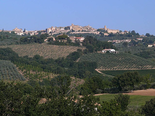

Montefalco
- Italian comune
Hiking in Montefalco
Montefalco, often referred to as the "Balcony of Umbria," is a beautiful hilltop town in central Italy known for its stunning panoramic views, rich history, and excellent wine, particularly the Sagrantino. Hiking in and around Montefalco offers a unique combination of natural beauty, cultural experiences, and culinary delights....
- Country:
- Postal Code: 06036
- Local Dialing Code: 0742
- Licence Plate Code: PG
- Coordinates: 42° 53' 27" N, 12° 38' 54" E
- GPS tracks (wikiloc): [Link]
- AboveSeaLevel: 473 м m
- Area: 69.51 sq km
- Population: 5577
- Web site: [Link]


Sellano
- Italian comune
Hiking in Sellano
Sellano, a picturesque village located in the heart of the Umbria region of Italy, offers a variety of hiking opportunities set against a backdrop of stunning landscapes, rolling hills, and rich cultural heritage. Here are some highlights of hiking in Sellano:...
- Country:
- Postal Code: 06030
- Local Dialing Code: 0743
- Licence Plate Code: PG
- Coordinates: 42° 53' 14" N, 12° 55' 23" E
- GPS tracks (wikiloc): [Link]
- AboveSeaLevel: 640 м m
- Area: 85.85 sq km
- Population: 1048
- Web site: [Link]


Spoleto
- Italian comune
Hiking in Spoleto
Spoleto, located in the heart of Umbria, Italy, is a fantastic destination for hikers, offering a blend of stunning landscapes, historical significance, and a variety of trails catering to different skill levels. Here’s an overview of what you can expect when hiking in this enchanting region:...
- Country:
- Postal Code: 06049
- Local Dialing Code: 0743
- Licence Plate Code: PG
- Coordinates: 42° 44' 0" N, 12° 44' 0" E
- GPS tracks (wikiloc): [Link]
- AboveSeaLevel: 396 м m
- Area: 348.14 sq km
- Population: 38035
- Web site: [Link]