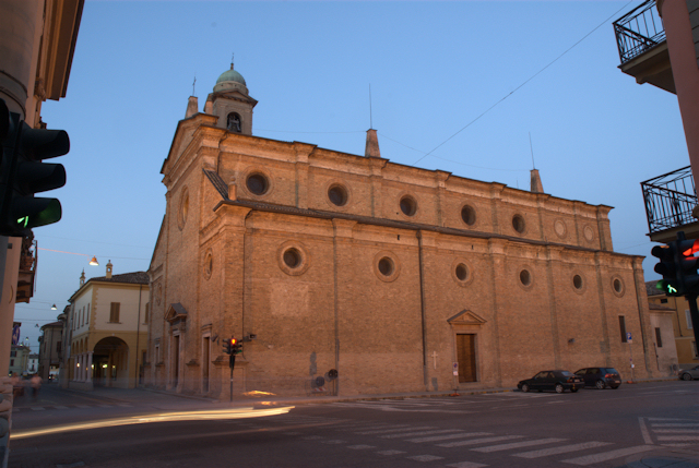
Trigolo (Trigolo)
.svg)
- comune of Italy
 Hiking in Trigolo
Trigolo is a small town located in the Lombardy region of Italy, and while it may not be widely known as a hiking destination, the region around it offers beautiful landscapes and trails for outdoor enthusiasts. Here are some aspects to consider if you're interested in hiking in and around Trigolo:
Nearby Natural Areas
-
Parco Regionale Oglio Nord: This regional park is not far from Trigolo and features several hiking trails along the Oglio River. It's a great place to explore natural landscapes, including wetlands, forests, and rich wildlife.
-
Monte Isola: Located a bit further away, this is the largest lake island in Italy and offers stunning views and hiking opportunities. The paths around the island provide panoramic vistas of Lake Iseo and the surrounding mountains.
-
Pre-Alps and the Italian Alps: If you venture a bit further, the Pre-Alps and the Italian Alps offer more challenging hiking routes. You'll find trails suitable for all levels, from leisurely walks to strenuous hikes.
Tips for Hiking in Trigolo
-
Check Local Maps: Local tourist offices or online resources can provide maps of hiking trails and specific recommendations based on your skill level and interests.
-
Plan for the Weather: The weather can change quickly in these areas, so be prepared with proper gear and check forecasts before heading out.
-
Respect Nature: Maintain the local flora and fauna by sticking to marked trails and practicing Leave No Trace principles.
-
Know Your Limits: Start with easier trails if you're new to hiking, gradually increasing the difficulty as you build experience and confidence.
Additional Considerations
-
Local Culture and Cuisine: While hiking, you might want to experience the local culture. Lombardy is known for its delicious cuisine, so consider stopping in local towns for meals or snacks after your hikes.
-
Safety: Always inform someone about your hiking plans, carry adequate water and snacks, and have a first aid kit on hand.
While Trigolo itself may not have extensive hiking options within its immediate vicinity, the surrounding areas are rich in natural beauty and offer plenty of opportunities for hiking enthusiasts!
- Country:

- Postal Code: 26018
- Local Dialing Code: 0374
- Licence Plate Code: CR
- Coordinates: 45° 19' 39" N, 9° 49' 2" E


- GPS tracks (wikiloc): [Link]
- AboveSeaLevel: 70 м m
- Area: 16.06 sq km
- Population: 1731
- Web site: http://www.comune.trigolo.cr.it/
- Wikipedia en: wiki(en)
- Wikipedia: wiki(it)
- Wikidata storage: Wikidata: Q42849
- Wikipedia Commons Category: [Link]
- Freebase ID: [/m/0gj_cd]
- GeoNames ID: Alt: [6541594]
- VIAF ID: Alt: [237520021]
- OSM relation ID: [44720]
- UN/LOCODE: [ITTGI]
- ISTAT ID: 019110
- Italian cadastre code: L426
Shares border with regions:

Castelleone
- Italian comune
Hiking in Castelleone
Castelleone is a charming town located in the Lombardy region of Italy, and while it may not be the most well-known hiking destination, it offers access to some lovely spots worth exploring....
- Country:
- Postal Code: 26012
- Local Dialing Code: 0374
- Licence Plate Code: CR
- Coordinates: 45° 17' 45" N, 9° 45' 39" E
- GPS tracks (wikiloc): [Link]
- AboveSeaLevel: 66 м m
- Area: 45.08 sq km
- Population: 9374
- Web site: [Link]


Cumignano sul Naviglio
- Italian comune
Hiking in Cumignano sul Naviglio
Cumignano sul Naviglio is a small town located in the Lombardy region of Italy, near the Naviglio River. While it may not be as famous for hiking as some other Italian destinations, it offers a peaceful environment with charming landscapes that can still provide a pleasant experience for nature lovers and hikers....
- Country:
- Postal Code: 26020
- Local Dialing Code: 0374
- Licence Plate Code: CR
- Coordinates: 45° 21' 0" N, 9° 50' 0" E
- GPS tracks (wikiloc): [Link]
- AboveSeaLevel: 73 м m
- Area: 6.77 sq km
- Population: 448
- Web site: [Link]
Salvirola
- Italian comune
Hiking in Salvirola
Salvirola, though a small town in the Lombardy region of northern Italy, offers a picturesque backdrop for hiking enthusiasts. Surrounded by the beautiful landscapes of the Po Valley, it provides access to various trails that highlight the natural beauty and cultural sights of the area....
- Country:
- Postal Code: 26010
- Local Dialing Code: 0373
- Licence Plate Code: CR
- Coordinates: 45° 21' 0" N, 9° 47' 0" E
- GPS tracks (wikiloc): [Link]
- AboveSeaLevel: 74 м m
- Area: 7.36 sq km
- Population: 1163
- Web site: [Link]


Fiesco
- Italian comune
Hiking in Fiesco
Fiesco, located in the Lombardy region of Italy, is a charming area that offers a variety of outdoor activities, including hiking. While Fiesco itself may not be as well-known for hiking compared to nearby regions with more popular trails, it can serve as a good starting point for exploring the surrounding landscapes....
- Country:
- Postal Code: 26010
- Local Dialing Code: 0374
- Licence Plate Code: CR
- Coordinates: 45° 20' 0" N, 9° 47' 0" E
- GPS tracks (wikiloc): [Link]
- AboveSeaLevel: 69 м m
- Area: 8.19 sq km
- Population: 1202
- Web site: [Link]


Soresina
- Italian comune
Hiking in Soresina
Soresina, located in the Lombardy region of Italy, is primarily known for its agricultural landscape and historical significance rather than traditional hiking trails. However, there are several options for enjoying the outdoors and exploring the surrounding areas....
- Country:
- Postal Code: 26015
- Local Dialing Code: 0374
- Licence Plate Code: CR
- Coordinates: 45° 17' 17" N, 9° 51' 31" E
- GPS tracks (wikiloc): [Link]
- AboveSeaLevel: 45 м m
- Area: 28.57 sq km
- Population: 8948
- Web site: [Link]