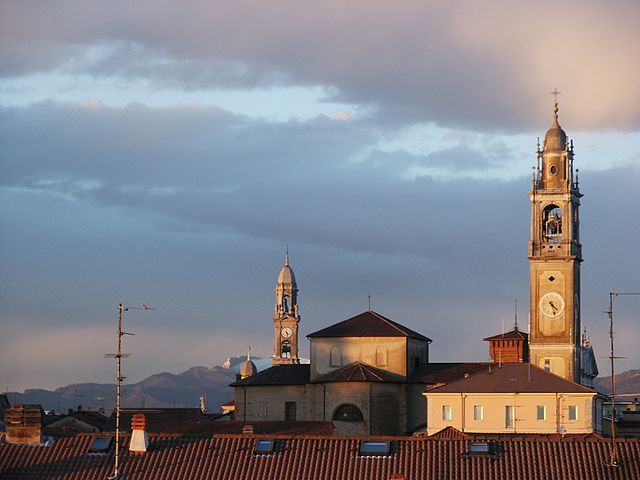
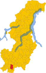
Turate (Turate)
.svg)
- Italian comune
 Hiking in Turate
Turate, located in the Lombardy region of Italy, is primarily known as a residential town rather than a hiking destination. However, its location provides access to various hiking opportunities in the surrounding areas.
-
Surrounding Nature Reserves: Explore nearby natural parks such as the Parco delle Groane or the Parco Regionale della Valle del Lambro, both of which offer marked trails suitable for hiking and enjoying nature.
-
Lake Como: A short drive from Turate, Lake Como boasts stunning trails with views of the lake and surrounding mountains. Popular hiking routes include the Sentiero del Viandante, which runs along the lake’s eastern shore.
-
The Prealps: If you're willing to travel further, the Italian Pre-Alps offer numerous hiking areas suited for all levels. Trails here often feature beautiful scenery, charming villages, and historic sites.
-
Local Trails: Within Turate and immediate vicinity, there might be local paths or smaller nature walks that can be explored. It's advisable to check local maps or inquire at visitor centers for guidance on these trails.
When planning your hiking trip, ensure you're prepared with proper gear, plenty of water, and maps or a GPS device. Always check the weather conditions before heading out, and follow local regulations and guidelines while hiking.
- Country:

- Postal Code: 22078
- Local Dialing Code: 02
- Licence Plate Code: CO
- Coordinates: 45° 39' 30" N, 9° 0' 0" E


- GPS tracks (wikiloc): [Link]
- AboveSeaLevel: 240 м m
- Area: 10.28 sq km
- Population: 9506
- Web site: http://www.comune.turate.co.it
- Wikipedia en: wiki(en)
- Wikipedia: wiki(it)
- Wikidata storage: Wikidata: Q47390
- Wikipedia Commons Category: [Link]
- Freebase ID: [/m/0gj219]
- GeoNames ID: Alt: [6543730]
- VIAF ID: Alt: [242774940]
- OSM relation ID: [45623]
- UN/LOCODE: [ITTRA]
- ISTAT ID: 013227
- Italian cadastre code: L470
Shares border with regions:
Cirimido
- Italian comune
Hiking in Cirimido
Cirimido is a small town in the Lombardy region of Italy, situated near the northern portion of the Po Valley and close to the beautiful landscapes of the surrounding areas. Although not widely recognized as a major hiking destination, the region offers several opportunities for outdoor activities, including hiking....
- Country:
- Postal Code: 22070
- Local Dialing Code: 031
- Licence Plate Code: CO
- Coordinates: 45° 42' 0" N, 9° 1' 0" E
- GPS tracks (wikiloc): [Link]
- AboveSeaLevel: 290 м m
- Area: 2.63 sq km
- Population: 2129
- Web site: [Link]


Gerenzano
- Italian comune
Hiking in Gerenzano
Gerenzano is a small town located in the Lombardy region of Italy, near Como and Milan. While it may not be widely known as a primary hiking destination, there are opportunities for outdoor enthusiasts in and around the area....
- Country:
- Postal Code: 21040
- Local Dialing Code: 02
- Licence Plate Code: VA
- Coordinates: 45° 38' 26" N, 9° 0' 7" E
- GPS tracks (wikiloc): [Link]
- AboveSeaLevel: 226 м m
- Area: 9.79 sq km
- Population: 10914
- Web site: [Link]


Cislago
- Italian comune
Hiking in Cislago
Cislago, located in the Lombardy region of Italy, is not only known for its charming atmosphere but also offers some lovely opportunities for hiking and outdoor activities. While Cislago itself is a small town, its proximity to natural areas and trails makes it a great starting point for hiking enthusiasts....
- Country:
- Postal Code: 21040
- Local Dialing Code: 02
- Licence Plate Code: VA
- Coordinates: 45° 39' 0" N, 8° 58' 0" E
- GPS tracks (wikiloc): [Link]
- AboveSeaLevel: 237 м m
- Area: 11.13 sq km
- Population: 10394
- Web site: [Link]
Rovello Porro
- Italian comune
Hiking in Rovello Porro
Rovello Porro, located in the Lombardy region of Italy, is a charming town that offers a variety of outdoor activities, including hiking. While it may not be as widely recognized for hiking as some other locations in Italy, there are still great opportunities to explore the natural beauty of the surrounding area....
- Country:
- Postal Code: 22070
- Local Dialing Code: 02
- Licence Plate Code: CO
- Coordinates: 45° 39' 0" N, 9° 2' 0" E
- GPS tracks (wikiloc): [Link]
- AboveSeaLevel: 240 м m
- Area: 5.53 sq km
- Population: 6122
- Web site: [Link]
Limido Comasco
- Italian comune
Hiking in Limido Comasco
Limido Comasco is a charming town located in the Como province of Italy, nestled in the beautiful region of Lombardy. While it might not be as famous as some other hiking destinations in Italy, it offers several wonderful opportunities for outdoor activities, particularly hiking, thanks to its proximity to the scenic landscape of the Prealps and nearby Lake Como....
- Country:
- Postal Code: 22070
- Local Dialing Code: 031
- Licence Plate Code: CO
- Coordinates: 45° 41' 0" N, 8° 59' 0" E
- GPS tracks (wikiloc): [Link]
- AboveSeaLevel: 276 м m
- Area: 4.56 sq km
- Population: 3828
- Web site: [Link]
Fenegrò
- Italian comune
Hiking in Fenegrò
Fenegrò, located in the province of Como in the Lombardy region of Italy, offers a variety of hiking opportunities for outdoor enthusiasts. The area is characterized by its lush greenery, rolling hills, and proximity to both the natural beauty of the surrounding landscape and cultural attractions....
- Country:
- Postal Code: 22070
- Local Dialing Code: 031
- Licence Plate Code: CO
- Coordinates: 45° 42' 0" N, 9° 0' 0" E
- GPS tracks (wikiloc): [Link]
- AboveSeaLevel: 290 м m
- Area: 5.36 sq km
- Population: 3236
- Web site: [Link]
Lomazzo
- Italian comune
Hiking in Lomazzo
Lomazzo, a charming town located in the Lombardy region of Italy, offers a variety of hiking opportunities, particularly due to its proximity to the beautiful natural landscapes of the surrounding area, including the nearby Alps and the foothills of the Prealps....
- Country:
- Postal Code: 22074
- Local Dialing Code: 02
- Licence Plate Code: CO
- Coordinates: 45° 42' 0" N, 9° 2' 0" E
- GPS tracks (wikiloc): [Link]
- AboveSeaLevel: 296 м m
- Area: 9.48 sq km
- Population: 9929
- Web site: [Link]