Ubraye (Ubraye)
- commune in Alpes-de-Haute-Provence, France
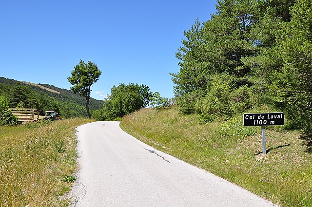
 Hiking in Ubraye
Ubraye is a charming village located in the Alpes-de-Haute-Provence region of France, known for its stunning landscapes, rugged terrain, and beautiful trails. It offers a variety of hiking opportunities suitable for different skill levels and interests. Here’s an overview of what to expect when hiking in Ubraye:
Trails and Scenery
-
Variety of Trails: Ubraye has several marked hiking trails that cater to both beginners and more experienced hikers. Some paths lead through lush forests, while others offer panoramic views of the surrounding mountains and valleys.
-
Natural Beauty: The region is characterized by its diverse flora and fauna, with vibrant wildflowers in the spring and breathtaking views of the Verdon Gorge and surrounding peaks. The natural scenery is an excellent backdrop for photography and nature walks.
-
Cultural Heritage: Many trails in and around Ubraye also lead to historical sites, such as ancient villages, chapels, and ruins. These cultural elements can enrich your hiking experience, providing insight into the region's history.
Hiking Recommendations
- Preparation: Ensure you have good hiking boots, appropriate clothing for the weather, and carry enough water and snacks, as some trails may be remote.
- Trail Maps: It’s beneficial to have a detailed map or GPS for navigation, as some trails might not be well-marked.
- Local Guides: Consider hiring a local guide if you want to learn more about the area’s ecology and history. Guides can offer valuable insights and ensure a safe hike.
Weather and Best Time to Hike
- Season: The best time for hiking in Ubraye is typically from late spring through early fall (May to September), when the weather is mild and the trails are more accessible. Summer can be hot, so early morning hikes are preferable to avoid the heat.
- Weather: Always check the weather forecast before heading out, as conditions can change rapidly in mountain regions.
Safety
- Hiking Alone: If you’re hiking alone, inform someone of your plans and expected return time.
- Emergency Preparedness: Carry a basic first aid kit, and know how to use it in case of minor injuries or accidents.
Overall, hiking in Ubraye can be a rewarding experience, offering tranquility, natural beauty, and a chance to connect with nature. Whether you're looking for a leisurely stroll or a challenging trek, Ubraye has something to offer every outdoor enthusiast.
- Country:

- Postal Code: 04240
- Coordinates: 43° 54' 31" N, 6° 41' 49" E


- GPS tracks (wikiloc): [Link]
- Area: 35.65 sq km
- Population: 88
- Wikipedia en: wiki(en)
- Wikipedia: wiki(fr)
- Wikidata storage: Wikidata: Q1016832
- Wikipedia Commons Category: [Link]
- Freebase ID: [/m/03m7xt6]
- Freebase ID: [/m/03m7xt6]
- GeoNames ID: Alt: [2971416]
- GeoNames ID: Alt: [2971416]
- SIREN number: [210402244]
- SIREN number: [210402244]
- VIAF ID: Alt: [244316882]
- VIAF ID: Alt: [244316882]
- INSEE municipality code: 04224
- INSEE municipality code: 04224
Shares border with regions:

Soleilhas
- commune in Alpes-de-Haute-Provence, France
Hiking in Soleilhas
Soleilhas is a charming village located in the Alpes-Maritimes region of France, nestled in the heart of the Pre-Alps. It's a great starting point for hiking enthusiasts, offering a variety of trails with stunning views, diverse landscapes, and opportunities to connect with nature....
- Country:
- Postal Code: 04120
- Coordinates: 43° 51' 26" N, 6° 38' 57" E
- GPS tracks (wikiloc): [Link]
- Area: 34.53 sq km
- Population: 120

Saint-Benoît
- commune in Alpes-de-Haute-Provence, France
Hiking in Saint-Benoît
Saint-Benoît, located in the Alpes-de-Haute-Provence region of southeastern France, offers an array of hiking opportunities amidst stunning natural scenery. The area is characterized by its picturesque landscapes, which include mountains, valleys, and rivers....
- Country:
- Postal Code: 04240
- Coordinates: 43° 58' 2" N, 6° 43' 32" E
- GPS tracks (wikiloc): [Link]
- Area: 21.03 sq km
- Population: 145
Val-de-Chalvagne
- commune in Alpes-de-Haute-Provence, France
Hiking in Val-de-Chalvagne
Val-de-Chalvagne, located in the Alpes-de-Haute-Provence region of France, offers a variety of beautiful hiking opportunities. The area is characterized by stunning natural landscapes, including scenic valleys, mountains, and rivers, making it a great destination for outdoor enthusiasts....
- Country:
- Postal Code: 04320
- Coordinates: 43° 54' 51" N, 6° 48' 28" E
- GPS tracks (wikiloc): [Link]
- AboveSeaLevel: 900 м m
- Area: 32.57 sq km
- Population: 88
- Web site: [Link]

Annot
- commune in Alpes-de-Haute-Provence, France
Hiking in Annot
Annot is a beautiful village located in the Alpes-de-Haute-Provence region of France, known for its stunning natural landscapes and fascinating geological formations. This area offers a variety of hiking opportunities that cater to different skill levels, making it an excellent destination for both beginners and experienced hikers. Here are some key points about hiking in and around Annot:...
- Country:
- Postal Code: 04240
- Coordinates: 43° 57' 55" N, 6° 40' 7" E
- GPS tracks (wikiloc): [Link]
- Area: 29.8 sq km
- Population: 1049

Entrevaux
- commune in Alpes-de-Haute-Provence, France
Hiking in Entrevaux
Entrevaux, a picturesque medieval village situated in the Alpes-de-Haute-Provence region of France, offers a unique hiking experience characterized by stunning landscapes, rich history, and well-marked trails. Here are some details about hiking in and around Entrevaux:...
- Country:
- Postal Code: 04320
- Coordinates: 43° 56' 55" N, 6° 48' 37" E
- GPS tracks (wikiloc): [Link]
- Area: 60.37 sq km
- Population: 877
- Web site: [Link]

Vergons
- commune in Alpes-de-Haute-Provence, France
Hiking in Vergons
Vergons is a charming village located in the Alpes-de-Haute-Provence region of France, offering stunning natural beauty and a variety of hiking opportunities. Here are some key points about hiking in and around Vergons:...
- Country:
- Postal Code: 04170
- Coordinates: 43° 54' 51" N, 6° 35' 14" E
- GPS tracks (wikiloc): [Link]
- Area: 45.73 sq km
- Population: 114


Briançonnet
- commune in Alpes-Maritimes, France
Hiking in Briançonnet
Briançonnet is a picturesque village located in the Alpes-Maritimes region of France, known for its stunning natural scenery and diverse hiking opportunities. Nestled in the foothills of the Alps, Briançonnet offers a range of trails that cater to different skill levels, making it an excellent destination for both beginner and experienced hikers....
- Country:
- Postal Code: 06850
- Coordinates: 43° 51' 55" N, 6° 45' 28" E
- GPS tracks (wikiloc): [Link]
- Area: 24.32 sq km
- Population: 226