Uhlwiller (Uhlwiller)

- commune in Bas-Rhin, France
- Country:

- Postal Code: 67350
- Coordinates: 48° 49' 14" N, 7° 40' 23" E


- GPS tracks (wikiloc): [Link]
- Area: 7.46 sq km
- Population: 706
- Web site: http://www.uhlwiller.fr
- Wikipedia en: wiki(en)
- Wikipedia: wiki(fr)
- Wikidata storage: Wikidata: Q21632
- Wikipedia Commons Category: [Link]
- Freebase ID: [/m/03m9cjg]
- Freebase ID: [/m/03m9cjg]
- GeoNames ID: Alt: [6545400]
- GeoNames ID: Alt: [6545400]
- SIREN number: [216704973]
- SIREN number: [216704973]
- BnF ID: [15271639k]
- BnF ID: [15271639k]
- VIAF ID: Alt: [237518215]
- VIAF ID: Alt: [237518215]
- archINFORM location ID: [43839]
- archINFORM location ID: [43839]
- INSEE municipality code: 67497
- INSEE municipality code: 67497
Shares border with regions:


Dauendorf
- commune in Bas-Rhin, France
- Country:
- Postal Code: 67350
- Coordinates: 48° 49' 49" N, 7° 39' 19" E
- GPS tracks (wikiloc): [Link]
- Area: 7.63 sq km
- Population: 1448

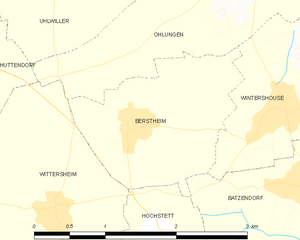
Berstheim
- commune in Bas-Rhin, France
- Country:
- Postal Code: 67170
- Coordinates: 48° 47' 32" N, 7° 40' 33" E
- GPS tracks (wikiloc): [Link]
- Area: 3.09 sq km
- Population: 431
- Web site: [Link]

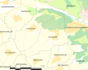
Ohlungen
- commune in Bas-Rhin, France
- Country:
- Postal Code: 67590
- Coordinates: 48° 48' 41" N, 7° 42' 3" E
- GPS tracks (wikiloc): [Link]
- Area: 8.39 sq km
- Population: 1306


Schweighouse-sur-Moder
- commune in Bas-Rhin, France
- Country:
- Postal Code: 67590
- Coordinates: 48° 49' 9" N, 7° 43' 41" E
- GPS tracks (wikiloc): [Link]
- AboveSeaLevel: 158 м m
- Area: 9.91 sq km
- Population: 4891
- Web site: [Link]


Huttendorf
- commune in Bas-Rhin, France
- Country:
- Postal Code: 67270
- Coordinates: 48° 48' 3" N, 7° 38' 24" E
- GPS tracks (wikiloc): [Link]
- Area: 4.4 sq km
- Population: 506