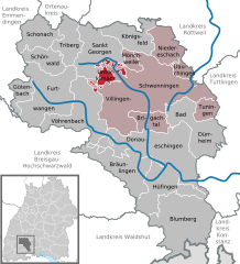
Unterkirnach (Unterkirnach)
- municipality in Germany
Unterkirnach is a picturesque village located in the Black Forest region of Germany. It's an excellent destination for hikers due to its stunning natural landscapes and well-marked trails that cater to various skill levels. Here are some key highlights and tips for hiking in and around Unterkirnach:
Scenic Trails
- Saulgrub Trail: A popular hiking trail that offers beautiful views of the surrounding forests and valleys. It can be a moderate hike suitable for families.
- Schwarzwald Trail: This historical trail connects several villages in the Black Forest and allows hikers to enjoy the unique flora and fauna of the area.
- Kirnach Valley Trail: A tranquil path that follows the Kirnach River, providing opportunities to see waterfalls and serene woodland.
Difficulty Levels
- Easy Trails: Suitable for beginners or families with children, often featuring gentle slopes and accessible paths.
- Moderate Trails: For those with some hiking experience, featuring more challenging terrain and elevation changes.
- Difficult Trails: For seasoned hikers looking for a rigorous experience and scenic viewpoints.
Essential Tips
- Weather: Check the local weather before you head out, as conditions can change quickly in the mountains.
- Gear Up: Wear appropriate hiking shoes, and carry essentials like water, snacks, a first aid kit, and a map or GPS.
- Stay on Marked Trails: To protect the local ecosystem and avoid getting lost, it's best to stick to marked paths.
Nature and Wildlife
The area around Unterkirnach offers a rich diversity of wildlife, including deer, various bird species, and unique plants typical of the Black Forest region. Keep your eyes peeled for these natural wonders as you hike.
Local Attractions
Make sure to explore the local culture and cuisine after your hikes. Traditional Black Forest dishes and regional specialties can be found in nearby restaurants.
Getting There
Unterkirnach is accessible by car and public transport, making it easy to reach for a day hike or a longer stay.
Overall, hiking in Unterkirnach offers the opportunity to immerse yourself in the natural beauty of the Black Forest while enjoying the tranquility of this charming village.
- Country:

- Postal Code: 78089
- Local Dialing Code: 07721
- Licence Plate Code: VS
- Coordinates: 48° 4' 44" N, 8° 21' 53" E


- GPS tracks (wikiloc): [Link]
- AboveSeaLevel: 815 м m
- Area: 13.17 sq km
- Population: 2583
- Web site: https://www.unterkirnach.de/
- Wikipedia en: wiki(en)
- Wikipedia: wiki(de)
- Wikidata storage: Wikidata: Q81419
- Wikipedia Commons Category: [Link]
- Freebase ID: [/m/02p_x6j]
- GeoNames ID: Alt: [2819248]
- VIAF ID: Alt: [123221312]
- OSM relation ID: [1242305]
- GND ID: Alt: [4061930-8]
- Library of Congress authority ID: Alt: [n85152583]
- Historical Gazetteer (GOV) ID: [UNTACHJN48EC]
- German municipality key: 08326065

