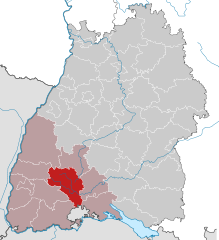
Schwarzwald-Baar (Schwarzwald-Baar-Kreis)
- district of Baden-Württemberg, Germany
The Schwarzwald-Baar-Kreis in Baden-Württemberg, Germany, offers a diverse range of hiking opportunities, with its stunning landscapes characterized by dense forests, rolling hills, and picturesque villages. Here are some highlights and tips for hiking in the Schwarzwald-Baar-Kreis:
Key Features
-
Natural Beauty: The region boasts the scenic beauty of the Black Forest (Schwarzwald) and the Baar plateau. Hikers can expect lush forests, meandering streams, and panoramic views.
-
Variety of Trails: There are numerous well-marked trails catering to different skill levels. From gentle walks suitable for families to more challenging hikes for experienced adventurers, there’s something for everyone.
-
Landmarks and Cultural Sites: Along many hiking routes, you'll encounter charming villages such as Donaueschingen, known for its source of the Danube River, and historical sites like the Triberg Waterfalls, which are the highest waterfalls in Germany.
-
Wildlife and Flora: The region is home to a rich diversity of flora and fauna. Keep an eye out for local wildlife, including deer and various bird species, as well as abundant wildflower patches in spring and summer.
-
Signposted Trails: The area has a network of signposted trails, including long-distance paths like the Westweg, which runs through the Black Forest. Local hiking associations maintain these paths, ensuring they are in good condition.
Popular Hiking Routes
- Schwarzwaldhochstraße: This high road offers breathtaking views and several access points to shorter hiking trails.
- Baar River Trail: A more leisurely option that follows the river and allows for easy exploration of the surrounding nature.
- Hiking to the Feldberg: For those seeking a challenge, the Feldberg is the highest mountain in the Black Forest and offers stunning vistas from the summit.
Tips for Hiking in Schwarzwald-Baar-Kreis
- Check the Weather: Weather in the Black Forest can change quickly, so be sure to check forecasts before heading out.
- Appropriate Gear: Wear sturdy hiking boots and dress in layers. Being prepared for both sunny and cooler conditions is essential.
- Stay Hydrated: Always bring enough water, as some trails may not have reliable water sources.
- Local Maps: While trails are well-marked, having a local map or a hiking app can enhance your experience and help you navigate.
- Respect Nature: Follow the Leave No Trace principles to protect the natural beauty of the area. Stick to marked trails, take all trash with you, and avoid disturbing wildlife.
Conclusion
Hiking in Schwarzwald-Baar-Kreis can be a rewarding and memorable experience for outdoor enthusiasts. Whether you're looking for a peaceful nature walk or an adventurous hike through breathtaking landscapes, the region has plenty to offer. Enjoy your time exploring this beautiful part of Germany!
- Country:

- Capital: Villingen-Schwenningen
- Licence Plate Code: VS
- Coordinates: 48° 1' 0" N, 8° 26' 0" E


- GPS tracks (wikiloc): [Link]
- AboveSeaLevel: 749 м m
- Area: 1025.24 sq km
- Web site: http://www.schwarzwald-baar-kreis.de/
- Wikipedia en: wiki(en)
- Wikipedia: wiki(de)
- Wikidata storage: Wikidata: Q8203
- Wikipedia Commons Category: [Link]
- Freebase ID: [/m/01l203]
- GeoNames ID: Alt: [2834685]
- VIAF ID: Alt: [153670860]
- OSM relation ID: [62690]
- GND ID: Alt: [4053809-6]
- archINFORM location ID: [2606]
- Library of Congress authority ID: Alt: [n85149028]
- TGN ID: [7093908]
- NUTS code: [DE136]
- German district key: 08326
Includes regions:


Villingen-Schwenningen
- city in Baden-Württemberg, Germany
 Hiking in Villingen-Schwenningen
Villingen-Schwenningen, located in the Black Forest region of Germany, offers a variety of beautiful hiking trails that cater to different skill levels. The area is known for its picturesque landscapes, dense forests, rolling hills, and charming villages....
- Country:

- Postal Code: 78048–78056
- Local Dialing Code: 07721; 07720; 07705; 07425
- Licence Plate Code: VS
- Coordinates: 48° 3' 37" N, 8° 27' 31" E


- GPS tracks (wikiloc): [Link]
- AboveSeaLevel: 704 м m
- Area: 165.48 sq km
- Population: 81916
- Web site: [Link]

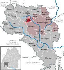
Unterkirnach
- municipality in Germany
Unterkirnach is a picturesque village located in the Black Forest region of Germany. It's an excellent destination for hikers due to its stunning natural landscapes and well-marked trails that cater to various skill levels. Here are some key highlights and tips for hiking in and around Unterkirnach:...
- Country:

- Postal Code: 78089
- Local Dialing Code: 07721
- Licence Plate Code: VS
- Coordinates: 48° 4' 44" N, 8° 21' 53" E


- GPS tracks (wikiloc): [Link]
- AboveSeaLevel: 815 м m
- Area: 13.17 sq km
- Population: 2583
- Web site: [Link]

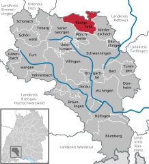
Königsfeld im Schwarzwald
- municipality in Germany
 Hiking in Königsfeld im Schwarzwald
Königsfeld im Schwarzwald, located in the Black Forest region of Germany, offers a wonderful setting for hiking enthusiasts. This picturesque village is surrounded by lush forests, rolling hills, and scenic landscapes, making it an ideal spot for outdoor activities....
- Country:

- Postal Code: 78126
- Local Dialing Code: 07725
- Licence Plate Code: VS
- Coordinates: 48° 8' 17" N, 8° 25' 11" E


- GPS tracks (wikiloc): [Link]
- AboveSeaLevel: 769 м m
- Area: 40.24 sq km
- Population: 6017
- Web site: [Link]


Gütenbach
- village in the Black Forest in Germany
Gütenbach is a charming village located in the Black Forest region of Germany, known for its beautiful landscapes, lush forests, and serene hiking trails. The area offers a variety of hiking opportunities suitable for different skill levels, making it a great destination for nature enthusiasts and outdoorsy types....
- Country:

- Postal Code: 78148
- Local Dialing Code: 07723
- Licence Plate Code: VS
- Coordinates: 48° 2' 41" N, 8° 8' 21" E


- GPS tracks (wikiloc): [Link]
- AboveSeaLevel: 826 м m
- Area: 18.49 sq km
- Population: 1167
- Web site: [Link]

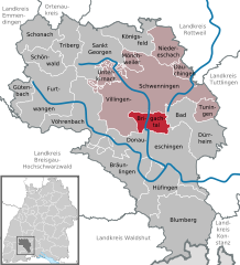
Brigachtal
- municipality in Germany
Brigachtal, a picturesque municipality in the Black Forest region of Germany, offers a wonderful hiking experience with its stunning landscapes and diverse trails. Nestled between the rolling hills and dense forests, Brigachtal provides a perfect backdrop for both novice and experienced hikers....
- Country:

- Postal Code: 78086
- Local Dialing Code: 07721
- Licence Plate Code: VS
- Coordinates: 48° 0' 23" N, 8° 28' 6" E


- GPS tracks (wikiloc): [Link]
- AboveSeaLevel: 685 м m
- Area: 22.80 sq km
- Population: 5083
- Web site: [Link]

Dauchingen
- municipality in Germany
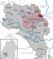
Dauchingen is a charming municipality in the Schwarzwald-Baar-Kreis in Baden-Württemberg, Germany. It is surrounded by beautiful landscapes that are ideal for hiking enthusiasts. Here are some highlights you can expect when hiking in and around Dauchingen:...
- Country:

- Postal Code: 78083
- Local Dialing Code: 07720
- Licence Plate Code: VS
- Coordinates: 48° 5' 25" N, 8° 33' 7" E


- GPS tracks (wikiloc): [Link]
- AboveSeaLevel: 732 м m
- Area: 10.04 sq km
- Population: 3702
- Web site: [Link]
Niedereschach
- municipality in Germany
Niedereschach is a picturesque town located in the Baden-Württemberg region of Germany, nestled within the scenic Black Forest. The town provides access to a variety of hiking trails that cater to different skill levels, making it an excellent destination for outdoor enthusiasts....
- Country:

- Postal Code: 78078
- Local Dialing Code: 07728
- Licence Plate Code: VS
- Coordinates: 48° 8' 0" N, 8° 32' 0" E


- GPS tracks (wikiloc): [Link]
- AboveSeaLevel: 659 м m
- Area: 33.07 sq km
- Population: 5852
- Web site: [Link]


Bräunlingen
- municipality in Germany
Bräunlingen, located in the Black Forest region of Germany, offers a variety of hiking opportunities that cater to different skill levels. The area is known for its stunning landscapes, dense forests, and picturesque views. Here are some highlights and tips for hiking in and around Bräunlingen:...
- Country:

- Postal Code: 78199
- Local Dialing Code: 07705; 07707; 0771
- Licence Plate Code: VS
- Coordinates: 47° 55' 47" N, 8° 26' 53" E


- GPS tracks (wikiloc): [Link]
- AboveSeaLevel: 693 м m
- Area: 62.10 sq km
- Population: 5783
- Web site: [Link]

Schonach im Schwarzwald
- municipality in Germany
 Hiking in Schonach im Schwarzwald
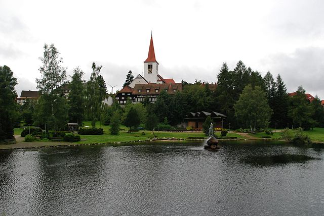
Schonach im Schwarzwald, located in the Black Forest region of Germany, is a beautiful destination for hiking enthusiasts. Nestled among dense forests, rolling hills, and charming valleys, it offers a variety of trails that cater to different skill levels and ages. Here are some highlights to consider when hiking in Schonach:...
- Country:

- Postal Code: 78136
- Local Dialing Code: 07722
- Licence Plate Code: VS
- Coordinates: 48° 8' 34" N, 8° 12' 9" E


- GPS tracks (wikiloc): [Link]
- AboveSeaLevel: 881 м m
- Area: 36.71 sq km
- Population: 3997
- Web site: [Link]

Blumberg
- municipality in Baden-Württemberg state, Germany
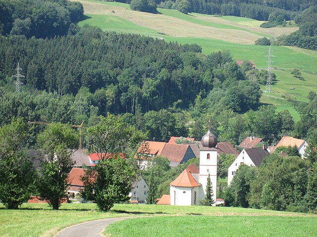
Blumberg, located in the southern part of Germany, is surrounded by beautiful landscapes that offer numerous hiking opportunities. The region is characterized by its forests, rolling hills, and scenic views, making it a great destination for both novice and experienced hikers....
- Country:

- Postal Code: 78176
- Local Dialing Code: 07736; 07702
- Licence Plate Code: VS
- Coordinates: 47° 50' 21" N, 8° 32' 3" E


- GPS tracks (wikiloc): [Link]
- AboveSeaLevel: 704 м m
- Area: 98.69 sq km
- Population: 9975
- Web site: [Link]

Furtwangen im Schwarzwald
- municipality in Baden-Württemberg, Germany
 Hiking in Furtwangen im Schwarzwald
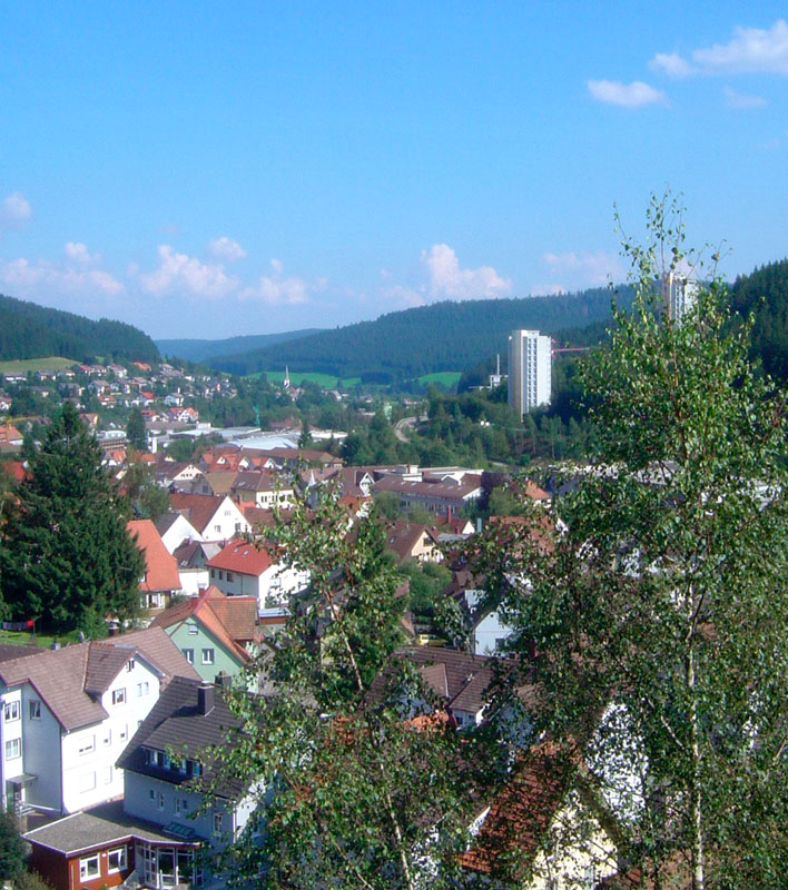
Furtwangen im Schwarzwald is a picturesque town nestled in the Black Forest (Schwarzwald) region of Germany, known for its stunning natural landscapes, dense forests, and vibrant cultural history. Hiking in this area offers a variety of trails for all skill levels, providing opportunities to explore the beauty of the Black Forest....
- Country:

- Postal Code: 78120
- Local Dialing Code: 07723
- Licence Plate Code: VS
- Coordinates: 48° 3' 1" N, 8° 12' 33" E


- GPS tracks (wikiloc): [Link]
- AboveSeaLevel: 857 м m
- Area: 82.57 sq km
- Population: 9157
- Web site: [Link]


Bad Dürrheim
- municipality in Germany
Bad Dürrheim is a charming spa town located in the southwestern part of Germany, in the Black Forest region. The area is known for its picturesque landscapes, therapeutic thermal springs, and beautiful hiking trails. Here are some highlights for hiking in and around Bad Dürrheim:...
- Country:

- Postal Code: 78073
- Local Dialing Code: 07726; 07706
- Licence Plate Code: VS
- Coordinates: 48° 1' 0" N, 8° 32' 0" E


- GPS tracks (wikiloc): [Link]
- AboveSeaLevel: 730 м m
- Area: 62.09 sq km
- Population: 12775
- Web site: [Link]

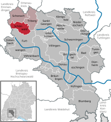
Schönwald im Schwarzwald
- municipality in Germany
 Hiking in Schönwald im Schwarzwald
Schönwald im Schwarzwald is a charming village located in the Black Forest (Schwarzwald) region of Germany. This area is known for its breathtaking natural beauty, dense forests, and picturesque landscapes, making it a fantastic destination for hiking enthusiasts....
- Country:

- Postal Code: 78141
- Local Dialing Code: 07722
- Licence Plate Code: VS
- Coordinates: 48° 6' 17" N, 8° 12' 10" E


- GPS tracks (wikiloc): [Link]
- AboveSeaLevel: 1000 м m
- Area: 27.81 sq km
- Population: 2415
- Web site: [Link]


St. Georgen im Schwarzwald
- municipality in Germany
 Hiking in St. Georgen im Schwarzwald
Sankt Georgen im Schwarzwald, located in the Black Forest region of Germany, is an excellent destination for hikers. The area is known for its stunning natural scenery, dense forests, and a network of well-marked trails that cater to various skill levels. Here are some highlights and tips for hiking in this beautiful location:...
- Country:

- Postal Code: 78112
- Local Dialing Code: 07725; 07724
- Licence Plate Code: VS
- Coordinates: 48° 7' 29" N, 8° 19' 51" E


- GPS tracks (wikiloc): [Link]
- AboveSeaLevel: 862 м m
- Area: 59.85 sq km
- Population: 13025
- Web site: [Link]


Donaueschingen
- municipality in Germany
Donaueschingen, located in southwestern Germany, is known for its scenic beauty and the significance of being at the source of the Danube River. The region offers a variety of hiking opportunities for outdoor enthusiasts, allowing hikers to explore lush landscapes, charming villages, and diverse ecosystems....
- Country:

- Postal Code: 78166
- Local Dialing Code: 0771
- Coordinates: 47° 57' 11" N, 8° 30' 12" E


- GPS tracks (wikiloc): [Link]
- AboveSeaLevel: 677 м m
- Area: 104.62 sq km
- Population: 21746
- Web site: [Link]

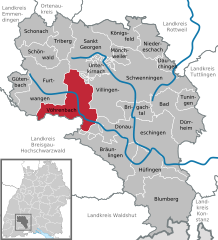
Vöhrenbach
- municipality in Germany
Vöhrenbach, located in the picturesque Black Forest region of Germany, offers a variety of hiking opportunities for both beginners and experienced hikers. Here are some key points about hiking in the area:...
- Country:

- Postal Code: 78147
- Local Dialing Code: 07727
- Licence Plate Code: VS
- Coordinates: 48° 2' 44" N, 8° 18' 15" E


- GPS tracks (wikiloc): [Link]
- AboveSeaLevel: 797 м m
- Area: 70.47 sq km
- Population: 3825
- Web site: [Link]

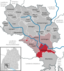
Hüfingen
- municipality in Germany
Hüfingen, located in the Baden-Württemberg region of Germany, offers a range of hiking opportunities that cater to various skill levels and preferences. Here are some aspects of hiking in this picturesque area:...
- Country:

- Postal Code: 78183
- Local Dialing Code: 0771
- Licence Plate Code: VS
- Coordinates: 47° 55' 34" N, 8° 29' 24" E


- GPS tracks (wikiloc): [Link]
- AboveSeaLevel: 684 м m
- Area: 58.53 sq km
- Population: 7595
- Web site: [Link]
Mönchweiler
- municipality in Germany
Mönchweiler is a small village located in the Baden-Württemberg region of Germany, near the Black Forest. While it is not as widely known as some larger hiking destinations, it offers beautiful natural surroundings and access to various trails suitable for hikers of all levels....
- Country:

- Postal Code: 78087
- Local Dialing Code: 07721
- Licence Plate Code: VS
- Coordinates: 48° 6' 0" N, 8° 26' 0" E


- GPS tracks (wikiloc): [Link]
- AboveSeaLevel: 757 м m
- Area: 9.60 sq km
- Population: 2979
- Web site: [Link]


Triberg im Schwarzwald
- municipality in Germany
 Hiking in Triberg im Schwarzwald
Triberg im Schwarzwald, located in the heart of the Black Forest (Schwarzwald) in Germany, is a fantastic destination for hiking enthusiasts. The region is renowned for its stunning natural beauty, dense forests, and picturesque waterfalls, notably the Triberg Waterfalls, which are among the highest in Germany....
- Country:

- Postal Code: 78098
- Local Dialing Code: 07722
- Licence Plate Code: VS
- Coordinates: 48° 7' 51" N, 8° 13' 54" E


- GPS tracks (wikiloc): [Link]
- AboveSeaLevel: 684 м m
- Area: 33.33 sq km
- Population: 4738
- Web site: [Link]
Tuningen
- municipality in Germany
Tuningen, a small municipality in Baden-Württemberg, Germany, is surrounded by beautiful landscapes that offer a great variety of hiking opportunities. The area is characterized by its lush forests, rolling hills, and picturesque views of the surrounding countryside, making it an excellent destination for both novice and experienced hikers....
- Country:

- Postal Code: 78609
- Local Dialing Code: 07464
- Licence Plate Code: VS
- Coordinates: 48° 2' 0" N, 8° 36' 0" E


- GPS tracks (wikiloc): [Link]
- AboveSeaLevel: 743 м m
- Area: 15.59 sq km
- Population: 2939
- Web site: [Link]
Shares border with regions:

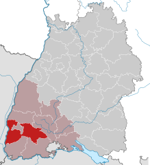
Breisgau-Hochschwarzwald
- district of Baden-Württemberg, Germany
 Hiking in Breisgau-Hochschwarzwald
Breisgau-Hochschwarzwald is a spectacular region in southwestern Germany, known for its diverse landscapes, lush forests, and scenic trails. It's located in the state of Baden-Württemberg and offers a myriad of hiking opportunities suitable for all skill levels. Here are some highlights about hiking in the area:...
- Country:

- Capital: Freiburg im Breisgau
- Licence Plate Code: FR
- Coordinates: 47° 57' 0" N, 7° 51' 0" E


- GPS tracks (wikiloc): [Link]
- AboveSeaLevel: 394 м m
- Area: 1378.30 sq km
- Population: 247711
- Web site: [Link]


Konstanz
- district in Baden-Württemberg, Germany
Hiking in the Konstanz district, located in the southern part of Germany near the borders with Switzerland and Austria, offers a blend of stunning natural beauty and cultural experiences. The area is characterized by the presence of Lake Constance (Bodensee), rolling hills, scenic vineyards, and picturesque towns. Here are some highlights and popular hiking options in the Konstanz district:...
- Country:

- Capital: Konstanz
- Licence Plate Code: KN
- Coordinates: 47° 49' 0" N, 8° 53' 0" E


- GPS tracks (wikiloc): [Link]
- AboveSeaLevel: 437 м m
- Area: 817.95 sq km
- Population: 270568
- Web site: [Link]


Tuttlingen
- district of Baden-Württemberg, Germany
Tuttlingen district, located in the southwestern part of Germany, is a beautiful region known for its diverse landscapes, including hills, forests, and rivers. This area is part of the Swabian Jura (Schwäbische Alb), making it an excellent destination for hiking enthusiasts....
- Country:

- Capital: Tuttlingen
- Licence Plate Code: TUT
- Coordinates: 48° 0' 0" N, 8° 48' 0" E


- GPS tracks (wikiloc): [Link]
- AboveSeaLevel: 831 м m
- Area: 734.40 sq km
- Population: 132476
- Web site: [Link]
