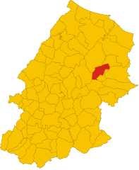
Ururi (Ururi)
.svg)
- Italian comune
 Hiking in Ururi
Ururi, although not widely known, is a charming location for outdoor enthusiasts and hikers seeking a mix of adventure and tranquility. Whether nestled in a natural park or surrounded by stunning landscapes, the region typically offers beautiful trails, scenic views, and the opportunity to engage with nature.
Here are some key aspects you might find when hiking in Ururi:
Trail Variety
- Easy Trails: Ideal for families or beginners, often featuring gentle slopes and well-marked paths.
- Intermediate Trails: Suitable for those with some hiking experience, these trails may include moderate elevation changes and varied terrain.
- Challenging Trails: Designed for seasoned hikers, with steep ascents, rough terrain, and potentially longer distances.
Scenic Views
Hiking in Ururi often means breathtaking vistas, whether it's verdant valleys, rolling hills, or stunning sunsets. Bring your camera to capture these moments!
Flora and Fauna
You may encounter diverse plant life, local wildlife, and possibly some unique species endemic to the region. It's a great opportunity for nature lovers and photographers.
Safety Considerations
- Weather Awareness: Always check the weather forecast before your hike and be prepared for sudden changes.
- Trail Conditions: Research trail conditions beforehand to ensure they align with your skill level.
- Packing Essentials: Bring enough water, snacks, and gear appropriate for the season.
Local Regulations
Make sure to familiarize yourself with any park regulations, such as fire restrictions, trail closures, or wildlife guidelines to ensure an enjoyable experience while minimizing your impact on the environment.
Local Culture
Engaging with the local communities can enrich your hiking experience. Look for opportunities to learn about local history, culture, and customs along the way.
Before embarking on your hike in Ururi, consider stopping by local visitor centers for maps, current trail conditions, and additional tips tailored for that area. Happy hiking!
- Country:

- Postal Code: 86049
- Local Dialing Code: 0874
- Licence Plate Code: CB
- Coordinates: 41° 49' 0" N, 15° 1' 0" E


- GPS tracks (wikiloc): [Link]
- AboveSeaLevel: 262 м m
- Area: 31.65 sq km
- Population: 2652
- Web site: http://www.comune.ururi.cb.it/hh/index.php
- Wikipedia en: wiki(en)
- Wikipedia: wiki(it)
- Wikidata storage: Wikidata: Q278395
- Wikipedia Commons Category: [Link]
- Freebase ID: [/m/0gnq1v]
- GeoNames ID: Alt: [6537530]
- VIAF ID: Alt: [310600683]
- OSM relation ID: [41554]
- WOEID: [725413]
- UN/LOCODE: [ITTYU]
- ISTAT ID: 070083
- Italian cadastre code: L505
Shares border with regions:


Larino
- Italian comune
Hiking in Larino
Larino, located in the Molise region of Italy, is a small town rich in history and natural beauty, making it a charming destination for hiking enthusiasts. The surrounding area offers a variety of hiking trails that cater to different skill levels. Here are some highlights to consider when hiking in Larino:...
- Country:
- Postal Code: 86035
- Local Dialing Code: 0874
- Licence Plate Code: CB
- Coordinates: 41° 48' 0" N, 14° 55' 0" E
- GPS tracks (wikiloc): [Link]
- AboveSeaLevel: 341 м m
- Area: 88.77 sq km
- Population: 6680
- Web site: [Link]

Montorio nei Frentani
- Italian comune
Hiking in Montorio nei Frentani
Montorio nei Frentani is a charming village in the Molise region of Italy, known for its picturesque landscapes and historical significance. Hiking in this area offers a blend of natural beauty, scenic views, and cultural experiences. Here are some highlights and tips for hiking in and around Montorio nei Frentani:...
- Country:
- Postal Code: 86040
- Local Dialing Code: 0874
- Licence Plate Code: CB
- Coordinates: 41° 45' 34" N, 14° 55' 58" E
- GPS tracks (wikiloc): [Link]
- AboveSeaLevel: 654 м m
- Area: 31.66 sq km
- Population: 403
- Web site: [Link]
Rotello
- Italian comune
Hiking in Rotello
Rotello is a charming village located in the Molise region of Italy, known for its beautiful landscapes and hiking opportunities. The surrounding area offers scenic trails that range from easy to more challenging routes, making it suitable for hikers of all skill levels. Here are some things to consider when hiking in Rotello:...
- Country:
- Postal Code: 86040
- Local Dialing Code: 0874
- Licence Plate Code: CB
- Coordinates: 41° 44' 51" N, 15° 0' 15" E
- GPS tracks (wikiloc): [Link]
- AboveSeaLevel: 360 м m
- Area: 70.75 sq km
- Population: 1191
- Web site: [Link]


San Martino in Pensilis
- Italian comune
Hiking in San Martino in Pensilis
San Martino in Pensilis is a charming municipality located in the Molise region of Italy. While it may not be as widely known for hiking as some other Italian destinations, it offers a variety of options for those looking to explore its picturesque landscapes....
- Country:
- Postal Code: 86046
- Local Dialing Code: 0875
- Licence Plate Code: CB
- Coordinates: 41° 52' 0" N, 15° 1' 0" E
- GPS tracks (wikiloc): [Link]
- AboveSeaLevel: 15 м m
- Area: 100.66 sq km
- Population: 4752
- Web site: [Link]