Völkermarkt District (Bezirk Völkermarkt)

- district in Austria
 Hiking in Völkermarkt District
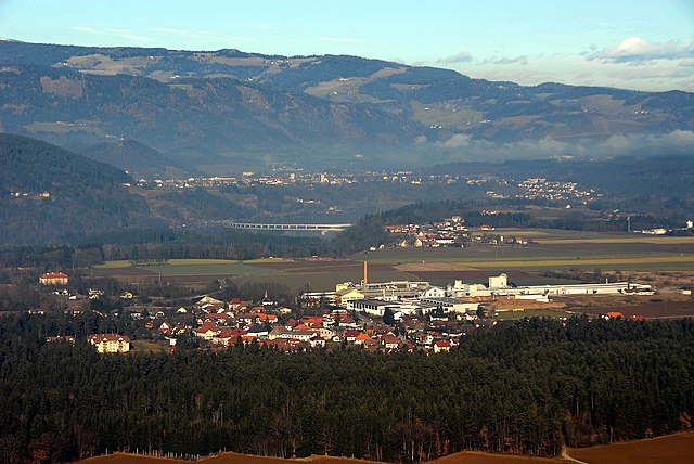
Völkermarkt District, located in the southern part of Austria, offers a variety of hiking opportunities set against a backdrop of stunning natural landscapes. The district is characterized by its diverse terrain, including mountains, forests, and lakes, making it an appealing destination for both casual hikers and seasoned adventurers.
Hiking Trails
-
Koralpe Mountain Range: One of the main attractions for hikers in the Völkermarkt area, the Koralpe offers numerous trails that range from easy walks to more challenging hikes. The panoramic views from the summits are breathtaking.
-
Lake Klopein: This area is perfect for those looking for lakeside hikes. There are numerous paths around the lake that provide a scenic walk along the water’s edge, suitable for families and those seeking a leisurely hike.
-
Waldweg Trails: These trails wind through the lush forests of the district, providing a chance to experience the local flora and fauna. The shaded paths are perfect for hot summer days.
-
Historical Trails: The district has some trails that feature historical landmarks and provide insight into the region's culture and history. These hikes can be both educational and scenic.
Tips for Hiking in Völkermarkt District
-
Check Trail Conditions: Before heading out, always check the local conditions. Some trails can be affected by weather or maintenance.
-
Be Prepared: Bring adequate supplies, including water, snacks, a first-aid kit, and proper clothing for changing weather conditions.
-
Follow Local Guidelines: Respect nature and follow local rules regarding wildlife, vegetation, and trail use to help preserve the area.
-
Navigation: Although many trails are well-marked, carrying a map or using a hiking app can help ensure you stay on the right path.
-
Seasonal Considerations: Summer is peak hiking season, but fall offers beautiful foliage. Winter hiking can be enjoyable too, with proper gear for snow conditions.
Conclusion
The Völkermarkt District is a fantastic destination for hikers looking to explore the natural beauty of southern Austria. Whether you're after the challenges of mountain trails or the tranquility of lakeside walks, this area has something to offer everyone. Just make sure to prepare adequately and respect the natural environment. Happy hiking!
- Country:

- Capital: Völkermarkt
- Licence Plate Code: VK
- Coordinates: 46° 35' 28" N, 14° 38' 38" E


- GPS tracks (wikiloc): [Link]
- AboveSeaLevel: 473 м m
- Area: 907.49 sq km
- Web site: http://www.verwaltung.ktn.gv.at/cgi-bin/evoweb.dll/web/akl/397_DE
- Wikipedia en: wiki(en)
- Wikipedia: wiki(de)
- Wikidata storage: Wikidata: Q660279
- Wikipedia Commons Category: [Link]
- Freebase ID: [/m/0c4dlt]
- GeoNames ID: Alt: [2762314]
- VIAF ID: Alt: [240370916]
- archINFORM location ID: [14656]
Includes regions:

Ruden
- municipality in Austria
Hiking in Ruden
Ruden, a small town located in the Carinthia region of Austria, is surrounded by stunning natural landscapes that offer excellent hiking opportunities. Here are some highlights and tips for hiking in and around Ruden:...
- Country:
- Postal Code: 9113
- Local Dialing Code: 0 42 34
- Licence Plate Code: VK
- Coordinates: 46° 39' 23" N, 14° 46' 11" E
- GPS tracks (wikiloc): [Link]
- AboveSeaLevel: 465 м m
- Area: 42.44 sq km
- Population: 1530
- Web site: [Link]

Völkermarkt
- municipality in Austria
Hiking in Völkermarkt
Völkermarkt, located in the southern part of Austria in Carinthia, provides some beautiful hiking opportunities amidst stunning natural landscapes. The region is characterized by its picturesque countryside, lakes, and the nearby Karawanken mountain range. Here are some key points to consider when hiking in Völkermarkt:...
- Country:
- Postal Code: 9100
- Licence Plate Code: VK
- Coordinates: 46° 39' 44" N, 14° 38' 4" E
- GPS tracks (wikiloc): [Link]
- AboveSeaLevel: 462 м m
- Area: 137.44 sq km
- Population: 10948
- Web site: [Link]

Eberndorf
- municipality in Austria
Hiking in Eberndorf
Eberndorf, located in Austria's Carinthia region, offers a range of hiking opportunities set against a stunning alpine backdrop. This picturesque area is characterized by beautiful landscapes, including rolling hills, tranquil lakes, and dense forests....
- Country:
- Postal Code: 9141
- Local Dialing Code: 04236
- Licence Plate Code: VK
- Coordinates: 46° 35' 29" N, 14° 38' 37" E
- GPS tracks (wikiloc): [Link]
- AboveSeaLevel: 476 м m
- Area: 68 sq km
- Population: 5862
- Web site: [Link]

Sittersdorf
- municipality in Austria
Hiking in Sittersdorf
Sittersdorf is a picturesque village located in the Carinthia region of Austria. It offers beautiful landscapes and a range of hiking opportunities suitable for various skill levels. Here’s a guide to hiking in and around Sittersdorf:...
- Country:
- Postal Code: 9133
- Local Dialing Code: 04237
- Licence Plate Code: VK
- Coordinates: 46° 32' 40" N, 14° 36' 21" E
- GPS tracks (wikiloc): [Link]
- AboveSeaLevel: 500 м m
- Area: 45.05 sq km
- Population: 2011
- Web site: [Link]

Feistritz ob Bleiburg
- municipality in Austria
Hiking in Feistritz ob Bleiburg
Feistritz ob Bleiburg, located in Carinthia, Austria, is a picturesque village surrounded by beautiful hiking landscapes. The region offers a range of hiking trails suitable for various skill levels, from easy walks to more challenging hikes. Here are some highlights and tips for hiking in and around Feistritz ob Bleiburg:...
- Country:
- Postal Code: 9143
- Local Dialing Code: 04235
- Licence Plate Code: VK
- Coordinates: 46° 33' 25" N, 14° 45' 34" E
- GPS tracks (wikiloc): [Link]
- AboveSeaLevel: 550 м m
- Area: 54.07 sq km
- Population: 2185
- Web site: [Link]

Globasnitz
- municipality in Austria
Hiking in Globasnitz
Globasnitz, located in the southern part of Austria, is a charming area known for its beautiful landscapes and outdoor activities, especially hiking. The region is characterized by rolling hills, lush forests, and scenic views of the surrounding mountains, making it a great destination for both casual walkers and experienced hikers....
- Country:
- Postal Code: 9142
- Local Dialing Code: 0 42 30
- Licence Plate Code: VK
- Coordinates: 46° 33' 25" N, 14° 42' 10" E
- GPS tracks (wikiloc): [Link]
- AboveSeaLevel: 541 м m
- Area: 38.43 sq km
- Population: 1620
- Web site: [Link]
Diex
- municipality in Austria
Hiking in Diex
Diex, a small town in the southern part of Austria, is nestled in the stunning Carinthian region and offers some wonderful hiking opportunities. The area is characterized by its beautiful landscapes, rolling hills, and a mix of lush forests and open fields, making it ideal for outdoor enthusiasts....
- Country:
- Postal Code: 9103
- Local Dialing Code: 0 42 31
- Licence Plate Code: VK
- Coordinates: 46° 44' 40" N, 14° 37' 0" E
- GPS tracks (wikiloc): [Link]
- AboveSeaLevel: 1159 м m
- Area: 54.9 sq km
- Population: 825
- Web site: [Link]

Sankt Kanzian am Klopeiner See
- municipality in Austria
Hiking in Sankt Kanzian am Klopeiner See
Sankt Kanzian am Klopeiner See is a beautiful destination located in Carinthia, Austria, known for its stunning lake and surrounding natural landscapes. Here are some key highlights and tips for hiking in the area:...
- Country:
- Postal Code: 9122
- Local Dialing Code: 04239
- Licence Plate Code: VK
- Coordinates: 46° 36' 52" N, 14° 34' 33" E
- GPS tracks (wikiloc): [Link]
- AboveSeaLevel: 442 м m
- Area: 40.94 sq km
- Population: 4403
- Web site: [Link]

Griffen
- municipality in Austria
Hiking in Griffen
Griffen, Austria, is a charming town situated in the Carinthia region, known for its stunning landscapes and proximity to the foothills of the Alps. Hiking in this area can be a rewarding experience, offering a mix of scenic routes, historical sites, and natural beauty....
- Country:
- Postal Code: 9112
- Local Dialing Code: 04233
- Licence Plate Code: VK
- Coordinates: 46° 42' 16" N, 14° 43' 58" E
- GPS tracks (wikiloc): [Link]
- AboveSeaLevel: 484 м m
- Area: 74.74 sq km
- Population: 3466
- Web site: [Link]


Neuhaus
- municipality in Austria
Hiking in Neuhaus
Neuhaus, in Carinthia, Austria, is a charming location for hiking enthusiasts. Nestled in the breathtaking landscapes of the Alps, it offers a variety of trails suitable for different skill levels, ranging from leisurely walks to more challenging hikes. Here are some highlights of hiking in this region:...
- Country:
- Postal Code: 9155
- Local Dialing Code: 0 43 56
- Licence Plate Code: VK
- Coordinates: 46° 38' 36" N, 14° 53' 16" E
- GPS tracks (wikiloc): [Link]
- AboveSeaLevel: 442 м m
- Area: 36.33 sq km
- Population: 1040
- Web site: [Link]

Eisenkappel-Vellach
- market town in the Völkermarkt District in the Austrian state of Carinthia
Hiking in Eisenkappel-Vellach
Eisenkappel-Vellach is a beautiful destination for hiking enthusiasts, located in the southern part of Austria, specifically in the Carinthia region. The area is known for its stunning landscapes, diverse flora and fauna, and picturesque alpine scenery. Here are some details that might help you plan your hiking adventure there:...
- Country:
- Postal Code: 9135
- Local Dialing Code: 04238
- Licence Plate Code: VK
- Coordinates: 46° 29' 11" N, 14° 35' 46" E
- GPS tracks (wikiloc): [Link]
- AboveSeaLevel: 556 м m
- Area: 199.43 sq km
- Population: 2306
- Web site: [Link]

Bleiburg
- municipality in Austria
Hiking in Bleiburg
Bleiburg, located in Austria, is a picturesque town set against the backdrop of the Karawanken mountain range. This region offers various hiking opportunities for all levels, making it an attractive destination for outdoor enthusiasts....
- Country:
- Postal Code: 9150
- Local Dialing Code: 04235
- Licence Plate Code: VK
- Coordinates: 46° 35' 24" N, 14° 47' 56" E
- GPS tracks (wikiloc): [Link]
- AboveSeaLevel: 479 м m
- Area: 69.72 sq km
- Population: 4072
- Web site: [Link]

Gallizien
- municipality in Austria
Hiking in Gallizien
Gallizien, located in Carinthia, Austria, is a picturesque area that offers a variety of hiking opportunities amidst beautiful natural landscapes. Here are some key points to consider if you're planning to hike in Gallizien:...
- Country:
- Postal Code: 9132
- Local Dialing Code: 0 42 21
- Licence Plate Code: VK
- Coordinates: 46° 33' 25" N, 14° 30' 28" E
- GPS tracks (wikiloc): [Link]
- AboveSeaLevel: 436 м m
- Area: 46.8 sq km
- Population: 1761
- Web site: [Link]