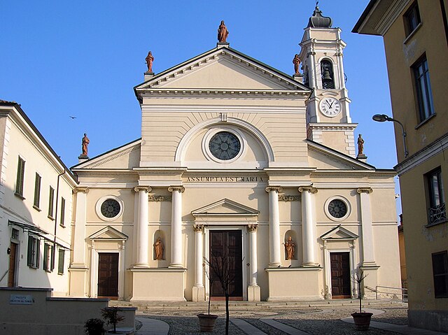
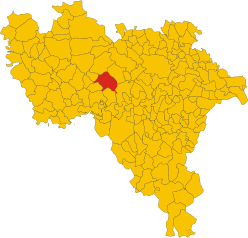
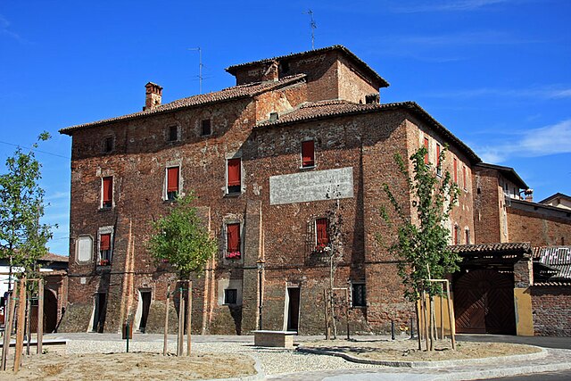
Valeggio (Valeggio)
- Italian comune
Valeggio sul Mincio, located in the Lombardy region of Italy, is known for its picturesque landscapes, historical sites, and the beautiful Mincio River. Hiking in this area offers a unique combination of natural beauty and cultural heritage. Here are some highlights and tips for hiking in Valeggio:
Trails and Routes:
-
The Mincio River Path: This is a scenic route that follows the Mincio River, ideal for leisurely hikes or walks. The trail offers beautiful views of the river, lush vegetation, and opportunities to spot local wildlife.
-
Sigurtà Park: While primarily a park, it has several trails that wind through its gardens and natural areas. This park is known for its stunning floral displays, ponds, and scenic landscapes, making it a pleasant place for a hike intertwined with nature’s beauty.
-
Ciclopista del Mincio: This is a bike and walking path that runs along the river and connects Valeggio with Lake Garda. It's a longer route, so it's great for those looking for a more extended hike or bike ride.
-
The hills surrounding Valeggio: If you're up for a more challenging hike, you can explore the hills and offer panoramic views of the surrounding countryside. The trails may lead you through vineyards and olive groves.
Highlights:
- Castellaro Lagusello: A nearby medieval village worth visiting, known for its charming architecture and serene lake.
- Parco Giardino Sigurtà: As mentioned, it's one of the most beautiful gardens in Italy, providing a picturesque backdrop for hikers.
- Local Culture and Cuisine: After your hike, don’t miss the opportunity to enjoy local specialties such as tortellini from Valeggio, which can be found in many restaurants in the area.
Tips for Hiking in Valeggio:
- Best Time to Visit: Spring (April to June) and early autumn (September to October) are ideal times for hiking, as the weather is usually mild and the scenery is at its best.
- Prepare for Varying Terrain: Some trails may have uneven surfaces, so wear sturdy and comfortable footwear.
- Hydration and Snacks: Always carry enough water and some snacks, especially on longer hikes.
- Local Maps and Resources: Consider picking up a local hiking map or guidebook which may provide additional routes and tips.
Safety Considerations:
- Be aware of the weather conditions before your hike and dress accordingly.
- Inform someone of your hiking plans, especially if you’re going on longer or less-traveled paths.
Whether you're a casual walker or a seasoned hiker, Valeggio offers diverse options to enjoy the natural beauty and rich culture of the Lombardy region. Enjoy your hike!
- Country:

- Postal Code: 27020
- Local Dialing Code: 0384
- Licence Plate Code: PV
- Coordinates: 45° 9' 0" N, 8° 52' 0" E


- GPS tracks (wikiloc): [Link]
- AboveSeaLevel: 93 м m
- Area: 9.85 sq km
- Population: 222
- Web site: http://www.comune.valeggio.pv.it
- Wikipedia en: wiki(en)
- Wikipedia: wiki(it)
- Wikidata storage: Wikidata: Q39839
- Wikipedia Commons Category: [Link]
- Freebase ID: [/m/0gjxv2]
- GeoNames ID: Alt: [6539790]
- VIAF ID: Alt: [248297070]
- OSM relation ID: [44284]
- MusicBrainz area ID: [7322e7b4-787f-41e1-9474-de5b8ede7785]
- ISTAT ID: 018167
- Italian cadastre code: L568
Shares border with regions:


Tromello
- Italian comune
Tromello is a small town located in the Lombardy region of Italy, known more for its agricultural landscape and quaint charm than for extensive hiking trails. However, the surrounding area offers opportunities for outdoor activities and nature exploration....
- Country:

- Postal Code: 27020
- Local Dialing Code: 0382
- Licence Plate Code: PV
- Coordinates: 45° 13' 0" N, 8° 52' 0" E


- GPS tracks (wikiloc): [Link]
- AboveSeaLevel: 97 м m
- Area: 35.5 sq km
- Population: 3795
- Web site: [Link]


Scaldasole
- Italian comune
Scaldasole is a charming area located in the province of Pavia in Lombardy, Italy. Although it may not be widely recognized as a major hiking destination, it offers a range of outdoor activities and scenic views that can attract hiking enthusiasts....
- Country:

- Postal Code: 27020
- Local Dialing Code: 0382
- Licence Plate Code: PV
- Coordinates: 45° 7' 0" N, 8° 55' 0" E


- GPS tracks (wikiloc): [Link]
- AboveSeaLevel: 86 м m
- Area: 11.57 sq km
- Population: 923
- Web site: [Link]


Ottobiano
- Italian comune
Ottobiano, a small comune located in the Lombardy region of Italy, is known primarily for its motorsport activities due to the famous motocross track, but it also offers opportunities for those who enjoy hiking and exploring nature....
- Country:

- Postal Code: 27030
- Local Dialing Code: 0384
- Licence Plate Code: PV
- Coordinates: 45° 9' 0" N, 8° 50' 0" E


- GPS tracks (wikiloc): [Link]
- AboveSeaLevel: 96 м m
- Area: 24.98 sq km
- Population: 1114
- Web site: [Link]
Ferrera Erbognone
- Italian comune
Ferrera Erbognone is a small town in the Lombardy region of Italy. It's located near the Po River and is surrounded by beautiful natural landscapes, making it a great spot for hiking enthusiasts. While specific trails in Ferrera Erbognone may not be as well-known as those in larger national parks, there are still many opportunities for outdoor exploration and enjoyment in the surrounding areas....
- Country:

- Postal Code: 27032
- Local Dialing Code: 0382
- Licence Plate Code: PV
- Coordinates: 45° 7' 0" N, 8° 52' 0" E


- GPS tracks (wikiloc): [Link]
- AboveSeaLevel: 89 м m
- Area: 19 sq km
- Population: 1196
- Web site: [Link]


Dorno
- Italian comune
Dorno is a lovely area located in the Scottish Borders, known for its scenic landscapes and diverse hiking opportunities. Here are some key points about hiking in Dorno:...
- Country:

- Postal Code: 27020
- Local Dialing Code: 0382
- Licence Plate Code: PV
- Coordinates: 45° 9' 0" N, 8° 57' 0" E


- GPS tracks (wikiloc): [Link]
- AboveSeaLevel: 90 м m
- Area: 30.57 sq km
- Population: 4671
- Web site: [Link]


Alagna
- Italian comune
Alagna Valsesia is a picturesque village located in the Aosta Valley region of northern Italy, nestled in the foothills of the Alps. It offers a variety of hiking opportunities for both beginners and experienced hikers. Here are some key points to consider when planning your hiking trips around Alagna:...
- Country:

- Postal Code: 27020
- Local Dialing Code: 0382
- Licence Plate Code: PV
- Coordinates: 45° 10' 0" N, 8° 53' 0" E


- GPS tracks (wikiloc): [Link]
- AboveSeaLevel: 92 м m
- Area: 8.34 sq km
- Population: 831
- Web site: [Link]

