
Valence (Valence)
- commune in Drôme, France
Valence, located in the Rhône-Alpes region of France, offers a wonderful base for hiking enthusiasts. While the city itself is more urban, it is surrounded by natural attractions and landscapes perfect for hiking.
Popular Hiking Areas Near Valence:
-
Vercors Regional Natural Park: Just a short drive from Valence, this park features a variety of trails that cater to different skill levels. From challenging mountain hikes to gentler paths through meadows, the Vercors provides stunning views, limestone cliffs, and the opportunity to explore local wildlife.
-
Drôme Valley: The picturesque Drôme Valley is known for its diverse landscapes, from vineyards to olive groves. You can find numerous hiking trails here, some that follow the riverbanks and others that venture into the hills, providing a mix of scenic beauty and cultural experiences.
-
Mount Gerbier de Jonc: This iconic peak is a bit further out but offers spectacular views of the region. There are several trails leading to the summit, and the area is renowned for its natural springs and rich biodiversity.
-
La Forêt de Saoû: About an hour from Valence, this forest offers a variety of well-marked trails surrounded by stunning geological formations. It's a great spot for a peaceful day hike, with trails suitable for different abilities.
Tips for Hiking in and Around Valence:
- Always check the weather: Conditions can change quickly in higher elevations, so be prepared.
- Bring sufficient water and snacks: Some trails, especially in more remote areas, may not have sources of water.
- Wear appropriate footwear: A good pair of hiking shoes can make a big difference in comfort and safety on the trails.
- Map and Navigation: While many trails are well-marked, it’s a good idea to carry a map or GPS device since cell service may be limited in some areas.
- Start early: For longer hikes, starting early can help you avoid the heat and crowds, especially in peak seasons.
Local Hiking Groups:
For those looking to connect with fellow hikers, Valence and the surrounding regions often have local hiking clubs or groups that organize outings and offer guided hikes. This can be a great way to explore the area while meeting new people.
In sum, Valence is an excellent starting point for hikers looking to explore the beautiful landscapes of the Rhône-Alpes region. Whether you're looking for a challenging trek or a leisurely stroll, there are plenty of options available!
- Country:

- Postal Code: 26000
- Coordinates: 44° 55' 57" N, 4° 53' 27" E


- GPS tracks (wikiloc): [Link]
- Area: 36.69 sq km
- Population: 62479
- Web site: http://www.valence.fr
- Wikipedia en: wiki(en)
- Wikipedia: wiki(fr)
- Wikidata storage: Wikidata: Q8848
- Wikipedia Commons Gallery: [Link]
- Wikipedia Commons Category: [Link]
- Freebase ID: [/m/01405k]
- Freebase ID: [/m/01405k]
- Freebase ID: [/m/01405k]
- Freebase ID: [/m/01405k]
- Freebase ID: [/m/01405k]
- GeoNames ID: Alt: [2971053]
- GeoNames ID: Alt: [2971053]
- GeoNames ID: Alt: [2971053]
- GeoNames ID: Alt: [2971053]
- GeoNames ID: Alt: [2971053]
- SIREN number: [212603625]
- SIREN number: [212603625]
- SIREN number: [212603625]
- SIREN number: [212603625]
- SIREN number: [212603625]
- BnF ID: [15253222t]
- BnF ID: [15253222t]
- BnF ID: [15253222t]
- BnF ID: [15253222t]
- BnF ID: [15253222t]
- VIAF ID: Alt: [123970872]
- VIAF ID: Alt: [123970872]
- VIAF ID: Alt: [123970872]
- VIAF ID: Alt: [123970872]
- VIAF ID: Alt: [123970872]
- GND ID: Alt: [4119350-7]
- GND ID: Alt: [4119350-7]
- GND ID: Alt: [4119350-7]
- GND ID: Alt: [4119350-7]
- GND ID: Alt: [4119350-7]
- archINFORM location ID: [46067]
- archINFORM location ID: [46067]
- archINFORM location ID: [46067]
- archINFORM location ID: [46067]
- archINFORM location ID: [46067]
- Library of Congress authority ID: Alt: [n81101041]
- Library of Congress authority ID: Alt: [n81101041]
- Library of Congress authority ID: Alt: [n81101041]
- Library of Congress authority ID: Alt: [n81101041]
- Library of Congress authority ID: Alt: [n81101041]
- PACTOLS thesaurus ID: [pcrtwtyAN6Y1rr]
- PACTOLS thesaurus ID: [pcrtwtyAN6Y1rr]
- PACTOLS thesaurus ID: [pcrtwtyAN6Y1rr]
- PACTOLS thesaurus ID: [pcrtwtyAN6Y1rr]
- PACTOLS thesaurus ID: [pcrtwtyAN6Y1rr]
- MusicBrainz area ID: [9828e130-c29c-4bb3-a248-0b3a5970d76e]
- MusicBrainz area ID: [9828e130-c29c-4bb3-a248-0b3a5970d76e]
- MusicBrainz area ID: [9828e130-c29c-4bb3-a248-0b3a5970d76e]
- MusicBrainz area ID: [9828e130-c29c-4bb3-a248-0b3a5970d76e]
- MusicBrainz area ID: [9828e130-c29c-4bb3-a248-0b3a5970d76e]
- SUDOC authorities ID: [030599709]
- SUDOC authorities ID: [030599709]
- SUDOC authorities ID: [030599709]
- SUDOC authorities ID: [030599709]
- SUDOC authorities ID: [030599709]
- Encyclopædia Britannica Online ID: [place/Valence-France]
- Encyclopædia Britannica Online ID: [place/Valence-France]
- Encyclopædia Britannica Online ID: [place/Valence-France]
- Encyclopædia Britannica Online ID: [place/Valence-France]
- Encyclopædia Britannica Online ID: [place/Valence-France]
- Encyclopædia Universalis ID: [valence-france]
- Encyclopædia Universalis ID: [valence-france]
- Encyclopædia Universalis ID: [valence-france]
- Encyclopædia Universalis ID: [valence-france]
- Encyclopædia Universalis ID: [valence-france]
- EMLO location ID: [b249fde8-a765-4af1-8b74-237bb276717e]
- EMLO location ID: [b249fde8-a765-4af1-8b74-237bb276717e]
- EMLO location ID: [b249fde8-a765-4af1-8b74-237bb276717e]
- EMLO location ID: [b249fde8-a765-4af1-8b74-237bb276717e]
- EMLO location ID: [b249fde8-a765-4af1-8b74-237bb276717e]
- Twitter username: Alt: [VilledeValence]
- Twitter username: Alt: [VilledeValence]
- Twitter username: Alt: [VilledeValence]
- Twitter username: Alt: [VilledeValence]
- Twitter username: Alt: [VilledeValence]
- Digital Atlas of the Roman Empire ID: [191]
- Digital Atlas of the Roman Empire ID: [191]
- Digital Atlas of the Roman Empire ID: [191]
- Digital Atlas of the Roman Empire ID: [191]
- Digital Atlas of the Roman Empire ID: [191]
- INSEE municipality code: 26362
- INSEE municipality code: 26362
- INSEE municipality code: 26362
- INSEE municipality code: 26362
- INSEE municipality code: 26362
Shares border with regions:


Montéléger
- commune in Drôme, France
Montéléger is a small commune located in the Drôme department in the Auvergne-Rhône-Alpes region of France. While it may not be one of the most renowned hiking destinations, it can offer beautiful scenery and a chance to explore the natural beauty of the surrounding areas....
- Country:

- Postal Code: 26760
- Coordinates: 44° 51' 12" N, 4° 56' 0" E


- GPS tracks (wikiloc): [Link]
- Area: 9.45 sq km
- Population: 1786


Bourg-lès-Valence
- commune in Drôme, France
Bourg-lès-Valence is a charming town located in the Auvergne-Rhône-Alpes region of France, situated near the banks of the Rhône River. While it may not be a major hiking destination in itself, its proximity to the surrounding natural landscapes makes it a great starting point for various hiking opportunities....
- Country:

- Postal Code: 26500
- Coordinates: 44° 56' 51" N, 4° 53' 43" E


- GPS tracks (wikiloc): [Link]
- Area: 20.3 sq km
- Population: 20074
- Web site: [Link]

Guilherand-Granges
- commune in Ardèche, France
Guilherand-Granges, located in the Auvergne-Rhône-Alpes region of France, offers some beautiful hiking opportunities, especially considering its proximity to the Rhône River and the stunning landscapes of the Ardèche department. Here are some highlights of hiking in and around Guilherand-Granges:...
- Country:

- Postal Code: 07500
- Coordinates: 44° 56' 4" N, 4° 52' 29" E


- GPS tracks (wikiloc): [Link]
- AboveSeaLevel: 123 м m
- Area: 6.55 sq km
- Population: 10862
- Web site: [Link]


Alixan
- commune in Drôme, France
Alixan is a charming commune located in the Drôme department of southeastern France. While it may not be as well-known as some of the more prominent hiking destinations, it offers a serene landscape and opportunities for outdoor activities, including hiking....
- Country:

- Postal Code: 26300
- Coordinates: 44° 58' 30" N, 5° 1' 39" E


- GPS tracks (wikiloc): [Link]
- Area: 28.28 sq km
- Population: 2484
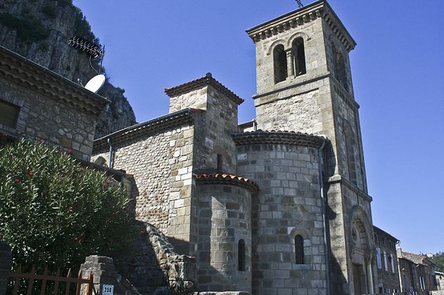
Soyons
- commune in Ardèche, France
Soyons is a charming village located in the Auvergne-Rhône-Alpes region of France, near the city of Valence. It offers a variety of scenic landscapes ideal for hiking enthusiasts. Here are some features and suggestions for hiking in and around Soyons:...
- Country:

- Postal Code: 07130
- Coordinates: 44° 53' 21" N, 4° 51' 1" E


- GPS tracks (wikiloc): [Link]
- Area: 7.9 sq km
- Population: 2211
- Web site: [Link]

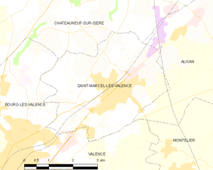
Saint-Marcel-lès-Valence
- commune in Drôme, France
 Hiking in Saint-Marcel-lès-Valence
Saint-Marcel-lès-Valence, located in the Auvergne-Rhône-Alpes region of France, offers a variety of hiking opportunities that showcase the beautiful landscapes of the Drôme department. Here are some key points about hiking in the area:...
- Country:

- Postal Code: 26320
- Coordinates: 44° 58' 15" N, 4° 57' 24" E


- GPS tracks (wikiloc): [Link]
- Area: 15.05 sq km
- Population: 6165
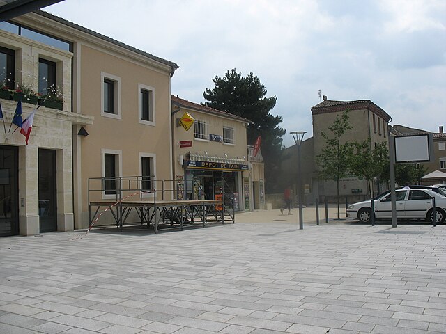
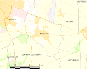
Malissard
- commune in Drôme, France
Malissard is a beautiful hiking destination located in the French Alps, near the city of Grenoble. The region offers stunning panoramic views, diverse landscapes, and a variety of trails suitable for different skill levels. Here are some highlights of hiking in Malissard:...
- Country:

- Postal Code: 26120
- Coordinates: 44° 54' 5" N, 4° 57' 24" E


- GPS tracks (wikiloc): [Link]
- Area: 10.17 sq km
- Population: 3211

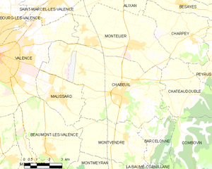
Chabeuil
- commune in Drôme, France
Chabeuil is a charming commune located in the Drôme department in southeastern France, near the city of Valence. It offers a variety of hiking opportunities, showcasing the stunning landscapes of the Rhône-Alpes region. Here are some highlights about hiking in Chabeuil:...
- Country:

- Postal Code: 26120
- Coordinates: 44° 53' 59" N, 5° 1' 12" E


- GPS tracks (wikiloc): [Link]
- Area: 41.07 sq km
- Population: 6896
- Web site: [Link]

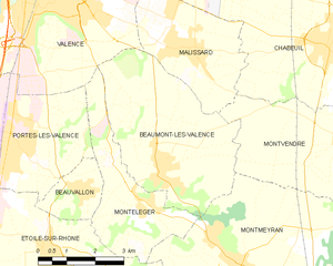
Beaumont-lès-Valence
- commune in Drôme, France
 Hiking in Beaumont-lès-Valence
Beaumont-lès-Valence is a charming commune located in the Drôme department in southeastern France. The area around Beaumont-lès-Valence offers a range of hiking opportunities, particularly appealing for nature lovers and those looking to explore the scenic landscapes of the Rhône-Alpes region....
- Country:

- Postal Code: 26760
- Coordinates: 44° 51' 43" N, 4° 56' 34" E


- GPS tracks (wikiloc): [Link]
- Area: 17.61 sq km
- Population: 3621
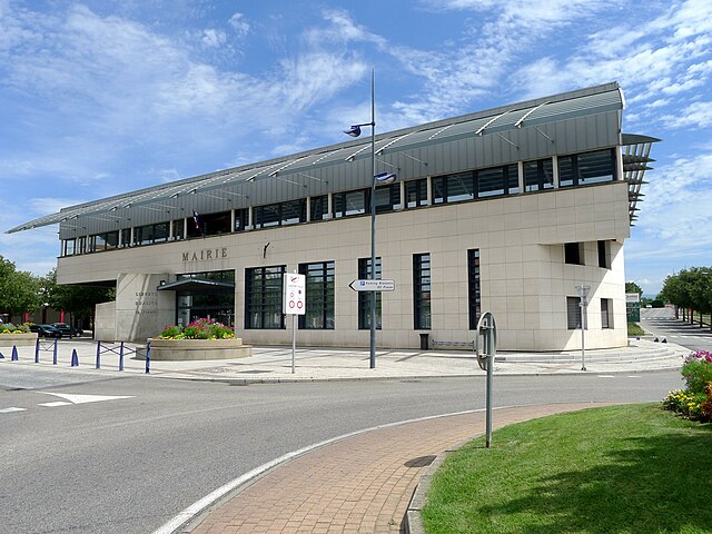

Portes-lès-Valence
- commune in Drôme, France
Portes-lès-Valence is a charming town located in the Drôme department in southeastern France. It serves as a great base for hikers, offering access to various trails that showcase the beauty of the surrounding landscapes, including vineyards, rolling hills, and the Drôme River....
- Country:

- Postal Code: 26800
- Coordinates: 44° 52' 24" N, 4° 52' 35" E


- GPS tracks (wikiloc): [Link]
- Area: 14.43 sq km
- Population: 10209
- Web site: [Link]


Montélier
- commune in Drôme, France
Montélier, located in the Drôme department of southeastern France, is a charming village that provides access to beautiful hiking opportunities, particularly within the surrounding regions of the Vercors and the Col de la Machine. Here are some highlights for hiking in and around Montélier:...
- Country:

- Postal Code: 26120
- Coordinates: 44° 56' 15" N, 5° 1' 52" E


- GPS tracks (wikiloc): [Link]
- Area: 24.76 sq km
- Population: 4074
