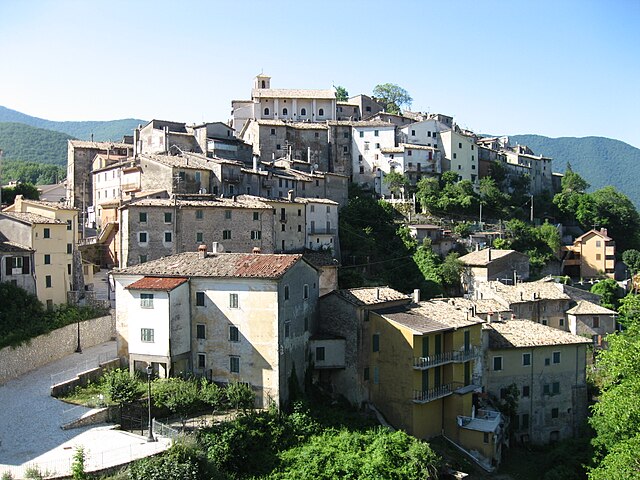
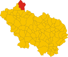
Vallepietra (Vallepietra)
.svg)
- Italian comune
 Hiking in Vallepietra
Vallepietra, located in the Lazio region of Italy, is known for its beautiful landscapes and its setting within the Simbruini Mountains. The area is an excellent choice for hiking enthusiasts due to its varied terrain, rich wildlife, and historical sites.
Hiking Trails
-
Sentiero degli Altipiani: This trail offers stunning views of the surrounding mountains and is suitable for hikers of various skill levels. It's a relatively moderate hike that allows you to experience the beauty of the local flora and fauna.
-
Vallepietra to Monte Rognoso: This hike leads you to Monte Rognoso, providing a more challenging route with rewarding panoramic views from the summit. You'll encounter diverse landscapes, including forests and rocky outcrops.
-
Footpaths through Villages: There are numerous trails connecting Vallepietra to surrounding villages. These routes often pass through charming hamlets and offer a glimpse into rural Italian life and architecture.
Points of Interest
- Historical Sites: Visit the Sanctuary of the Madonna del Soccorso, which is a significant spiritual site in the area. The architecture and serene surroundings are worth a stop during your hike.
- Natural Attractions: Keep an eye out for local wildlife, including various bird species, deer, and other animals native to the region. The diverse plant life also makes for interesting observations.
Tips for Hiking in Vallepietra
- Preparation: Ensure you're equipped with good hiking boots and carry sufficient water and snacks. The trails can vary in difficulty, so it's advisable to choose routes that match your skill level.
- Weather: Check the weather conditions before heading out, as conditions can change rapidly in mountainous areas.
- Maps and Guides: It’s beneficial to have a detailed map or GPS device, as some trails may not be well-marked.
- Respect Nature: Follow the Leave No Trace principles to help preserve the environment for future visitors.
Overall, hiking in Vallepietra can be an enriching experience, combining physical activity with natural beauty and cultural heritage. Whether you're looking for a leisurely stroll or a more intense trek, there are options available for all preferences.
- Country:

- Postal Code: 00020
- Local Dialing Code: 0774
- Licence Plate Code: RM
- Coordinates: 41° 56' 0" N, 13° 14' 0" E


- GPS tracks (wikiloc): [Link]
- AboveSeaLevel: 825 м m
- Area: 52.94 sq km
- Population: 268
- Web site: http://www.comunevallepietra.it/
- Wikipedia en: wiki(en)
- Wikipedia: wiki(it)
- Wikidata storage: Wikidata: Q243500
- Wikipedia Commons Category: [Link]
- Freebase ID: [/m/0gm8kp]
- GeoNames ID: Alt: [6540528]
- VIAF ID: Alt: [130375115]
- OSM relation ID: [41651]
- WOEID: [725576]
- TGN ID: [1047298]
- ISTAT ID: 058108
- Italian cadastre code: L611
Shares border with regions:
Filettino
- Italian comune
Hiking in Filettino
Filettino is a scenic village located in the Apennine Mountains of Italy, known for its beautiful landscapes, traditional architecture, and an abundance of hiking opportunities. Here’s what you can expect when hiking in and around Filettino:...
- Country:
- Postal Code: 03010
- Local Dialing Code: 0775
- Licence Plate Code: FR
- Coordinates: 41° 53' 0" N, 13° 20' 0" E
- GPS tracks (wikiloc): [Link]
- AboveSeaLevel: 1063 м m
- Area: 78.08 sq km
- Population: 538
- Web site: [Link]


Trevi nel Lazio
- Italian comune
Hiking in Trevi nel Lazio
Trevi nel Lazio is a picturesque town located in the province of Frosinone in the Lazio region of Italy. It offers beautiful hiking opportunities characterized by stunning natural landscapes, historical sites, and a mix of moderate to challenging trails. Here are some key points to consider if you’re planning to hike in this area:...
- Country:
- Postal Code: 03010
- Local Dialing Code: 0775
- Licence Plate Code: FR
- Coordinates: 41° 51' 50" N, 13° 15' 4" E
- GPS tracks (wikiloc): [Link]
- AboveSeaLevel: 821 м m
- Area: 54.32 sq km
- Population: 1768
- Web site: [Link]
Camerata Nuova
- Italian comune
Hiking in Camerata Nuova
Camerata Nuova is a charming village located in the province of Rome, Italy, nestled within the beautiful landscape of the Apennine Mountains. This area is known for its natural beauty, making it a fantastic destination for hiking enthusiasts....
- Country:
- Postal Code: 00020
- Local Dialing Code: 0774
- Licence Plate Code: RM
- Coordinates: 42° 1' 0" N, 13° 6' 0" E
- GPS tracks (wikiloc): [Link]
- AboveSeaLevel: 810 м m
- Area: 40.5 sq km
- Population: 445
- Web site: [Link]


Jenne, Lazio
- Italian comune
Hiking in Jenne, Lazio
Jenne, a charming town located in the Lazio region of Italy, is a hidden gem for hikers and outdoor enthusiasts. Nestled in the Simbruini Mountains, it offers a variety of trails that range from easy walks to more challenging hikes, allowing for exploration of the stunning landscapes, rich biodiversity, and historical sites....
- Country:
- Postal Code: 00020
- Local Dialing Code: 0774
- Licence Plate Code: RM
- Coordinates: 41° 53' 0" N, 13° 10' 0" E
- GPS tracks (wikiloc): [Link]
- AboveSeaLevel: 834 м m
- Area: 31.52 sq km
- Population: 347
- Web site: [Link]


Subiaco
- Italian comune
Hiking in Subiaco
Subiaco, located in the Lazio region of Italy, is known for its stunning natural landscapes, rich history, and numerous hiking opportunities. It is situated in the Aniene Valley, surrounded by the Simbruini Mountains, making it a great base for hiking enthusiasts. Here’s what you should know about hiking in Subiaco:...
- Country:
- Postal Code: 00028
- Local Dialing Code: 0774
- Licence Plate Code: RM
- Coordinates: 41° 56' 0" N, 13° 6' 0" E
- GPS tracks (wikiloc): [Link]
- AboveSeaLevel: 408 м m
- Area: 63.23 sq km
- Population: 8916
- Web site: [Link]

Cappadocia, Abruzzo
- Italian comune
Hiking in Cappadocia, Abruzzo
Cappadocia in Turkey and Abruzzo in Italy are two fantastic hiking destinations, each with its own unique landscapes and cultural experiences. However, since you mentioned "Cappadocia, Abruzzo," I'm assuming you might be looking for information on hiking in both regions separately....
- Country:
- Postal Code: 67060
- Local Dialing Code: 0863
- Licence Plate Code: AQ
- Coordinates: 42° 0' 27" N, 13° 16' 51" E
- GPS tracks (wikiloc): [Link]
- AboveSeaLevel: 1108 м m
- Area: 68.58 sq km
- Population: 546
- Web site: [Link]