Valmondois (Valmondois)

- commune in Val-d'Oise, France
- Country:

- Postal Code: 95760
- Coordinates: 49° 5' 48" N, 2° 11' 27" E


- GPS tracks (wikiloc): [Link]
- Area: 4.59 sq km
- Population: 1208
- Web site: http://www.valmondois.fr
- Wikipedia en: wiki(en)
- Wikipedia: wiki(fr)
- Wikidata storage: Wikidata: Q258502
- Wikipedia Commons Category: [Link]
- Freebase ID: [/m/03qlmys]
- Freebase ID: [/m/03qlmys]
- GeoNames ID: Alt: [2970866]
- GeoNames ID: Alt: [2970866]
- SIREN number: [219506284]
- SIREN number: [219506284]
- BnF ID: [15280538x]
- BnF ID: [15280538x]
- VIAF ID: Alt: [234707442]
- VIAF ID: Alt: [234707442]
- MusicBrainz area ID: [f5c450c1-0e05-4582-8353-23edae90e66f]
- MusicBrainz area ID: [f5c450c1-0e05-4582-8353-23edae90e66f]
- Quora topic ID: [Valmondois]
- Quora topic ID: [Valmondois]
- INSEE municipality code: 95628
- INSEE municipality code: 95628
Shares border with regions:

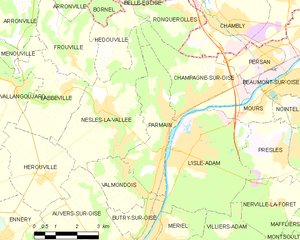
Parmain
- commune in Val-d'Oise, France
- Country:
- Postal Code: 95620
- Coordinates: 49° 6' 53" N, 2° 12' 31" E
- GPS tracks (wikiloc): [Link]
- Area: 9.2 sq km
- Population: 5618
- Web site: [Link]


Auvers-sur-Oise
- commune in Val-d'Oise, France
- Country:
- Postal Code: 95430
- Coordinates: 49° 4' 18" N, 2° 10' 27" E
- GPS tracks (wikiloc): [Link]
- Area: 12.69 sq km
- Population: 6964
- Web site: [Link]
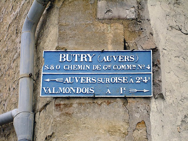
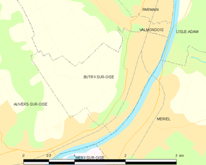
Butry-sur-Oise
- commune in Val-d'Oise, France
- Country:
- Postal Code: 95430
- Coordinates: 49° 5' 10" N, 2° 11' 54" E
- GPS tracks (wikiloc): [Link]
- Area: 2.6 sq km
- Population: 2257
- Web site: [Link]


Nesles-la-Vallée
- commune in Val-d'Oise, France
- Country:
- Postal Code: 95690
- Coordinates: 49° 7' 48" N, 2° 10' 14" E
- GPS tracks (wikiloc): [Link]
- Area: 13.46 sq km
- Population: 1801


L'Isle-Adam
- commune in Val-d'Oise, France
- Country:
- Postal Code: 95290
- Coordinates: 49° 6' 40" N, 2° 13' 22" E
- GPS tracks (wikiloc): [Link]
- Area: 14.94 sq km
- Population: 12249
- Web site: [Link]