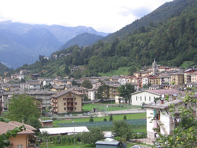
Valnegra (Valnegra)
.svg)
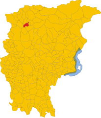
- Italian comune
 Hiking in Valnegra
Valnegra, a picturesque village located in the province of Bergamo in the Lombardy region of Italy, is an excellent destination for hikers. Nestled in the Italian Alps, it offers stunning landscapes, lush forests, and a variety of trails suitable for different skill levels.
Hiking Trails:
-
Sentiero delle Orobie: This long-distance trail runs through the Orobie Alps and offers magnificent views of the Bergamasque and the surrounding valleys. You can choose sections that fit your ability, as the trail is broken up into segments.
-
Trekking to Monte Alben: A popular hike that takes you to the summit of Monte Alben. The path is marked and provides breathtaking panoramic views at the top. It’s a moderate hike, usually taking about 2-3 hours to reach the summit.
-
Val di Scalve: Nearby, the Val di Scalve offers beautiful landscapes and various trails. The area boasts several paths that wind through mountains, past waterfalls, and alongside rivers.
-
Forcella di Lago: This is a charming, less-traveled trail that can give you a taste of solitude in nature. The path leads along scenic ridges, offering views of surrounding peaks.
Best Time to Hike:
- Late spring to early autumn (May to October) is the most favorable time for hiking in Valnegra. During these months, the weather is generally mild, and the trails are safe to navigate. However, always check local conditions, as weather can change rapidly in mountainous areas.
Preparation:
-
Gear: Ensure you wear suitable hiking boots, carry plenty of water, snacks, a first aid kit, and proper clothing for changing weather conditions. A map or GPS device is also helpful.
-
Difficulty: Assess your fitness level before choosing a trail. Most trails in Valnegra vary from easy to challenging, so there’s something for everyone.
Local Attractions:
- Besides hiking, Valnegra is known for its charming architecture and cultural sites. Be sure to explore the village and enjoy local cuisine, which often includes hearty mountain dishes.
Safety:
- Always inform someone about your hiking plans and expected return time. It's advisable to hike with a companion or group, especially on more remote trails.
Whether you're a beginner or an experienced hiker, Valnegra provides a wonderful backdrop for your outdoor adventures, with its serene environment and stunning natural beauty. Enjoy your hike!
- Country:

- Postal Code: 24010
- Local Dialing Code: 0345
- Licence Plate Code: BG
- Coordinates: 45° 57' 0" N, 9° 41' 26" E


- GPS tracks (wikiloc): [Link]
- AboveSeaLevel: 581 м m
- Area: 2.23 sq km
- Population: 211
- Web site: http://www.comune.valnegra.bg.it/
- Wikipedia en: wiki(en)
- Wikipedia: wiki(it)
- Wikidata storage: Wikidata: Q101713
- Wikipedia Commons Gallery: [Link]
- Wikipedia Commons Category: [Link]
- Freebase ID: [/m/0gjfjp]
- GeoNames ID: Alt: [6536161]
- OSM relation ID: [46584]
- ISTAT ID: 016227
- Italian cadastre code: L642
Shares border with regions:


Lenna, Lombardy
- Italian comune
Hiking in Lenna, Lombardy
Lenna is a quaint village located in the Bergamo province of Lombardy, Italy. It is situated in a picturesque part of the Italian Alps, making it a great base for hiking enthusiasts. The area is characterized by stunning landscapes, rich flora and fauna, and a variety of trails that cater to different skill levels....
- Country:
- Postal Code: 24010
- Local Dialing Code: 0345
- Licence Plate Code: BG
- Coordinates: 45° 56' 36" N, 9° 40' 39" E
- GPS tracks (wikiloc): [Link]
- AboveSeaLevel: 465 м m
- Area: 12.74 sq km
- Population: 592
- Web site: [Link]


Moio de' Calvi
- Italian comune
Hiking in Moio de' Calvi
Moio de' Calvi is a charming village located in the province of Bergamo, Italy, in the Lombardy region. Nestled in the foothills of the Alps, it offers a picturesque setting for hiking enthusiasts. While the village itself is small and not overly commercialized, it serves as a gateway to some beautiful hiking routes in the surrounding area....
- Country:
- Postal Code: 24070
- Local Dialing Code: 0345
- Licence Plate Code: BG
- Coordinates: 45° 57' 6" N, 9° 42' 3" E
- GPS tracks (wikiloc): [Link]
- AboveSeaLevel: 654 м m
- Area: 6.36 sq km
- Population: 206
- Web site: [Link]
Piazza Brembana
- Italian comune
Hiking in Piazza Brembana
Piazza Brembana is a picturesque valley located in the Bergamo province of Lombardy, Italy. It's surrounded by the stunning Orobie Alps, making it an excellent destination for hiking enthusiasts. The area boasts a variety of trails, ranging from easy walks suitable for families to challenging hikes for more experienced trekkers....
- Country:
- Postal Code: 24014
- Local Dialing Code: 0345
- Licence Plate Code: BG
- Coordinates: 45° 56' 50" N, 9° 40' 30" E
- GPS tracks (wikiloc): [Link]
- AboveSeaLevel: 518 м m
- Area: 6.77 sq km
- Population: 1213
- Web site: [Link]

Piazzolo
- Italian comune
Hiking in Piazzolo
Piazzolo, located in the beautiful region of Italy, particularly near the eastern Alpin Valley, offers stunning landscapes and an array of hiking opportunities. While specific trails may vary, here are some general tips and highlights that can enhance your hiking experience in the area:...
- Country:
- Postal Code: 24010
- Local Dialing Code: 0345
- Licence Plate Code: BG
- Coordinates: 45° 58' 47" N, 9° 40' 14" E
- GPS tracks (wikiloc): [Link]
- AboveSeaLevel: 702 м m
- Area: 4.15 sq km
- Population: 92
- Web site: [Link]