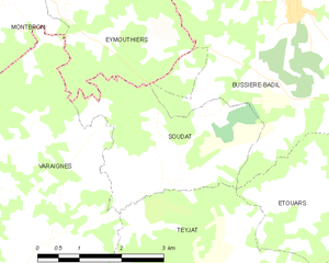
Varaignes (Varaignes)

- commune in Dordogne, France
- Country:

- Postal Code: 24360
- Coordinates: 45° 35' 53" N, 0° 31' 51" E


- GPS tracks (wikiloc): [Link]
- Area: 16.6 sq km
- Population: 418
- Wikipedia en: wiki(en)
- Wikipedia: wiki(fr)
- Wikidata storage: Wikidata: Q629868
- Wikipedia Commons Category: [Link]
- Freebase ID: [/m/03mg9jj]
- GeoNames ID: Alt: [2970744]
- SIREN number: [212405658]
- BnF ID: [15252206b]
- VIAF ID: Alt: [233833430]
- GND ID: Alt: [4308385-7]
- WOEID: [630049]
- INSEE municipality code: 24565
Shares border with regions:
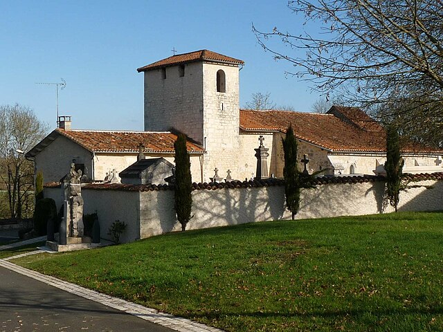
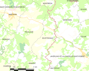
Souffrignac
- commune in Charente, France
- Country:
- Postal Code: 16380
- Coordinates: 45° 35' 33" N, 0° 30' 16" E
- GPS tracks (wikiloc): [Link]
- Area: 9.37 sq km
- Population: 141


Eymouthiers
- commune in Charente, France
- Country:
- Postal Code: 16220
- Coordinates: 45° 38' 35" N, 0° 32' 34" E
- GPS tracks (wikiloc): [Link]
- Area: 8.68 sq km
- Population: 292


Feuillade
- commune in Charente, France
- Country:
- Postal Code: 16380
- Coordinates: 45° 36' 25" N, 0° 28' 18" E
- GPS tracks (wikiloc): [Link]
- Area: 21.83 sq km
- Population: 301

Javerlhac-et-la-Chapelle-Saint-Robert
- commune in Dordogne, France
- Country:
- Postal Code: 24300
- Coordinates: 45° 34' 11" N, 0° 33' 38" E
- GPS tracks (wikiloc): [Link]
- AboveSeaLevel: 128 м m
- Area: 29.25 sq km
- Population: 858
- Web site: [Link]


Teyjat
- commune in Dordogne, France
- Country:
- Postal Code: 24300
- Coordinates: 45° 35' 9" N, 0° 34' 31" E
- GPS tracks (wikiloc): [Link]
- Area: 16.99 sq km
- Population: 278
Soudat
- commune in Dordogne, France
- Country:
- Postal Code: 24360
- Coordinates: 45° 37' 27" N, 0° 33' 53" E
- GPS tracks (wikiloc): [Link]
- Area: 8.82 sq km
- Population: 92


Montbron
- commune in Charente, France
- Country:
- Postal Code: 16220
- Coordinates: 45° 40' 2" N, 0° 30' 3" E
- GPS tracks (wikiloc): [Link]
- Area: 43.34 sq km
- Population: 2060
- Web site: [Link]