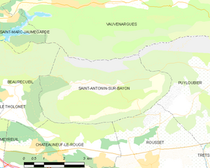
Puyloubier (Puyloubier)

- commune in Bouches-du-Rhône, France
 Hiking in Puyloubier
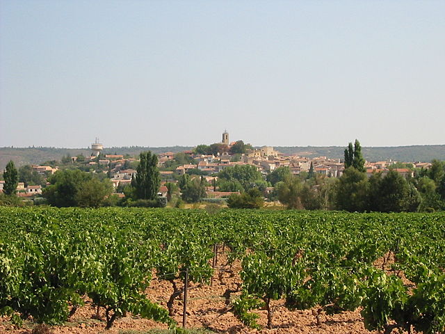
Puyloubier is a charming commune located in the Provence-Alpes-Côte d'Azur region of southern France, nestled at the foot of the Sainte-Victoire Mountain. Known for its beautiful landscapes and diverse ecosystems, it offers a variety of hiking opportunities for both novice and experienced hikers.
Highlights of Hiking in Puyloubier
-
Stunning Scenery: The area boasts picturesque views, particularly of the Sainte-Victoire Mountain, which is famed for its dramatic limestone cliffs and vibrant vegetation.
-
Diverse Trails: You can find trails suited for different skill levels, from leisurely strolls to more challenging hikes. The variety includes paths through scenic vineyards, forests, and rocky terrain.
-
Natural Attractions: The local fauna and flora are abundant, with opportunities to observe wildlife and unique plant species endemic to the region. Keep an eye out for the beautiful wildflowers in the spring!
-
Historical Sites: Hiking in Puyloubier can also lead you to various historical landmarks, including the remnants of old stone constructions and traditional Provençal farms.
-
Access to Sainte-Victoire: Puyloubier serves as a gateway to the larger network of trails that ascend to the summit of Sainte-Victoire, which offers breathtaking panoramic views. This is a popular route for those seeking to experience the mountain's dramatic landscape.
Practical Tips
-
Trail Maps: Before heading out, it’s advisable to check local maps or use hiking apps for detailed trail information.
-
Weather Considerations: The climate in this region can be warm, particularly in the summer months. Always check the weather forecast and prepare accordingly with appropriate clothing and hydration.
-
Timing: The best times for hiking are typically in the spring and autumn when the weather is milder and the scenery is particularly beautiful.
-
Local Support: Consider connecting with local hiking clubs or guides for a richer experience and to ensure safety. They can provide insights on the best trails and current conditions.
-
Respect Nature: As with all outdoor activities, be sure to follow Leave No Trace principles to help protect the environment.
Overall, hiking in Puyloubier is an enriching experience that combines physical activity with the opportunity to enjoy the natural and cultural beauty of southern France. Whether you’re looking for a peaceful walk or an adventurous climb, Puyloubier has something to offer every hiking enthusiast.
- Country:

- Postal Code: 13114
- Coordinates: 43° 31' 30" N, 5° 40' 37" E


- GPS tracks (wikiloc): [Link]
- Area: 40.85 sq km
- Population: 1799
- Web site: http://www.puyloubier.com
- Wikipedia en: wiki(en)
- Wikipedia: wiki(fr)
- Wikidata storage: Wikidata: Q675854
- Wikipedia Commons Category: [Link]
- Freebase ID: [/m/02rpclj]
- GeoNames ID: Alt: [2984944]
- SIREN number: [211300793]
- BnF ID: [15247361r]
- VIAF ID: Alt: [218573220]
- GND ID: Alt: [4625423-7]
- PACTOLS thesaurus ID: [pcrt6ZjSzJHUNE]
- MusicBrainz area ID: [fc5e4f04-a0d5-4da0-9a25-4dc96f404741]
- Pleiades ID: [148163]
- INSEE municipality code: 13079
Shares border with regions:

Saint-Antonin-sur-Bayon
- commune in Bouches-du-Rhône, France
Hiking in Saint-Antonin-sur-Bayon
Saint-Antonin-sur-Bayon, located in the Provence-Alpes-Côte d'Azur region of France, is surrounded by stunning natural landscapes, making it an ideal destination for hiking enthusiasts. Here are some highlights and tips for hiking in this beautiful area:...
- Country:
- Postal Code: 13100
- Coordinates: 43° 31' 6" N, 5° 34' 58" E
- GPS tracks (wikiloc): [Link]
- Area: 17.57 sq km
- Population: 124
- Web site: [Link]
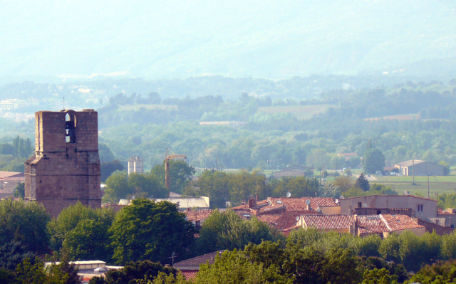

Trets
- commune in Bouches-du-Rhône, France
Hiking in Trets
Trets is a charming town located in the Provence-Alpes-Côte d'Azur region of France, and it offers access to some beautiful hiking opportunities. The surrounding landscape features rolling hills, vineyards, and stunning views of the Sainte-Victoire Mountain, making it an appealing destination for outdoor enthusiasts....
- Country:
- Postal Code: 13530
- Coordinates: 43° 26' 49" N, 5° 41' 9" E
- GPS tracks (wikiloc): [Link]
- Area: 70.31 sq km
- Population: 10963
- Web site: [Link]

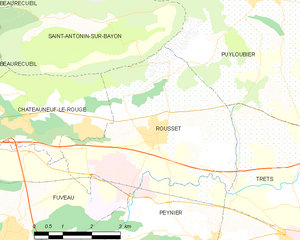
Rousset
- commune in Bouches-du-Rhône, France
Hiking in Rousset
Rousset, located in the Bouches-du-Rhône department of southern France, is a beautiful area that offers a variety of hiking opportunities, thanks to its stunning landscapes and proximity to the Sainte-Victoire Mountain. Here are some highlights for hiking in Rousset:...
- Country:
- Postal Code: 13790
- Coordinates: 43° 28' 56" N, 5° 37' 20" E
- GPS tracks (wikiloc): [Link]
- AboveSeaLevel: 224 м m
- Area: 19.5 sq km
- Population: 4768
- Web site: [Link]
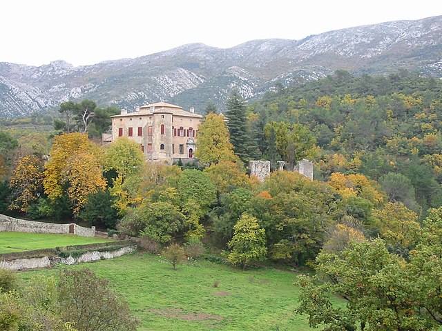

Vauvenargues
- commune in Bouches-du-Rhône, France
Hiking in Vauvenargues
Vauvenargues, located in the Bouches-du-Rhône department in Provence, France, is a picturesque destination for hiking enthusiasts. Nestled at the foot of the iconic Mont Sainte-Victoire, this area offers stunning landscapes, diverse flora and fauna, and a variety of hiking trails suitable for all levels....
- Country:
- Postal Code: 13126
- Coordinates: 43° 33' 19" N, 5° 36' 10" E
- GPS tracks (wikiloc): [Link]
- Area: 54.31 sq km
- Population: 1023


Rians
- commune in Var, France
Hiking in Rians
Rians, located in the Var department of the Provence-Alpes-Côte d'Azur region in southeastern France, offers a picturesque setting for hiking enthusiasts. Nestled in the heart of Provence, Rians is surrounded by the beautiful landscapes of rolling hills, vineyards, and lush forests, making it an excellent destination for outdoor activities....
- Country:
- Postal Code: 83560
- Coordinates: 43° 36' 25" N, 5° 45' 26" E
- GPS tracks (wikiloc): [Link]
- AboveSeaLevel: 455 м m
- Area: 96.87 sq km
- Population: 4254
- Web site: [Link]

Pourrières
- commune in Var, France
Hiking in Pourrières
Pourrières is a charming village located in the Var department of the Provence-Alpes-Côte d'Azur region in southeastern France. It is surrounded by beautiful natural landscapes, making it an excellent destination for hiking enthusiasts....
- Country:
- Postal Code: 83910
- Coordinates: 43° 30' 14" N, 5° 44' 2" E
- GPS tracks (wikiloc): [Link]
- Area: 56.32 sq km
- Population: 5000