Vaux-Rouillac (Vaux-Rouillac)

- commune in Charente, France
- Country:

- Postal Code: 16170
- Coordinates: 45° 44' 35" N, 0° 5' 29" E


- GPS tracks (wikiloc): [Link]
- Area: 13.37 sq km
- Population: 299
- Wikipedia en: wiki(en)
- Wikipedia: wiki(fr)
- Wikidata storage: Wikidata: Q1625096
- Wikipedia Commons Category: [Link]
- Freebase ID: [/m/03mcf62]
- GeoNames ID: Alt: [2970326]
- SIREN number: [211603956]
- BnF ID: [15248832s]
- WOEID: [630378]
- INSEE municipality code: 16395
Shares border with regions:


Foussignac
- commune in Charente, France
- Country:
- Postal Code: 16200
- Coordinates: 45° 43' 0" N, 0° 7' 0" E
- GPS tracks (wikiloc): [Link]
- Area: 15.14 sq km
- Population: 620


Sigogne
- commune in Charente, France
- Country:
- Postal Code: 16200
- Coordinates: 45° 44' 12" N, 0° 9' 28" E
- GPS tracks (wikiloc): [Link]
- Area: 22.16 sq km
- Population: 990
- Web site: [Link]


Plaizac
- former commune in Charente, France
- Country:
- Postal Code: 16170
- Coordinates: 45° 45' 18" N, 0° 7' 24" E
- GPS tracks (wikiloc): [Link]
- Area: 3.98 sq km
- Population: 155


Échallat
- commune in Charente, France
- Country:
- Postal Code: 16170
- Coordinates: 45° 43' 23" N, 0° 2' 26" E
- GPS tracks (wikiloc): [Link]
- Area: 15.14 sq km
- Population: 499

Rouillac
- former commune in Charente, France
- Country:
- Postal Code: 16170
- Coordinates: 45° 46' 32" N, 0° 3' 48" E
- GPS tracks (wikiloc): [Link]
- Area: 29.28 sq km
- Population: 1937
- Web site: [Link]


Saint-Cybardeaux
- commune in Charente, France
- Country:
- Postal Code: 16170
- Coordinates: 45° 46' 11" N, 0° 1' 22" E
- GPS tracks (wikiloc): [Link]
- Area: 21 sq km
- Population: 842

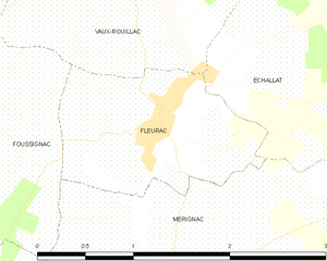
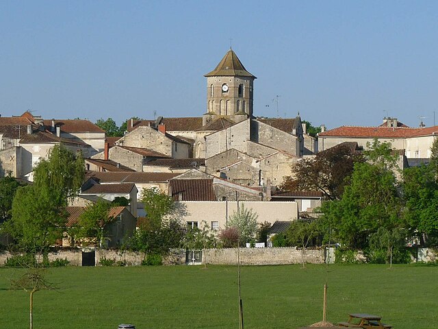
Fleurac
- commune in Charente, France
- Country:
- Postal Code: 16200
- Coordinates: 45° 43' 14" N, 0° 5' 0" E
- GPS tracks (wikiloc): [Link]
- Area: 2.17 sq km
- Population: 249