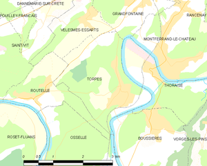
Velesmes-Essarts (Velesmes-Essarts)

- commune in Doubs, France
 Hiking in Velesmes-Essarts
Velesmes-Essarts is a charming small commune located in the Doubs department of France. While it may not be as widely known for hiking as some larger regions, it offers an array of beautiful landscapes, lush forests, and scenic routes that are quite appealing to outdoor enthusiasts.
Here are some aspects to consider when hiking in Velesmes-Essarts:
Trails and Scenery
- Natural Beauty: The area features rolling hills, dense forests, and picturesque countryside, making it ideal for hiking and nature walks.
- Trail Difficulty: The trails range from easy to moderate difficulty, suitable for both beginners and more experienced hikers.
- Wildlife Spotting: Keep an eye out for local fauna and flora; the region is home to a variety of species that can make your hike even more enjoyable.
Preparation
- Maps and Guides: It's advisable to have a detailed map or a guide to the trails in the area. Local tourist offices can provide valuable resources.
- Gear: Standard hiking gear is recommended, including sturdy footwear, appropriate clothing for the weather, and hydration supplies.
Local Attractions
- Cultural Sites: In addition to the natural beauty, there may be historical or cultural sites worth visiting in the vicinity, offering a well-rounded experience of the region.
- Food and Accommodation: After a day of hiking, you can find local restaurants and accommodations that offer regional cuisine and a comfortable place to rest.
Safety Tips
- Weather Awareness: Always check local weather conditions before setting out.
- Stay on Marked Trails: For safety and to protect the local environment, stick to marked paths.
- Inform Someone: Let someone know your hiking plans, especially if you're going on a longer trek.
Whether you’re looking for a peaceful day hike or an adventure exploring the rural landscapes, Velesmes-Essarts can provide a rewarding experience in nature. Enjoy your hiking!
- Country:

- Postal Code: 25410
- Coordinates: 47° 11' 28" N, 5° 52' 29" E


- GPS tracks (wikiloc): [Link]
- Area: 2.92 sq km
- Population: 338
- Wikipedia en: wiki(en)
- Wikipedia: wiki(fr)
- Wikidata storage: Wikidata: Q906311
- Wikipedia Commons Category: [Link]
- Freebase ID: [/m/03mgblx]
- GeoNames ID: Alt: [6430035]
- SIREN number: [212505945]
- BnF ID: [15252820j]
- INSEE municipality code: 25594
Shares border with regions:


Dannemarie-sur-Crète
- commune in Doubs, France
Hiking in Dannemarie-sur-Crète
Dannemarie-sur-Crète is a charming small village located in the Bourgogne-Franche-Comté region of eastern France. The area is known for its picturesque landscapes, rolling hills, and natural beauty, making it a great destination for hiking enthusiasts....
- Country:
- Postal Code: 25410
- Coordinates: 47° 12' 22" N, 5° 51' 56" E
- GPS tracks (wikiloc): [Link]
- Area: 4.06 sq km
- Population: 1411

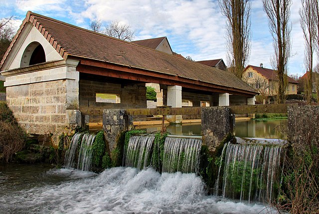
Torpes
- commune in Doubs, France
Hiking in Torpes
Torpes is a charming village located in the Doubs department of France, known for its picturesque landscapes and natural beauty. If you're interested in hiking in and around Torpes, here are some key points to consider:...
- Country:
- Postal Code: 25320
- Coordinates: 47° 10' 9" N, 5° 53' 26" E
- GPS tracks (wikiloc): [Link]
- Area: 5.55 sq km
- Population: 1060
- Web site: [Link]


Routelle
- former commune in Doubs, France
Hiking in Routelle
Routelle, situated in the French Alps, is a fantastic destination for hiking enthusiasts. The region is characterized by its stunning landscapes, diverse flora and fauna, and a variety of trails suitable for all skill levels. Here are some key points to consider when planning a hike in Routelle:...
- Country:
- Postal Code: 25410
- Coordinates: 47° 10' 4" N, 5° 50' 59" E
- GPS tracks (wikiloc): [Link]
- Area: 3.06 sq km
- Population: 501


Saint-Vit
- commune in Doubs, France
Hiking in Saint-Vit
Saint-Vit, located in the Bourgogne-Franche-Comté region of France, offers a charming backdrop for hiking enthusiasts. While it may not be as widely known as some larger hiking destinations in the country, the surrounding areas provide beautiful landscapes and trails that can be enjoyed. Here are some aspects to consider when hiking in and around Saint-Vit:...
- Country:
- Postal Code: 25410
- Coordinates: 47° 10' 53" N, 5° 48' 39" E
- GPS tracks (wikiloc): [Link]
- Area: 16.44 sq km
- Population: 4833
- Web site: [Link]

Grandfontaine
- commune in Doubs, France
Hiking in Grandfontaine
Grandfontaine, located in the Doubs department of France, is a picturesque area that offers a range of hiking opportunities amidst beautiful natural scenery. This region is part of the Jura Mountains, characterized by lush forests, rolling hills, and stunning views. Here are some key highlights for hiking in Grandfontaine:...
- Country:
- Postal Code: 25320
- Coordinates: 47° 11' 51" N, 5° 54' 2" E
- GPS tracks (wikiloc): [Link]
- Area: 5.68 sq km
- Population: 1539
- Web site: [Link]