Verson (Verson)

- commune in Calvados, France
- Country:

- Postal Code: 14790
- Coordinates: 49° 9' 18" N, 0° 27' 9" E


- GPS tracks (wikiloc): [Link]
- Area: 10.36 sq km
- Population: 3498
- Web site: http://www.ville-verson.fr
- Wikipedia en: wiki(en)
- Wikipedia: wiki(fr)
- Wikidata storage: Wikidata: Q862292
- Wikipedia Commons Category: [Link]
- Freebase ID: [/m/0412rd]
- GeoNames ID: Alt: [2969665]
- SIREN number: [211407382]
- BnF ID: [152481456]
- VIAF ID: Alt: [156390156]
- GND ID: Alt: [4325100-6]
- Library of Congress authority ID: Alt: [nr95040178]
- PACTOLS thesaurus ID: [pcrtTJmvpPFldF]
- MusicBrainz area ID: [b3179070-e77f-4847-a845-8c9dbfe83db4]
- Twitter username: Alt: [VilleVerson]
- INSEE municipality code: 14738
Shares border with regions:


Éterville
- commune in Calvados, France
- Country:
- Postal Code: 14930
- Coordinates: 49° 8' 38" N, 0° 25' 31" E
- GPS tracks (wikiloc): [Link]
- Area: 4.87 sq km
- Population: 1580


Bretteville-sur-Odon
- commune in Calvados, France
- Country:
- Postal Code: 14760
- Coordinates: 49° 10' 12" N, 0° 24' 50" E
- GPS tracks (wikiloc): [Link]
- Area: 6.46 sq km
- Population: 3823
- Web site: [Link]


Fontaine-Étoupefour
- commune in Calvados, France
- Country:
- Postal Code: 14790
- Coordinates: 49° 8' 46" N, 0° 27' 15" E
- GPS tracks (wikiloc): [Link]
- Area: 5.08 sq km
- Population: 2243
- Web site: [Link]


Baron-sur-Odon
- commune in Calvados, France
- Country:
- Postal Code: 14210
- Coordinates: 49° 7' 58" N, 0° 28' 45" E
- GPS tracks (wikiloc): [Link]
- Area: 6.43 sq km
- Population: 895
- Web site: [Link]

Carpiquet
- commune in Calvados, France
- Country:
- Postal Code: 14650
- Coordinates: 49° 11' 10" N, 0° 26' 40" E
- GPS tracks (wikiloc): [Link]
- AboveSeaLevel: 69 м m
- Area: 5.88 sq km
- Population: 2401
- Web site: [Link]


Cheux
- former commune in Calvados, France
- Country:
- Postal Code: 14210
- Coordinates: 49° 9' 58" N, 0° 31' 33" E
- GPS tracks (wikiloc): [Link]
- Area: 14.38 sq km
- Population: 1365
- Web site: [Link]


Mouen
- commune in Calvados, France
- Country:
- Postal Code: 14790
- Coordinates: 49° 8' 53" N, 0° 29' 1" E
- GPS tracks (wikiloc): [Link]
- Area: 4.16 sq km
- Population: 1489

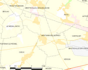
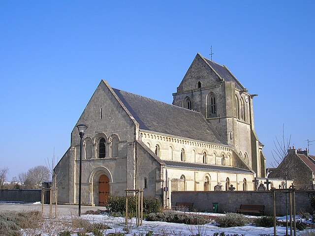
Saint-Manvieu-Norrey
- commune in Calvados, France
- Country:
- Postal Code: 14740
- Coordinates: 49° 10' 50" N, 0° 30' 5" E
- GPS tracks (wikiloc): [Link]
- AboveSeaLevel: 82 м m
- Area: 8.28 sq km
- Population: 1909
- Web site: [Link]