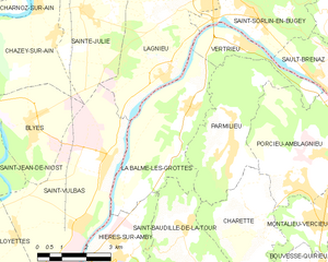
Vertrieu (Vertrieu)

- commune in Isère, France
 Hiking in Vertrieu
Vertrieu is a great destination for hiking enthusiasts. Located in the Auvergne-Rhône-Alpes region of France, it offers beautiful natural landscapes and a variety of trails suitable for different skill levels. Here are some highlights for hiking in the area:
Scenic Trails
- Wooded Paths: Vertrieu features lush forests that provide shaded trails. These paths are ideal for pleasant hikes, especially in warmer months.
- Riverside Walks: The area around the Rhône River offers stunning views and the opportunity to enjoy nature by the water.
- Panoramic Views: Some trails lead to elevated points where hikers can enjoy breathtaking vistas of the surrounding countryside and mountains.
Difficulty Levels
- Beginner Trails: There are easier routes suitable for families and those new to hiking. These trails often have gentle gradients and well-maintained paths.
- Intermediate Trails: For those with some experience, there are moderate trails that offer more of a challenge, including steeper sections and varied terrain.
Preparing for Your Hike
- Check the Weather: Always check the local weather conditions before heading out, as they can change quickly in mountainous regions.
- Footwear: Wear sturdy hiking boots or shoes for better grip and comfort on uneven surfaces.
- Hydration and Snacks: Carry enough water and some snacks to keep your energy up throughout the hike.
Additional Tips
- Maps and Guides: Consider bringing a physical map or downloading a hiking app that works offline, as cell service can be spotty in rural areas.
- Local Regulations: Stay informed about any local regulations regarding wildlife and plants, and always follow Leave No Trace principles.
Conclusion
With its combination of natural beauty, diverse terrain, and various trail options, hiking in Vertrieu can be a fulfilling outdoor experience suitable for hikers of all levels. Be sure to plan ahead to make the most of your adventure!
- Country:

- Postal Code: 38390
- Coordinates: 45° 52' 24" N, 5° 22' 1" E


- GPS tracks (wikiloc): [Link]
- Area: 4.59 sq km
- Population: 666
- Web site: http://www.commune-vertrieu.fr
- Wikipedia en: wiki(en)
- Wikipedia: wiki(fr)
- Wikidata storage: Wikidata: Q1066608
- Wikipedia Commons Category: [Link]
- Freebase ID: [/m/03nvk1p]
- GeoNames ID: Alt: [6433451]
- SIREN number: [213805393]
- BnF ID: [152583391]
- VIAF ID: Alt: [243272230]
- WOEID: [630950]
- INSEE municipality code: 38539
Shares border with regions:

La Balme-les-Grottes
- commune in Isère, France
Hiking in La Balme-les-Grottes
La Balme-les-Grottes is a charming village in the Auvergne-Rhône-Alpes region of France, known for its stunning natural surroundings and the remarkable geological formations that attract hikers and outdoor enthusiasts. Here are some highlights regarding hiking in this area:...
- Country:
- Postal Code: 38390
- Coordinates: 45° 51' 9" N, 5° 20' 12" E
- GPS tracks (wikiloc): [Link]
- Area: 14.61 sq km
- Population: 1011
- Web site: [Link]


Parmilieu
- commune in Isère, France
Hiking in Parmilieu
Parmilieu is a charming commune located in the Isère department of the Auvergne-Rhône-Alpes region in southeastern France. The area is characterized by its beautiful natural scenery, which offers excellent opportunities for hiking and outdoor activities. Here are some highlights and tips for hiking in and around Parmilieu:...
- Country:
- Postal Code: 38390
- Coordinates: 45° 50' 25" N, 5° 21' 18" E
- GPS tracks (wikiloc): [Link]
- Area: 12.83 sq km
- Population: 691
- Web site: [Link]

Lagnieu
- commune in Ain, France
Hiking in Lagnieu
Lagnieu is a charming town located in the Auvergne-Rhône-Alpes region of France, surrounded by stunning landscapes that are perfect for hiking enthusiasts. Here are some important aspects to consider if you’re planning to hike in or around Lagnieu:...
- Country:
- Postal Code: 01150
- Coordinates: 45° 54' 13" N, 5° 20' 57" E
- GPS tracks (wikiloc): [Link]
- Area: 27.25 sq km
- Population: 7022
- Web site: [Link]


Porcieu-Amblagnieu
- commune in Isère, France
Hiking in Porcieu-Amblagnieu
Porcieu-Amblagnieu is a charming commune located in the Isère department of the Auvergne-Rhône-Alpes region in France. This area is characterized by its beautiful natural landscapes, rolling hills, and proximity to the Alps, making it a fantastic destination for hiking enthusiasts....
- Country:
- Postal Code: 38390
- Coordinates: 45° 50' 3" N, 5° 24' 4" E
- GPS tracks (wikiloc): [Link]
- Area: 15.8 sq km
- Population: 1759
- Web site: [Link]

Saint-Sorlin-en-Bugey
- commune in Ain, France
Hiking in Saint-Sorlin-en-Bugey
Saint-Sorlin-en-Bugey, located in the Ain department of the Auvergne-Rhône-Alpes region in France, offers a variety of hiking opportunities that showcase its beautiful landscapes, including hills, forests, and rivers. Here are some highlights and tips for hiking in this area:...
- Country:
- Postal Code: 01150
- Coordinates: 45° 53' 6" N, 5° 22' 14" E
- GPS tracks (wikiloc): [Link]
- Area: 9.07 sq km
- Population: 1131
- Web site: [Link]

Sault-Brénaz
- commune in Ain, France
Hiking in Sault-Brénaz
Sault-Brénaz is a charming commune located in the Isère department in the Auvergne-Rhône-Alpes region of southeastern France. While it may not be as widely known as some other hiking destinations, it offers picturesque landscapes and trails suitable for various skill levels. Here are some points to consider when hiking in and around Sault-Brénaz:...
- Country:
- Postal Code: 01150
- Coordinates: 45° 51' 19" N, 5° 24' 36" E
- GPS tracks (wikiloc): [Link]
- Area: 5.61 sq km
- Population: 985
- Web site: [Link]