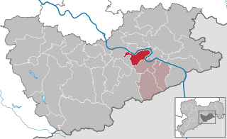
Verwaltungsgemeinschaft Königstein/Sächs. Schw. (Verwaltungsgemeinschaft Königstein/Sächs. Schw.)
- administrative community in the Free State of Saxony, Germany
 Hiking in Verwaltungsgemeinschaft Königstein/Sächs. Schw.
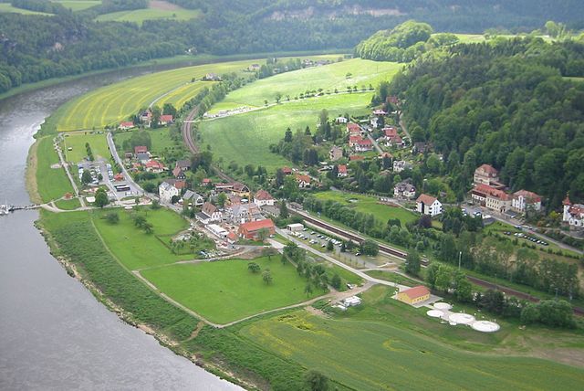
Verwaltungsgemeinschaft Königstein, located in the Saxon Switzerland region of Germany, offers a stunning landscape for hiking enthusiasts. This area is renowned for its dramatic sandstone formations, deep valleys, and dense forests, making it a popular destination for both casual walkers and experienced hikers.
Key Highlights for Hiking in the Region:
-
Scenic Trails: There are a variety of hiking trails catering to different skill levels. Popular routes include those that lead to famous sights like the Bastei Bridge, with panoramic views of the Elbe River, and the Königstein Fortress, one of the largest hilltop fortifications in Europe.
-
Natural Beauty: The Saxon Switzerland National Park, adjacent to the Verwaltungsgemeinschaft, is renowned for its breathtaking natural scenery, featuring unique rock formations, diverse flora, and fauna. Trails often integrate stunning landscapes, including waterfalls and scenic overlooks.
-
Trail Information: The trails are well-marked and maintained, with maps readily available at tourist information centers. It's advisable to check trail difficulties and lengths in advance to suit your fitness level and experience.
-
Seasons: Spring and fall are particularly beautiful times to hike in this region due to mild weather and vibrant foliage. Summer can be busy, especially on popular trails, so plan to start early in the day for a quieter experience.
-
Local Culture: Along the trails, you may encounter charming villages with traditional architecture, where you can enjoy local cuisine and perhaps stop at a café for refreshments.
-
Safety Tips: While hiking, ensure you have appropriate gear, such as sturdy shoes, weather-appropriate clothing, and sufficient water. Always inform someone of your hiking plans and estimated return time.
Popular Hiking Routes:
-
The Malerweg Trail: This is a classic hiking route that includes some of the most scenic parts of Saxon Switzerland. It spans about 112 kilometers and can be split into multiple days of hiking, allowing for exploration of various natural and historical landmarks.
-
Schrammsteine: A challenging but rewarding hike that offers spectacular views from the rocky peaks.
-
Lilienstein: This prominent peak provides excellent panoramic views and is accessible via well-marked trails.
Conclusion:
Hiking in Verwaltungsgemeinschaft Königstein and the surrounding Saxon Switzerland region offers an unforgettable experience for nature lovers and adventure seekers alike. Whether you’re gazing down from a cliff or wandering through ancient forests, this region is sure to captivate and inspire. Always check local guidelines and weather conditions to ensure a safe and enjoyable hike.
- Country:

- Coordinates: 50° 55' 0" N, 14° 4' 0" E


- GPS tracks (wikiloc): [Link]
- Wikidata storage: Wikidata: Q8271
Includes regions:


Königstein
- town in the Free State of Saxony in Germany
Hiking in Königstein
Königstein, located in the Saxon Switzerland region of Germany, is renowned for its stunning natural landscapes, rich history, and excellent hiking opportunities. Here are some key highlights regarding hiking in and around Königstein:...
- Country:
- Postal Code: 01824
- Local Dialing Code: 035021
- Licence Plate Code: PIR
- Coordinates: 50° 55' 8" N, 14° 4' 17" E
- GPS tracks (wikiloc): [Link]
- AboveSeaLevel: 212 м m
- Area: 26.93 sq km
- Population: 2098
- Web site: [Link]

Rathen
- village in Saxony, Germany
Hiking in Rathen
Rathen is a picturesque village located in the Saxon Switzerland region of Germany, which is renowned for its stunning landscapes, rock formations, and hiking trails. If you're considering hiking in Rathen, here are some essentials and highlights to keep in mind:...
- Country:
- Postal Code: 01824
- Local Dialing Code: 035024
- Licence Plate Code: PIR
- Coordinates: 50° 57' 0" N, 14° 5' 0" E
- GPS tracks (wikiloc): [Link]
- AboveSeaLevel: 112 м m
- Area: 3.58 sq km
- Population: 348
- Web site: [Link]


Rosenthal-Bielatal
- municipality in the Sächsische Schweiz-Osterzgebirge district, in Saxony, Germany
Hiking in Rosenthal-Bielatal
Rosenthal-Bielatal is a beautiful region located in the eastern part of Germany, near the borders of the Czech Republic. It is known for its stunning natural landscapes, rocky cliffs, and dense forests, making it an excellent destination for hiking enthusiasts....
- Country:
- Postal Code: 01824
- Local Dialing Code: 035033
- Licence Plate Code: PIR
- Coordinates: 50° 52' 0" N, 14° 3' 0" E
- GPS tracks (wikiloc): [Link]
- AboveSeaLevel: 408 м m
- Area: 46.6 sq km
- Population: 1600
- Web site: [Link]

Struppen
- municipality in the Sächsische Schweiz-Osterzgebirge district, in Saxony, Germany
Hiking in Struppen
Struppen is a small village located in Saxony, Germany, near the beautiful town of Pirna and close to the stunning Elbe Sandstone Mountains, also known as the Saxon Switzerland National Park. The area is renowned for its dramatic rock formations, deep valleys, and scenic trails, making it a fantastic destination for hiking enthusiasts....
- Country:
- Postal Code: 01796
- Local Dialing Code: 035020
- Licence Plate Code: PIR
- Coordinates: 50° 56' 0" N, 14° 1' 0" E
- GPS tracks (wikiloc): [Link]
- AboveSeaLevel: 231 м m
- Area: 20.65 sq km
- Population: 2488
- Web site: [Link]