Königstein (Königstein)
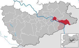
- town in the Free State of Saxony in Germany
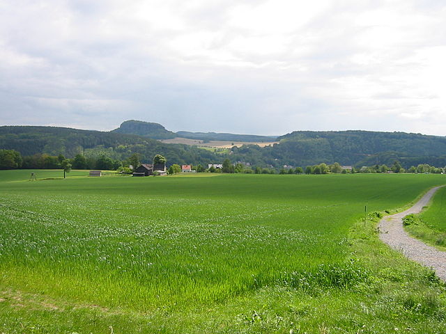
Königstein, located in the Saxon Switzerland region of Germany, is renowned for its stunning natural landscapes, rich history, and excellent hiking opportunities. Here are some key highlights regarding hiking in and around Königstein:
Scenic Views and Terrain
- Breathtaking Landscapes: The area is characterized by unique sandstone formations, dense forests, and panoramic views of the Elbe River. The rock formations are an essential feature of the Saxon Switzerland National Park.
- Variety of Trails: There are numerous hiking trails suitable for varying skill levels, from leisurely walks to more challenging treks. The trails often lead through picturesque valleys, rocky cliffs, and serene woodlands.
Popular Trails
- Königstein Fortress Trail: This trail takes you to the imposing Königstein Fortress, one of the largest hilltop fortifications in Europe. The views from the fortress are spectacular.
- Malerweg (Painter's Way): This famous long-distance hiking trail runs through the Saxon Switzerland region, passing through Königstein. It is approximately 112 km long and includes beautiful views that inspired many artists.
- Schrammsteine: For those seeking more adventure, the Schrammsteine area offers rugged trails and climbing opportunities, providing stunning vistas and a more challenging hike.
Wildlife and Nature
- Biodiversity: The region is home to diverse flora and fauna. Hikers might spot various bird species, deer, and other wildlife while exploring the area.
- Seasonal Beauty: Each season offers a different experience, from vibrant autumn foliage to snowy landscapes in winter and lush greenery in spring and summer.
Practical Tips
- Weather: Always check the weather before heading out, as conditions can change quickly in the mountains.
- Footwear and Gear: Wear sturdy hiking boots and bring along essentials like water, snacks, a map, and a first-aid kit.
- Guided Tours: If you're unfamiliar with the area, consider joining a guided hiking tour to learn more about the landscape and ensure you stay on track.
Accessibility
- Getting There: Königstein is accessible by train or car, and there are good public transport options to nearby hiking starting points.
- Facilities: The town of Königstein has amenities such as restaurants and accommodations, making it a convenient base for hikers.
Königstein offers a wonderful blend of history, adventure, and natural beauty, making it a fantastic destination for hikers of all experience levels. Whether you’re looking for a short day hike or an extended trek, you’ll find plenty to keep you engaged and inspired.
- Country:

- Postal Code: 01824
- Local Dialing Code: 035021
- Licence Plate Code: PIR
- Coordinates: 50° 55' 8" N, 14° 4' 17" E


- GPS tracks (wikiloc): [Link]
- AboveSeaLevel: 212 м m
- Area: 26.93 sq km
- Population: 2098
- Web site: http://www.koenigstein-sachsen.de
- Wikipedia en: wiki(en)
- Wikipedia: wiki(de)
- Wikidata storage: Wikidata: Q6783
- Wikipedia Commons Category: [Link]
- Freebase ID: [/m/08fpql]
- Freebase ID: [/m/08fpql]
- GeoNames ID: Alt: [2885764]
- GeoNames ID: Alt: [2885764]
- VIAF ID: Alt: [146087068]
- VIAF ID: Alt: [146087068]
- OSM relation ID: [534526]
- OSM relation ID: [534526]
- GND ID: Alt: [4031558-7]
- GND ID: Alt: [4031558-7]
- MusicBrainz area ID: [b094248a-319e-4178-b5d2-86108abe27a9]
- MusicBrainz area ID: [b094248a-319e-4178-b5d2-86108abe27a9]
- Quora topic ID: [Königstein]
- Quora topic ID: [Königstein]
- Facebook Places ID: [110585408968453]
- Facebook Places ID: [110585408968453]
- German municipality key: 14628210
- German municipality key: 14628210
Includes regions:
Halbestadt
- village in Germany
Halbestadt, while not widely recognized, may refer to a fictional or lesser-known location. However, if you're seeking general advice for hiking in small or less-known towns, I can provide you with useful tips and information....
- Country:

- Coordinates: 50° 55' 20" N, 14° 4' 10" E


- GPS tracks (wikiloc): [Link]

Ebenheit
- village in Germany
Ebenheit, located near Königstein in Germany, is a lovely hiking destination that offers stunning views and a variety of trails suitable for different skill levels. The area is characterized by its picturesque landscapes, featuring lush forests, rocky outcrops, and scenic vistas of the Saxon Switzerland National Park....
- Country:

- Coordinates: 50° 55' 32" N, 14° 4' 30" E


- GPS tracks (wikiloc): [Link]
Leupoldishain
- village in Germany
Leupoldishain is a charming small village located in the Saxony region of Germany, surrounded by beautiful landscapes that are perfect for hiking enthusiasts. The area is characterized by its lush forests, rolling hills, and picturesque valleys, making it a great destination for both casual walkers and more experienced hikers....
- Country:

- Postal Code: 01824
- Local Dialing Code: 035021
- Coordinates: 50° 54' 21" N, 14° 1' 34" E


- GPS tracks (wikiloc): [Link]
- AboveSeaLevel: 292 м m

Pfaffendorf
- village in Germany
Pfaffendorf is a charming village located in the Königstein im Taunus region of Germany, known for its beautiful landscapes and hiking opportunities. The area is part of the larger Taunus mountain range, which offers a variety of trails suitable for hikers of all skill levels. Here are some highlights of hiking in Pfaffendorf and the surrounding region:...
- Country:

- Postal Code: 01824
- Local Dialing Code: 035021
- Coordinates: 50° 54' 32" N, 14° 4' 40" E


- GPS tracks (wikiloc): [Link]
Hütten
- village in Germany
Hütten, located in Königstein, is a fantastic area for hiking enthusiasts. The region is known for its stunning natural landscapes, including breathtaking views of the Saxon Switzerland National Park, rock formations, and lush forests. Here are some highlights and tips for hiking in this area:...
- Country:

- Postal Code: 01824
- Local Dialing Code: 035021
- Coordinates: 50° 54' 45" N, 14° 3' 10" E


- GPS tracks (wikiloc): [Link]
Shares border with regions:


Bad Gottleuba-Berggießhübel
- town in the Free State of Saxony, Germany
 Hiking in Bad Gottleuba-Berggießhübel
Bad Gottleuba-Berggießhübel is a picturesque region located in the Saxon Switzerland area of Germany, known for its stunning landscapes, rich natural beauty, and a variety of hiking opportunities. Here are some key points to consider if you plan to hike in this area:...
- Country:

- Postal Code: 01816
- Local Dialing Code: 035054; 035032; 035025; 035023
- Licence Plate Code: PIR
- Coordinates: 50° 51' 30" N, 13° 57' 0" E


- GPS tracks (wikiloc): [Link]
- AboveSeaLevel: 364 м m
- Area: 88.75 sq km
- Population: 5624
- Web site: [Link]


Bad Schandau
- town in Germany
Bad Schandau, located in the Saxon Switzerland National Park in Germany, is a splendid destination for hiking enthusiasts. Known for its stunning sandstone formations, lush forests, and picturesque landscapes along the Elbe River, it offers a variety of trails for all skill levels. Here are some highlights:...
- Country:

- Postal Code: 01812–01814
- Local Dialing Code: 035022
- Licence Plate Code: PIR
- Coordinates: 50° 55' 0" N, 14° 9' 0" E


- GPS tracks (wikiloc): [Link]
- AboveSeaLevel: 146 м m
- Area: 46.77 sq km
- Population: 3606
- Web site: [Link]
