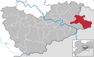
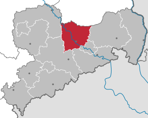
Sächsische Schweiz-Osterzgebirge (Landkreis Sächsische Schweiz-Osterzgebirge)

- district of Saxony, Germany
 Hiking in Sächsische Schweiz-Osterzgebirge
Sächsische Schweiz-Osterzgebirge, or Saxon Switzerland and the Eastern Ore Mountains, is a stunning region in Germany, renowned for its breathtaking landscapes, unique rock formations, and extensive hiking opportunities. Here are some key features and tips for hiking in this beautiful area:
Natural Features:
-
Elbsandsteingebirge: The region is part of the Elbe Sandstone Mountains, characterized by striking sandstone cliffs, deep gorges, and lush forests. Notable formations include the Bastei Bridge and the Königstein Fortress.
-
Biodiversity: The area boasts a rich variety of flora and fauna. Keep an eye out for rare bird species like the peregrine falcon, as well as diverse plant life, particularly in the spring and summer months.
-
Rivers and Lakes: The Elbe River runs through the region, providing scenic views and opportunities for water activities, such as canoeing or kayaking.
Hiking Trails:
-
Well-Marked Paths: The hiking trails in the Sächsische Schweiz are well-maintained and signposted, ranging from easy walks to challenging hikes. The Malerweg (Painter’s Way) is one of the most famous, offering a route that showcases stunning views and artistic landscapes.
-
Difficulty Levels: Trails vary widely in difficulty:
- Easy: Family-friendly paths that are suitable for all ages.
- Moderate: Scenic routes that may include some elevation changes.
- Difficult: More technical trails that require a good level of fitness and experience, often with rock scrambling involved.
-
Multi-Day Hikes: For those looking for an extended adventure, consider multi-day hikes where you can explore more remote areas, camping or staying in local accommodations.
Best Times to Visit:
- Spring and Autumn: These seasons are ideal for hiking due to mild temperatures and beautiful scenery, with spring flowers blooming in the meadows and autumn colors lighting up the forests.
- Summer: While it can be crowded, summer offers long days and a vibrant environment, perfect for hiking and enjoying the great outdoors.
- Winter: For those who enjoy winter sports, there are opportunities for snowshoeing and winter hiking, but trails can be icy, so proper equipment is essential.
Safety and Preparation:
- Gear: Ensure you have appropriate hiking gear, including good hiking boots, weather-appropriate clothing, and plenty of water and snacks.
- Maps and Navigation: Though trails are marked, carrying a map or GPS device is advisable, especially in less-trafficked areas.
- Local Regulations: Be aware of local rules and regulations regarding wildlife protection and trail usage to minimize your impact on the environment.
Accessibility:
- The region is fairly accessible by public transport from major cities in Germany, making it easy to reach trailheads.
Hiking in Sächsische Schweiz-Osterzgebirge provides a fantastic blend of natural beauty, adventure, and cultural experiences. Be sure to take your time to appreciate the stunning views and unique landscapes!
- Country:

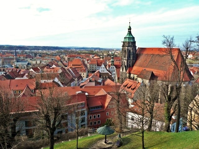
- Capital: Pirna
- Licence Plate Code: SEB; PIR; FTL; DW
- Coordinates: 50° 54' 0" N, 13° 50' 0" E


- GPS tracks (wikiloc): [Link]
- Area: 1653.64 sq km
- Population: 246066
- Web site: http://www.landratsamt-pirna.de/
- Wikipedia en: wiki(en)
- Wikipedia: wiki(de)
- Wikidata storage: Wikidata: Q6323
- Wikipedia Commons Category: [Link]
- Wikipedia Commons Maps Category: [Link]
- Freebase ID: [/m/04jn8pz]
- VIAF ID: Alt: [242333665]
- OSM relation ID: [62485]
- GND ID: Alt: [7638189-4]
- archINFORM location ID: [8945]
- NUTS code: [DED2F]
- German district key: 14628
Includes regions:


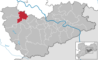
Altenberg
- municipality of Germany
Hiking in Altenberg
Altenberg, Saxony, is a picturesque destination known for its stunning natural landscapes, making it an excellent location for hiking enthusiasts. Situated in the Ore Mountains (Erzgebirge), Altenberg offers a variety of hiking trails that cater to different skill levels and preferences....
- Country:
- Postal Code: 01778; 01773
- Local Dialing Code: 035057; 035056; 035054; 035052
- Licence Plate Code: PIR
- Coordinates: 50° 45' 52" N, 13° 45' 28" E
- GPS tracks (wikiloc): [Link]
- AboveSeaLevel: 750 м m
- Area: 145810000 sq km
- Population: 7926
- Web site: [Link]
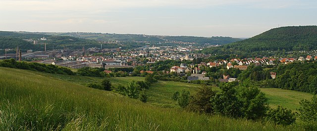
Freital
- town in the district of Sächsische Schweiz-Osterzgebirge in the Free State of Saxony, Germany
Hiking in Freital
Freital, located in Saxony, Germany, is surrounded by beautiful landscapes and offers various hiking opportunities for both novice and experienced hikers. Here are some highlights about hiking in the Freital area:...
- Country:
- Postal Code: 01705; 8225; 8212; 8211; 8210
- Local Dialing Code: 0351
- Coordinates: 51° 1' 0" N, 13° 39' 0" E
- GPS tracks (wikiloc): [Link]
- AboveSeaLevel: 171 м m
- Area: 40.45 sq km
- Population: 39300
- Web site: [Link]


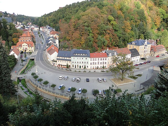
Bad Gottleuba-Berggießhübel
- town in the Free State of Saxony, Germany
Hiking in Bad Gottleuba-Berggießhübel
Bad Gottleuba-Berggießhübel is a picturesque region located in the Saxon Switzerland area of Germany, known for its stunning landscapes, rich natural beauty, and a variety of hiking opportunities. Here are some key points to consider if you plan to hike in this area:...
- Country:
- Postal Code: 01816
- Local Dialing Code: 035054; 035032; 035025; 035023
- Licence Plate Code: PIR
- Coordinates: 50° 51' 30" N, 13° 57' 0" E
- GPS tracks (wikiloc): [Link]
- AboveSeaLevel: 364 м m
- Area: 88.75 sq km
- Population: 5624
- Web site: [Link]

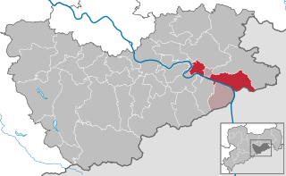
Bad Schandau
- town in Germany
Hiking in Bad Schandau
Bad Schandau, located in the Saxon Switzerland National Park in Germany, is a splendid destination for hiking enthusiasts. Known for its stunning sandstone formations, lush forests, and picturesque landscapes along the Elbe River, it offers a variety of trails for all skill levels. Here are some highlights:...
- Country:
- Postal Code: 01812–01814
- Local Dialing Code: 035022
- Licence Plate Code: PIR
- Coordinates: 50° 55' 0" N, 14° 9' 0" E
- GPS tracks (wikiloc): [Link]
- AboveSeaLevel: 146 м m
- Area: 46.77 sq km
- Population: 3606
- Web site: [Link]


Bahretal
- municipality in the Sächsische Schweiz-Osterzgebirge district in Saxony, Germany
Hiking in Bahretal
Bahretal is a picturesque municipality in Saxony, Germany, known for its charming landscapes and opportunities for hiking and outdoor activities. While it may not be as widely recognized as some major hiking destinations, it offers a variety of trails and scenic routes that cater to both casual walkers and more experienced hikers....
- Country:
- Postal Code: 01819
- Local Dialing Code: 035025; 035023
- Licence Plate Code: PIR
- Coordinates: 50° 53' 15" N, 13° 54' 0" E
- GPS tracks (wikiloc): [Link]
- AboveSeaLevel: 299 м m
- Area: 36.47 sq km
- Population: 2193
- Web site: [Link]

Bannewitz
- municipality in the Sächsische Schweiz-Osterzgebirge district, in the Free State of Saxony, Germany
Hiking in Bannewitz
Bannewitz is a charming municipality located in Saxony, Germany, not far from the city of Dresden. It offers a variety of hiking opportunities that showcase the beautiful landscapes of the region, including rolling hills, forests, and scenic views. Here are some highlights for hiking in Bannewitz:...
- Country:
- Postal Code: 01728
- Local Dialing Code: 035206; 0351
- Licence Plate Code: PIR
- Coordinates: 50° 59' 35" N, 13° 43' 0" E
- GPS tracks (wikiloc): [Link]
- AboveSeaLevel: 280 м m
- Area: 25.81 sq km
- Population: 10803
- Web site: [Link]


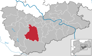
Dippoldiswalde
- town in the Free State of Saxony, Germany
Hiking in Dippoldiswalde
Dippoldiswalde, located in the German state of Saxony, is a lovely area for hiking enthusiasts. Nestled near the Erzgebirge (Ore Mountains), it offers beautiful landscapes, diverse trails, and rich natural scenery. Here are some highlights for hiking in and around Dippoldiswalde:...
- Country:
- Postal Code: 01744
- Local Dialing Code: 035052; 03504
- Coordinates: 50° 53' 36" N, 13° 40' 0" E
- GPS tracks (wikiloc): [Link]
- AboveSeaLevel: 375 м m
- Area: 104.13 sq km
- Population: 14405
- Web site: [Link]


Dohma
- municipality in the Sächsische Schweiz-Osterzgebirge district, in Saxony, Germany
Hiking in Dohma
Dohma is not a well-known location in the hiking community, so I'll do my best to provide information based on general advice for hiking in regions that may have similar features. If you meant a specific area or if there's a typo in the name, please clarify!...
- Country:
- Postal Code: 01796
- Local Dialing Code: 03501
- Licence Plate Code: PIR
- Coordinates: 50° 55' 0" N, 13° 56' 0" E
- GPS tracks (wikiloc): [Link]
- AboveSeaLevel: 215 м m
- Area: 19.53 sq km
- Population: 1955
- Web site: [Link]


Dohna
- town in the Sächsische Schweiz-Osterzgebirge district, Saxony, Germany
Hiking in Dohna
Hiking in Dohna, a small town in Saxony, Germany, offers a scenic experience with beautiful landscapes and trails. Here are some key points to consider when hiking in this area:...
- Country:
- Postal Code: 01809
- Local Dialing Code: 03529
- Licence Plate Code: PIR
- Coordinates: 50° 57' 17" N, 13° 51' 27" E
- GPS tracks (wikiloc): [Link]
- AboveSeaLevel: 164 м m
- Area: 28.58 sq km
- Population: 6270
- Web site: [Link]

Sebnitz
- town in the Sächsische Schweiz-Osterzgebirge district, in the Free State of Saxony, Germany
Hiking in Sebnitz
Sebnitz, a charming town located in Saxony, Germany, is renowned for its beautiful scenery and picturesque hiking opportunities, particularly within the nearby Saxon Switzerland National Park. Here are some highlights and tips for hiking in and around Sebnitz:...
- Country:
- Postal Code: 01851–01855
- Local Dialing Code: 035971
- Coordinates: 50° 58' 0" N, 14° 17' 0" E
- GPS tracks (wikiloc): [Link]
- AboveSeaLevel: 379 м m
- Area: 88.23 sq km
- Population: 9571
- Web site: [Link]


Dorfhain
- municipality in the Sächsische Schweiz-Osterzgebirge district, in Saxony, Germany
Hiking in Dorfhain
Dorfhain, a small village in Germany, is known for its picturesque landscapes and natural surroundings, making it a great spot for hiking enthusiasts. Here are some aspects to consider if you're planning a hiking trip there:...
- Country:
- Postal Code: 01738
- Local Dialing Code: 035055
- Licence Plate Code: PIR
- Coordinates: 50° 56' 0" N, 13° 34' 0" E
- GPS tracks (wikiloc): [Link]
- AboveSeaLevel: 341 м m
- Area: 6.25 sq km
- Population: 1073
- Web site: [Link]


Dürrröhrsdorf-Dittersbach
- municipality in the district of Sächsische Schweiz-Osterzgebirge, Germany
Hiking in Dürrröhrsdorf-Dittersbach
Dürrröhrsdorf-Dittersbach is a beautiful area located in the Saxony region of Germany, known for its picturesque landscapes, charming villages, and numerous opportunities for outdoor activities, including hiking. Here are some highlights for hiking in this region:...
- Country:
- Postal Code: 01833
- Local Dialing Code: 035026
- Licence Plate Code: PIR
- Coordinates: 51° 2' 0" N, 14° 0' 0" E
- GPS tracks (wikiloc): [Link]
- AboveSeaLevel: 240 м m
- Area: 43.5 sq km
- Population: 4200
- Web site: [Link]

Glashütte
- town in Sächsische Schweiz-Osterzgebirge, Free State of Saxony, Germany
Hiking in Glashütte
Glashütte, located in the Saxon Switzerland region of Germany, offers a wonderful experience for hiking enthusiasts. Renowned for its striking sandstone cliffs, dense forests, and beautiful valleys, the area is part of the Saxon Switzerland National Park, which boasts numerous trails with varying degrees of difficulty, making it accessible for both beginners and experienced hikers....
- Country:
- Postal Code: 01768
- Local Dialing Code: 035053
- Licence Plate Code: PIR
- Coordinates: 50° 51' 0" N, 13° 47' 0" E
- GPS tracks (wikiloc): [Link]
- AboveSeaLevel: 340 м m
- Area: 95.57 sq km
- Population: 6691
- Web site: [Link]


Gohrisch
- municipality in the Sächsische Schweiz-Osterzgebirge district, in Saxony, Germany
Hiking in Gohrisch
Gohrisch is a beautiful area located in the Saxon Switzerland region of Germany, known for its stunning sandstone rock formations, lush forests, and breathtaking landscapes. This region is a part of the Saxon Switzerland National Park, which is a popular destination for hiking enthusiasts....
- Country:
- Postal Code: 01824
- Local Dialing Code: 035021
- Licence Plate Code: PIR
- Coordinates: 50° 54' 35" N, 14° 6' 29" E
- GPS tracks (wikiloc): [Link]
- AboveSeaLevel: 300 м m
- Area: 34.86 sq km
- Population: 1862
- Web site: [Link]


Heidenau
- town in the Sächsische Schweiz-Osterzgebirge district, in the Free State of Saxony, Germany
Hiking in Heidenau
Heidenau, located in Germany near the Elbe River and in close proximity to the picturesque Saxon Switzerland National Park, offers a variety of hiking opportunities for enthusiasts of all skill levels. Here are some highlights of hiking in and around Heidenau:...
- Country:
- Postal Code: 01801–01809
- Local Dialing Code: 03529
- Licence Plate Code: PIR
- Coordinates: 50° 59' 0" N, 13° 52' 0" E
- GPS tracks (wikiloc): [Link]
- AboveSeaLevel: 121 м m
- Area: 11.07 sq km
- Population: 16608
- Web site: [Link]


Hermsdorf/Erzgeb.
- municipality in the Sächsische Schweiz-Osterzgebirge district, in Saxony, Germany
Hiking in Hermsdorf/Erzgeb.
Hermsdorf, located in Saxony, Germany, is a charming starting point for various hiking adventures thanks to its picturesque landscapes and proximity to the Ore Mountains (Erzgebirge). Here are some key points about hiking in and around Hermsdorf:...
- Country:
- Postal Code: 01776
- Local Dialing Code: 035057
- Licence Plate Code: PIR
- Coordinates: 50° 45' 40" N, 13° 37' 47" E
- GPS tracks (wikiloc): [Link]
- AboveSeaLevel: 720 м m
- Area: 20.06 sq km
- Population: 792
- Web site: [Link]


Hohnstein
- town in the Sächsische Schweiz-Osterzgebirge district, in the Free State of Saxony, Germany
Hiking in Hohnstein
Hohnstein is a charming town located in Saxon Switzerland, Germany, an area known for its stunning natural landscapes, unique rock formations, and excellent hiking opportunities. Here are some highlights and tips for hiking in and around Hohnstein:...
- Country:
- Postal Code: 01848
- Local Dialing Code: 035975
- Licence Plate Code: PIR
- Coordinates: 50° 59' 0" N, 14° 7' 0" E
- GPS tracks (wikiloc): [Link]
- AboveSeaLevel: 330 м m
- Area: 64.61 sq km
- Population: 3301
- Web site: [Link]


Kreischa
- municipality in the Sächsische Schweiz-Osterzgebirge district, Saxony, Germany
Hiking in Kreischa
Kreischa is a charming village located in the Saxon Switzerland region of Germany, not far from the city of Dresden. It provides access to beautiful hiking trails that cater to various skill levels. Here are some highlights and tips for hiking in and around Kreischa:...
- Country:
- Postal Code: 01731
- Local Dialing Code: 035206
- Licence Plate Code: PIR
- Coordinates: 50° 57' 0" N, 13° 46' 0" E
- GPS tracks (wikiloc): [Link]
- AboveSeaLevel: 257 м m
- Area: 28.97 sq km
- Population: 4517
- Web site: [Link]


Neustadt in Sachsen
- town in the Sächsische Schweiz-Osterzgebirge district, in the Free State of Saxony, Germany
Hiking in Neustadt in Sachsen
Neustadt in Sachsen is a charming town located in the Saxon Switzerland region of Germany, known for its stunning natural landscapes and outdoor activities, particularly hiking. Here are some highlights for hiking in this area:...
- Country:
- Postal Code: 01841–01844
- Local Dialing Code: 03596
- Licence Plate Code: PIR
- Coordinates: 51° 1' 26" N, 14° 13' 0" E
- GPS tracks (wikiloc): [Link]
- AboveSeaLevel: 340 м m
- Area: 83.12 sq km
- Population: 12148
- Web site: [Link]


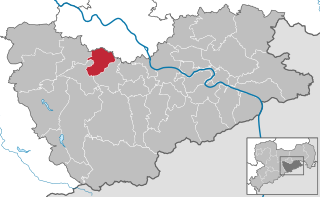
Rabenau
- town in the Sächsische Schweiz-Osterzgebirge district, in the Free State of Saxony, Germany
Hiking in Rabenau
Rabenau, a charming town located in Saxony, Germany, offers numerous opportunities for hiking enthusiasts. Nestled near the picturesque Saxon Switzerland National Park and the Erzgebirge (Ore Mountains), Rabenau serves as a great starting point for exploring the natural beauty of the region....
- Country:
- Postal Code: 01734
- Local Dialing Code: 0351
- Licence Plate Code: PIR
- Coordinates: 50° 58' 0" N, 13° 38' 0" E
- GPS tracks (wikiloc): [Link]
- AboveSeaLevel: 320 м m
- Area: 30.73 sq km
- Population: 4359
- Web site: [Link]


Stolpen
- town in the district of Sächsische Schweiz-Osterzgebirge, in the Free State of Saxony, Germany
Hiking in Stolpen
Stolpen, located in the Saxony region of Germany, is known for its scenic landscapes and historical significance. Here are some key points about hiking in Stolpen:...
- Country:
- Postal Code: 01833
- Local Dialing Code: 035973
- Licence Plate Code: PIR
- Coordinates: 51° 2' 56" N, 14° 4' 58" E
- GPS tracks (wikiloc): [Link]
- AboveSeaLevel: 274 м m
- Area: 60.89 sq km
- Population: 5649
- Web site: [Link]


Wilsdruff
- town in the Sächsische Schweiz-Osterzgebirge, in the Free State of Saxony, Germany
Hiking in Wilsdruff
Wilsdruff, located in Saxony, Germany, is a charming town that offers access to various hiking opportunities in the surrounding area. The region is characterized by scenic landscapes, forests, and hills, making it suitable for both novice and experienced hikers. Here are some highlights and tips for hiking in and around Wilsdruff:...
- Country:
- Postal Code: 01723; 8224
- Local Dialing Code: 0351; 035203; 035209; 035204
- Licence Plate Code: PIR
- Coordinates: 51° 3' 8" N, 13° 32' 18" E
- GPS tracks (wikiloc): [Link]
- AboveSeaLevel: 273 м m
- Area: 81.6 sq km
- Population: 14163
- Web site: [Link]
Altenberg Administrative Community
- management community in the Free State of Saxony, Germany
Hiking in Altenberg Administrative Community
Verwaltungsgemeinschaft Altenberg, located in Saxony, Germany, offers beautiful landscapes and a variety of hiking trails, making it an excellent destination for outdoor enthusiasts. The region is characterized by its picturesque scenery, dense forests, and hilly terrain, allowing for hikes that cater to various skill levels....

Verwaltungsgemeinschaft Bad Gottleuba-Berggießhübel
- administrative community in the Free State of Saxony, Germany
Hiking in Verwaltungsgemeinschaft Bad Gottleuba-Berggießhübel
Verwaltungsgemeinschaft Bad Gottleuba-Berggießhübel is located in the Saxon Switzerland region of Germany, known for its stunning natural landscape, which includes rock formations, dense forests, and picturesque views. This area is part of the larger Saxon Switzerland National Park, making it a fantastic location for hiking enthusiasts....
- Country:
- Coordinates: 50° 51' 30" N, 13° 57' 0" E
- GPS tracks (wikiloc): [Link]

Verwaltungsgemeinschaft Bad Schandau
- management community in the Free State of Saxony, Germany
Hiking in Verwaltungsgemeinschaft Bad Schandau
Verwaltungsgemeinschaft Bad Schandau, located in the Saxon Switzerland region of Germany, is renowned for its stunning natural beauty and excellent hiking opportunities. The area is part of the Saxon Switzerland National Park, which features dramatic sandstone cliffs, deep gorges, lush forests, and stunning views of the Elbe River. Here are some highlights for hiking in this region:...
- Country:
- Coordinates: 50° 55' 0" N, 14° 9' 0" E
- GPS tracks (wikiloc): [Link]

Verwaltungsgemeinschaft Dohna-Müglitztal
- administrative community in the Free State of Saxony, Germany
Hiking in Verwaltungsgemeinschaft Dohna-Müglitztal
Verwaltungsgemeinschaft Dohna-Müglitztal is located in the Saxony region of Germany, nestled within a picturesque landscape that features rolling hills, forests, and rivers. This area is well-suited for hiking, offering a range of trails catering to different skill levels, from easy walks to more challenging hikes....
- Country:
- Coordinates: 50° 57' 0" N, 13° 51' 0" E
- GPS tracks (wikiloc): [Link]

Verwaltungsgemeinschaft Königstein/Sächs. Schw.
- administrative community in the Free State of Saxony, Germany
Hiking in Verwaltungsgemeinschaft Königstein/Sächs. Schw.
Verwaltungsgemeinschaft Königstein, located in the Saxon Switzerland region of Germany, offers a stunning landscape for hiking enthusiasts. This area is renowned for its dramatic sandstone formations, deep valleys, and dense forests, making it a popular destination for both casual walkers and experienced hikers....
- Country:
- Coordinates: 50° 55' 0" N, 14° 4' 0" E
- GPS tracks (wikiloc): [Link]

Verwaltungsgemeinschaft Lohmen/Stadt Wehlen
- administrative community in the Free State of Saxony, Germany
Hiking in Verwaltungsgemeinschaft Lohmen/Stadt Wehlen
Verwaltungsgemeinschaft Lohmen-Stadt Wehlen is located in the beautiful Saxon Switzerland region of Germany, which is renowned for its stunning landscapes, rock formations, and diverse hiking trails. This area is part of the Saxon Switzerland National Park, making it an excellent destination for outdoor enthusiasts....
- Country:
- Coordinates: 50° 59' 0" N, 14° 0' 0" E
- GPS tracks (wikiloc): [Link]
Verwaltungsgemeinschaft Pirna
- management community in the Free State of Saxony, Germany
Hiking in Verwaltungsgemeinschaft Pirna
Verwaltungsgemeinschaft Pirna is located in Saxony, Germany, and is known for its stunning landscapes and extensive hiking opportunities, particularly in the surrounding areas that include parts of the Saxon Switzerland National Park. Here are some highlights and tips for hiking in this region:...
- Country:
- Coordinates: 50° 57' 0" N, 13° 56' 0" E
- GPS tracks (wikiloc): [Link]

Verwaltungsgemeinschaft Pretzschendorf
- administrative community in the Free State of Saxony, Germany
Hiking in Verwaltungsgemeinschaft Pretzschendorf
Verwaltungsgemeinschaft Klingenberg is located in the district of Miltenberg in Bavaria, Germany, and is known for its beautiful natural landscapes and accessible hiking trails. Here are some highlights for hikers interested in exploring this region:...
- Country:
- Coordinates: 50° 52' 0" N, 13° 31' 0" E
- GPS tracks (wikiloc): [Link]
Verwaltungsgemeinschaft Tharandt
- management community in the Free State of Saxony, Germany
Hiking in Verwaltungsgemeinschaft Tharandt
Verwaltungsgemeinschaft Tharandt, located in Saxony, Germany, is an excellent area for hiking, offering a mix of beautiful landscapes, forests, and cultural sights. The region is known for its rich natural beauty, with the Tharandt Forest being a prominent feature. Here are some highlights and tips for hiking in this area:...
- Country:
- Coordinates: 50° 59' 0" N, 13° 35' 0" E
- GPS tracks (wikiloc): [Link]
Shares border with regions:


Dresden
- capital city of the Free State of Saxony in Germany
Hiking in Dresden
Dresden, located in eastern Germany, is not only known for its rich history and stunning architecture but also offers wonderful hiking opportunities in its surrounding areas. Here are some highlights:...
- Country:
- Postal Code: 01279; 01129; 01307; 01127; 01159; 01099; 01097; 01069; 01309; 01326; 01067
- Local Dialing Code: 35201; 351
- Licence Plate Code: DD
- Coordinates: 51° 2' 57" N, 13° 44' 18" E
- GPS tracks (wikiloc): [Link]
- AboveSeaLevel: 112 м m
- Area: 328.48 sq km
- Population: 550948
- Web site: [Link]


Bautzen District
- district in the state of Saxony in Germany
Hiking in Bautzen District
Bautzen, located in the eastern part of Germany, specifically in Saxony, offers a rich landscape for hiking enthusiasts. The district is characterized by its picturesque scenery, which includes rolling hills, dense forests, and winding rivers, particularly the Spree River. Here are some key highlights about hiking in Bautzen and its surroundings:...
- Country:
- Licence Plate Code: KM; HY; BZ; BIW
- Coordinates: 51° 17' 0" N, 14° 16' 0" E
- GPS tracks (wikiloc): [Link]
- AboveSeaLevel: 178 м m
- Area: 2390.70 sq km
- Population: 304691
- Web site: [Link]

Meissen
- district of Saxony, Germany
Hiking in Meissen
Meissen, located in the state of Saxony in Germany, is known for its picturesque landscapes, historic towns, and charming vineyards. Hiking in the Meissen district offers a variety of trails that cater to different experience levels and interests, with beautiful scenery ranging from rolling hills to the banks of the Elbe River....
- Country:
- Licence Plate Code: RIE; RG; MEI; GRH
- Coordinates: 51° 13' 0" N, 13° 31' 0" E
- GPS tracks (wikiloc): [Link]
- AboveSeaLevel: 177 м m
- Area: 1454.59 sq km
- Population: 244717
- Web site: [Link]
Mittelsachsen
- German district of Saxony
Hiking in Mittelsachsen
Mittelsachsen, located in the Saxony region of Germany, offers a diverse range of hiking opportunities, thanks to its beautiful landscapes, numerous trails, and rich cultural heritage. Here are some key points to consider when hiking in Mittelsachsen:...
- Country:
- Licence Plate Code: RL; MW; HC; FLÖ; FG; DL; BED
- Coordinates: 50° 50' 0" N, 13° 20' 0" E
- GPS tracks (wikiloc): [Link]
- AboveSeaLevel: 550 м m
- Web site: [Link]