Vezza d'Oglio (Vezza d'Oglio)
- Italian comune
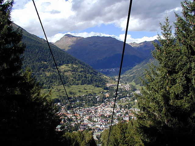
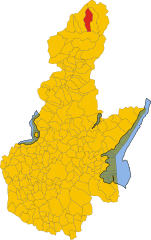
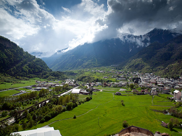
Vezza d'Oglio is a charming town located in the Camonica Valley in the Lombardy region of northern Italy. It serves as a gateway to numerous hiking opportunities in the surrounding areas. Here are some highlights and tips for hiking around Vezza d'Oglio:
Trails and Nature
-
Sentiero delle Orchidee: This trail is famous for its diverse flora, especially the various species of orchids that bloom in spring. It's a relatively easy hike suitable for all skill levels.
-
Valle di Vezza: This scenic valley offers several hiking paths that lead you through lush forests, alongside rivers, and to beautiful viewpoints overlooking the surrounding mountains.
-
Piz Valdidentro: For more experienced hikers, a trek to Piz Valdidentro offers a challenging ascent with rewarding panoramic views of the Alps and the Camonica Valley.
-
Adamello Park: Nearby, the Adamello Brenta Natural Park provides trails for all levels. You can take in stunning glacial lakes, rugged terrains, and rich wildlife.
Best Times to Hike
- Spring (April to June): Ideal for seeing wildflowers and enjoying moderate temperatures.
- Summer (July to August): Great for hiking, but it can get crowded. Early morning hikes are recommended to avoid the heat.
- Autumn (September to October): Offers beautiful fall colors and fewer crowds, making it a lovely time for hiking.
Preparation Tips
- Equipment: Ensure you have appropriate footwear, a map or GPS, water, snacks, and sun protection. A trekking pole can also be helpful for steeper sections.
- Weather: The weather can change rapidly in the mountains, so check forecasts and be prepared for sudden changes.
- Local Guidelines: Stay on marked paths, respect local wildlife, and follow Leave No Trace principles to preserve the natural beauty.
Local Culture
After a day of hiking, consider exploring the town of Vezza d'Oglio itself. Try local cuisine, visit cultural sites, and enjoy the cozy atmosphere of this mountain village.
Overall, Vezza d'Oglio is an excellent destination for outdoor enthusiasts looking to experience the beauty of the Italian Alps while enjoying a variety of hiking trails suitable for different skill levels.
- Country:

- Postal Code: 25059
- Local Dialing Code: 0364
- Licence Plate Code: BS
- Coordinates: 46° 14' 20" N, 10° 23' 53" E


- GPS tracks (wikiloc): [Link]
- AboveSeaLevel: 1080 м m
- Area: 54.15 sq km
- Population: 1443
- Web site: http://www.comune.vezzadoglio.bs.it
- Wikipedia en: wiki(en)
- Wikipedia: wiki(it)
- Wikidata storage: Wikidata: Q70944
- Wikipedia Commons Gallery: [Link]
- Wikipedia Commons Category: [Link]
- Freebase ID: [/m/04dsdd]
- GeoNames ID: Alt: [6536196]
- OSM relation ID: [47016]
- WOEID: [725842]
- ISTAT ID: 017198
- Italian cadastre code: L816
Shares border with regions:


Edolo
- Italian comune
Edolo is a charming town located in the Brescia province of Lombardy, Italy, surrounded by the stunning landscapes of the Adamello and Tonale mountains. It's an excellent destination for hiking enthusiasts, offering a variety of trails that cater to different skill levels. Here are some highlights of hiking in the Edolo area:...
- Country:

- Postal Code: 25048
- Local Dialing Code: 0364
- Licence Plate Code: BS
- Coordinates: 46° 10' 44" N, 10° 19' 48" E


- GPS tracks (wikiloc): [Link]
- AboveSeaLevel: 720 м m
- Area: 88.9 sq km
- Population: 4564
- Web site: [Link]


Incudine
- Italian comune
Incudine is a small and picturesque village located in the province of Brescia in the Lombardy region of Italy, nestled in the scenic Valle Camonica. Hiking in this area offers stunning views of the surrounding mountains, lush forests, and opportunities to explore rich cultural heritage....
- Country:

- Postal Code: 25040
- Local Dialing Code: 0364
- Licence Plate Code: BS
- Coordinates: 46° 13' 20" N, 10° 21' 30" E


- GPS tracks (wikiloc): [Link]
- AboveSeaLevel: 910 м m
- Area: 19.67 sq km
- Population: 371
- Web site: [Link]


Monno
- Italian comune
Monno, located in the province of Brescia in Italy, is an excellent destination for hiking enthusiasts. Nestled in the beautiful landscape of the Lombardy region, it offers a variety of trails suitable for different skill levels, from leisurely walks to more challenging hikes....
- Country:

- Postal Code: 25040
- Local Dialing Code: 0364
- Licence Plate Code: BS
- Coordinates: 46° 12' 48" N, 10° 20' 26" E


- GPS tracks (wikiloc): [Link]
- AboveSeaLevel: 1066 м m
- Area: 31.03 sq km
- Population: 540
- Web site: [Link]


Ponte di Legno
- Italian comune
Ponte di Legno is a beautiful alpine resort located in the Lombardy region of northern Italy, nestled within the stunning landscape of the Adamello-Presanella Natural Park. This area is renowned for its breathtaking mountain scenery, diverse flora and fauna, and a variety of hiking trails suitable for all levels of hikers....
- Country:

- Postal Code: 25056
- Local Dialing Code: 0364
- Licence Plate Code: BS
- Coordinates: 46° 15' 34" N, 10° 30' 34" E


- GPS tracks (wikiloc): [Link]
- AboveSeaLevel: 1258 м m
- Area: 100.43 sq km
- Population: 1730
- Web site: [Link]


Temù
- Italian comune
Temù is a charming town located in the Val Camonica region of northern Italy, nestled in the foothills of the Adamello-Presanella Alps. It's a great destination for hiking enthusiasts, offering a variety of trails and scenic landscapes....
- Country:

- Postal Code: 25050
- Local Dialing Code: 0364
- Licence Plate Code: BS
- Coordinates: 46° 14' 58" N, 10° 28' 8" E


- GPS tracks (wikiloc): [Link]
- AboveSeaLevel: 1150 м m
- Area: 43.26 sq km
- Population: 1105
- Web site: [Link]


Vione
- Italian comune
Vione, a charming village in the Lombardy region of Italy, serves as a great starting point for hiking adventures, especially in the nearby Valcamonica area. The region offers breathtaking landscapes, including rolling hills, lush forests, alpine meadows, and stunning views of the surrounding mountains....
- Country:

- Postal Code: 25050
- Local Dialing Code: 0364
- Licence Plate Code: BS
- Coordinates: 46° 14' 53" N, 10° 26' 54" E


- GPS tracks (wikiloc): [Link]
- AboveSeaLevel: 1250 м m
- Area: 35.27 sq km
- Population: 689
- Web site: [Link]


Sondalo
- Italian comune
Sondalo is a charming town located in the Valtellina Valley in northern Italy, surrounded by stunning natural landscapes that make it an excellent destination for hiking enthusiasts. The area is characterized by its dramatic mountains, lush forests, and rich biodiversity....
- Country:

- Postal Code: 23035
- Local Dialing Code: 0342
- Licence Plate Code: SO
- Coordinates: 46° 20' 0" N, 10° 20' 0" E


- GPS tracks (wikiloc): [Link]
- AboveSeaLevel: 900 м m
- Area: 95.45 sq km
- Population: 4114
- Web site: [Link]


Grosio
- Italian comune
Grosio, located in the Valtellina valley of northern Italy, is a wonderful destination for hiking enthusiasts. Surrounded by the stunning Rhaetian Alps, the area offers a variety of trails that cater to different skill levels, from casual walkers to experienced hikers....
- Country:

- Postal Code: 23033
- Local Dialing Code: 0342
- Licence Plate Code: SO
- Coordinates: 46° 18' 0" N, 10° 17' 0" E


- GPS tracks (wikiloc): [Link]
- AboveSeaLevel: 656 м m
- Area: 126.92 sq km
- Population: 4431
- Web site: [Link]

