Vieillevigne (Vieillevigne)

- commune in Loire-Atlantique, France
- Country:

- Postal Code: 44116
- Coordinates: 46° 58' 16" N, 1° 26' 0" E


- GPS tracks (wikiloc): [Link]
- Area: 51.76 sq km
- Population: 3964
- Web site: http://www.vieillevigne44.com
- Wikipedia en: wiki(en)
- Wikipedia: wiki(fr)
- Wikidata storage: Wikidata: Q1113990
- Wikipedia Commons Category: [Link]
- Freebase ID: [/m/03qd52s]
- Freebase ID: [/m/03qd52s]
- GeoNames ID: Alt: [6434559]
- GeoNames ID: Alt: [6434559]
- SIREN number: [214402166]
- SIREN number: [214402166]
- BnF ID: [15260385g]
- BnF ID: [15260385g]
- INSEE municipality code: 44216
- INSEE municipality code: 44216
Shares border with regions:

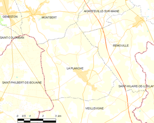
La Planche
- commune in Loire-Atlantique, France
- Country:
- Postal Code: 44140
- Coordinates: 47° 0' 59" N, 1° 26' 7" E
- GPS tracks (wikiloc): [Link]
- Area: 24.42 sq km
- Population: 2576
- Web site: [Link]
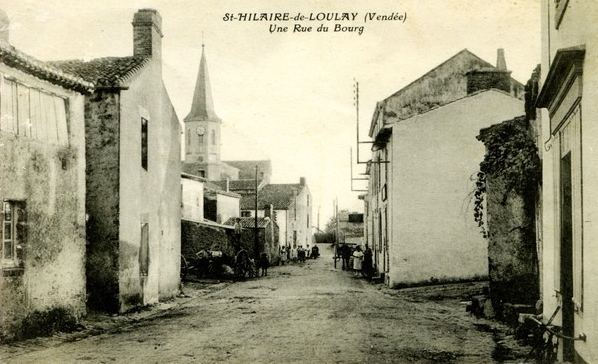

Saint-Hilaire-de-Loulay
- commune in Vendée, France
- Country:
- Postal Code: 85600
- Coordinates: 47° 0' 11" N, 1° 19' 51" E
- GPS tracks (wikiloc): [Link]
- Area: 40.62 sq km
- Population: 4493


Mormaison
- former commune in Vendée, France
- Country:
- Postal Code: 85260
- Coordinates: 46° 54' 25" N, 1° 27' 0" E
- GPS tracks (wikiloc): [Link]
- AboveSeaLevel: 55 м m
- Area: 15.44 sq km
- Population: 1122

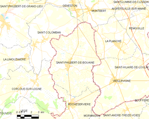
Saint-Philbert-de-Bouaine
- commune in Vendée, France
- Country:
- Postal Code: 85660
- Coordinates: 46° 59' 7" N, 1° 31' 15" E
- GPS tracks (wikiloc): [Link]
- Area: 50.16 sq km
- Population: 3326
- Web site: [Link]


Boufféré
- commune in Vendée, France
- Country:
- Postal Code: 85600
- Coordinates: 46° 57' 41" N, 1° 20' 25" E
- GPS tracks (wikiloc): [Link]
- Area: 16.55 sq km
- Population: 3288
- Web site: [Link]


Remouillé
- commune in Loire-Atlantique, France
- Country:
- Postal Code: 44140
- Coordinates: 47° 3' 20" N, 1° 22' 37" E
- GPS tracks (wikiloc): [Link]
- Area: 21.38 sq km
- Population: 1862
- Web site: [Link]


Rocheservière
- commune in Vendée, France
- Country:
- Postal Code: 85620
- Coordinates: 46° 56' 20" N, 1° 30' 33" E
- GPS tracks (wikiloc): [Link]
- Area: 28.15 sq km
- Population: 3221
- Web site: [Link]