Villa Minozzo (Villa Minozzo)
.svg)
- Italian comune
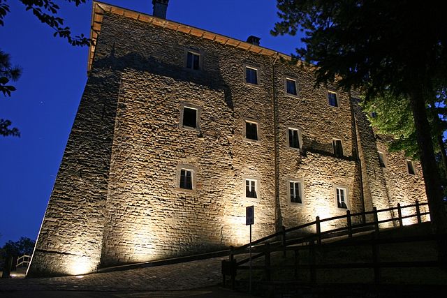
 Hiking in Villa Minozzo
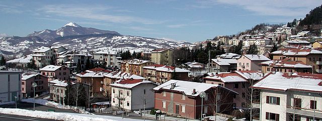
Villa Minozzo is a picturesque municipality located in the Emilia-Romagna region of Italy, nestled in the Apennine Mountains. This area is known for its stunning natural landscapes, historical sites, and a variety of outdoor activities, including hiking.
Hiking Opportunities
-
Diverse Trails: The region offers numerous hiking trails that vary in difficulty, making it suitable for both beginners and experienced hikers. You can find trails that lead through dense forests, along mountain ridges, and to breathtaking viewpoints.
-
Natural Parks: Villa Minozzo is close to the Parco Nazionale dell'Appennino Tosco-Emiliano, a national park that features diverse flora and fauna, as well as stunning geological formations. Trails within the park allow hikers to immerse themselves in nature and experience the area's biodiversity.
-
Historic Paths: Some trails in the region also have historical significance, connecting ancient villages or leading to sites of cultural interest. This adds an educational aspect to your hiking experience.
-
Scenic Views: Many trails offer incredible panoramic views of the surrounding mountains and valleys, especially in clear weather. It's a great extra incentive to reach the peak or lookout points.
-
Wildlife Watching: As you hike, keep an eye out for the local wildlife. The region is home to various species, including deer, wild boar, and a variety of birds.
Hiking Tips
-
Check Trail Conditions: Before heading out, check the conditions of the trails, as they can be affected by weather, especially in the mountainous areas.
-
Weather Preparedness: The weather in the Apennines can change rapidly, so be sure to dress in layers, carry rain gear, and be prepared for cooler temperatures at higher elevations.
-
Stay Hydrated and Nourished: Always bring enough water and snacks to keep your energy up during your hikes.
-
Respect Nature: Follow Leave No Trace principles to help preserve the natural beauty of the area.
-
Local Guides: If you're unsure of the best trails to take or want an enriched experience, consider hiring a local guide who can offer insights into the area's history and ecology.
Conclusion
Hiking in Villa Minozzo is a wonderful way to explore the natural beauty and culture of the Emilia-Romagna region. Whether you're looking for a leisurely walk or a challenging hike, this region caters to all adventurers while providing a serene backdrop for outdoor exploration.
- Country:

- Postal Code: 42030
- Local Dialing Code: 0522
- Licence Plate Code: RE
- Coordinates: 44° 22' 0" N, 10° 27' 0" E


- GPS tracks (wikiloc): [Link]
- AboveSeaLevel: 684 м m
- Area: 168.08 sq km
- Population: 3658
- Web site: http://comune.villa-faraldi.im.it
- Wikipedia en: wiki(en)
- Wikipedia: wiki(it)
- Wikidata storage: Wikidata: Q111306
- Wikipedia Commons Category: [Link]
- Freebase ID: [/m/0gkfzx]
- GeoNames ID: Alt: [6538447]
- VIAF ID: Alt: [245271531]
- OSM relation ID: [42964]
- MusicBrainz area ID: [a117c54b-4683-43b3-99be-e4f8be970dcf]
- Quora topic ID: [Villa-Minozzo]
- BNCF Thesaurus ID: [44117]
- ISTAT ID: 035045
- Italian cadastre code: L969
Shares border with regions:


Frassinoro
- Italian comune
Hiking in Frassinoro
Frassinoro is a charming town located in the Modena province of Emilia-Romagna in northern Italy, nestled in the Appenine mountains. It is an excellent location for hiking enthusiasts due to its stunning natural landscapes, rich history, and diverse trails. Here are some highlights and tips for hiking in the Frassinoro area:...
- Country:
- Postal Code: 41040; 41044
- Local Dialing Code: 0536
- Licence Plate Code: MO
- Coordinates: 44° 17' 47" N, 10° 34' 16" E
- GPS tracks (wikiloc): [Link]
- AboveSeaLevel: 1131 м m
- Area: 95.46 sq km
- Population: 1876
- Web site: [Link]

Montefiorino
- Italian comune
Hiking in Montefiorino
Montefiorino is a picturesque town located in the Emilia-Romagna region of Italy, surrounded by the beautiful landscapes of the Apennine Mountains. It's an excellent location for hiking enthusiasts due to its diverse terrain, rich flora and fauna, and a wealth of trails that cater to various skill levels....
- Country:
- Postal Code: 41045
- Local Dialing Code: 0536
- Licence Plate Code: MO
- Coordinates: 44° 21' 0" N, 10° 37' 0" E
- GPS tracks (wikiloc): [Link]
- AboveSeaLevel: 800 м m
- Area: 45.28 sq km
- Population: 2147
- Web site: [Link]


Carpineti
- Italian comune
Hiking in Carpineti
Carpineti is a charming town located in the Emilia-Romagna region of Italy, nestled in the Apennine Mountains. It's surrounded by beautiful landscapes, making it an excellent destination for hiking enthusiasts. Here are some highlights and tips for hiking in and around Carpineti:...
- Country:
- Postal Code: 42033
- Local Dialing Code: 0522
- Licence Plate Code: RE
- Coordinates: 44° 27' 24" N, 10° 31' 14" E
- GPS tracks (wikiloc): [Link]
- AboveSeaLevel: 562 м m
- Area: 89.57 sq km
- Population: 4011
- Web site: [Link]

Castelnovo ne' Monti
- Italian comune
Hiking in Castelnovo ne' Monti
Castelnovo ne' Monti is a charming town located in the Emilia-Romagna region of Italy, surrounded by the stunning landscapes of the Apennine Mountains. It's an excellent destination for hiking enthusiasts, offering a variety of trails that cater to different skill levels and preferences....
- Country:
- Postal Code: 42035
- Local Dialing Code: 0522
- Licence Plate Code: RE
- Coordinates: 44° 26' 0" N, 10° 24' 0" E
- GPS tracks (wikiloc): [Link]
- AboveSeaLevel: 700 м m
- Area: 96.68 sq km
- Population: 10473
- Web site: [Link]
Toano
- Italian comune
Hiking in Toano
Toano, Virginia, is a scenic area that offers several opportunities for hiking enthusiasts. While it may not be as widely known as some other hiking destinations, it features beautiful landscapes and trails that cater to various skill levels. Here are some highlights and tips for hiking in and around Toano:...
- Country:
- Postal Code: 42010
- Local Dialing Code: 0522
- Licence Plate Code: RE
- Coordinates: 44° 23' 0" N, 10° 34' 0" E
- GPS tracks (wikiloc): [Link]
- AboveSeaLevel: 842 м m
- Area: 67.25 sq km
- Population: 4433
- Web site: [Link]
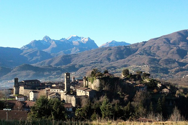

Castiglione di Garfagnana
- Italian comune
Hiking in Castiglione di Garfagnana
Castiglione di Garfagnana, located in the province of Lucca in Tuscany, Italy, is a beautiful area for hiking enthusiasts. Surrounded by the Apuan Alps and the Apennines, the region offers a variety of trails that cater to different skill levels, from leisure walks to more challenging hikes....
- Country:
- Postal Code: 55033
- Local Dialing Code: 0583
- Licence Plate Code: LU
- Coordinates: 44° 9' 3" N, 10° 24' 42" E
- GPS tracks (wikiloc): [Link]
- AboveSeaLevel: 545 м m
- Area: 48.53 sq km
- Population: 1783
- Web site: [Link]


Villa Collemandina
- Italian comune
Hiking in Villa Collemandina
Villa Collemandina is a picturesque village located in the province of Lucca in Tuscany, Italy. Nestled in the Apennine Mountains, it offers stunning views and a variety of hiking opportunities that cater to different skill levels. Here are some key aspects of hiking in this area:...
- Country:
- Postal Code: 55030
- Local Dialing Code: 0583
- Licence Plate Code: LU
- Coordinates: 44° 10' 0" N, 10° 24' 0" E
- GPS tracks (wikiloc): [Link]
- AboveSeaLevel: 549 м m
- Area: 34.79 sq km
- Population: 1309
- Web site: [Link]