Villandraut (Villandraut)

- commune in Gironde, France
- Country:

- Postal Code: 33730
- Coordinates: 44° 27' 26" N, 0° 22' 20" E


- GPS tracks (wikiloc): [Link]
- Area: 12.58 sq km
- Population: 1012
- Web site: http://www.villandraut.fr/fr/villandraut-commune-du-sud-gironde.php
- Wikipedia en: wiki(en)
- Wikipedia: wiki(fr)
- Wikidata storage: Wikidata: Q187654
- Wikipedia Commons Category: [Link]
- Freebase ID: [/m/03ns2w7]
- GeoNames ID: Alt: [6432499]
- SIREN number: [213305477]
- BnF ID: [15256593w]
- INSEE municipality code: 33547
Shares border with regions:


Préchac
- commune in Gironde, France
- Country:
- Postal Code: 33730
- Coordinates: 44° 23' 59" N, 0° 21' 12" E
- GPS tracks (wikiloc): [Link]
- Area: 63.87 sq km
- Population: 1024
- Web site: [Link]


Noaillan
- commune in Gironde, France
- Country:
- Postal Code: 33730
- Coordinates: 44° 28' 50" N, 0° 21' 59" E
- GPS tracks (wikiloc): [Link]
- Area: 31.8 sq km
- Population: 1674
- Web site: [Link]

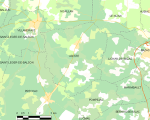
Uzeste
- commune in Gironde, France
- Country:
- Postal Code: 33730
- Coordinates: 44° 26' 29" N, 0° 19' 25" E
- GPS tracks (wikiloc): [Link]
- Area: 26.05 sq km
- Population: 387


Balizac
- commune in Gironde, France
- Country:
- Postal Code: 33730
- Coordinates: 44° 29' 15" N, 0° 26' 39" E
- GPS tracks (wikiloc): [Link]
- Area: 41.78 sq km
- Population: 493


Saint-Léger-de-Balson
- commune in Gironde, France
- Country:
- Postal Code: 33113
- Coordinates: 44° 25' 55" N, 0° 27' 57" E
- GPS tracks (wikiloc): [Link]
- Area: 38.04 sq km
- Population: 340