Villebrumier (Villebrumier)

- commune in Tarn-et-Garonne, France
- Country:

- Postal Code: 82370
- Coordinates: 43° 54' 24" N, 1° 27' 11" E


- GPS tracks (wikiloc): [Link]
- Area: 11.38 sq km
- Population: 1365
- Web site: http://www.villebrumier.fr/
- Wikipedia en: wiki(en)
- Wikipedia: wiki(fr)
- Wikidata storage: Wikidata: Q1626387
- Wikipedia Commons Category: [Link]
- Freebase ID: [/m/03qg2ly]
- Freebase ID: [/m/03qg2ly]
- GeoNames ID: Alt: [6445050]
- GeoNames ID: Alt: [6445050]
- SIREN number: [218201945]
- SIREN number: [218201945]
- BnF ID: [152778267]
- BnF ID: [152778267]
- INSEE municipality code: 82194
- INSEE municipality code: 82194
Shares border with regions:


Villemur-sur-Tarn
- commune in Haute-Garonne, France
- Country:
- Postal Code: 31340
- Coordinates: 43° 51' 56" N, 1° 30' 18" E
- GPS tracks (wikiloc): [Link]
- Area: 46.57 sq km
- Population: 5873
- Web site: [Link]


Reyniès
- commune in Tarn-et-Garonne, France
- Country:
- Postal Code: 82370
- Coordinates: 43° 55' 2" N, 1° 23' 54" E
- GPS tracks (wikiloc): [Link]
- Area: 9.94 sq km
- Population: 863


Nohic
- commune in Tarn-et-Garonne, France
- Country:
- Postal Code: 82370
- Coordinates: 43° 53' 25" N, 1° 26' 17" E
- GPS tracks (wikiloc): [Link]
- Area: 12.61 sq km
- Population: 1338

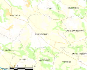
Saint-Nauphary
- commune in Tarn-et-Garonne, France
- Country:
- Postal Code: 82370
- Coordinates: 43° 57' 53" N, 1° 25' 42" E
- GPS tracks (wikiloc): [Link]
- Area: 24.43 sq km
- Population: 1820


Varennes
- commune in Tarn-et-Garonne, France
- Country:
- Postal Code: 82370
- Coordinates: 43° 54' 5" N, 1° 29' 52" E
- GPS tracks (wikiloc): [Link]
- AboveSeaLevel: 206 м m
- Area: 14.76 sq km
- Population: 567
- Web site: [Link]