Villefranche-de-Lauragais (Villefranche-de-Lauragais)

- commune in Haute-Garonne, France
- Country:

- Postal Code: 31290
- Coordinates: 43° 23' 59" N, 1° 43' 5" E


- GPS tracks (wikiloc): [Link]
- Area: 10.35 sq km
- Population: 4345
- Web site: http://www.mairie-villefranchedelauragais.fr
- Wikipedia en: wiki(en)
- Wikipedia: wiki(fr)
- Wikidata storage: Wikidata: Q671059
- Wikipedia Commons Category: [Link]
- Freebase ID: [/m/02vxhq0]
- GeoNames ID: Alt: [2968758]
- SIREN number: [213105828]
- BnF ID: [15255577d]
- VIAF ID: Alt: [124779364]
- Library of Congress authority ID: Alt: [nr96044723]
- PACTOLS thesaurus ID: [pcrtPuLEXFXsVE]
- WOEID: [12672469]
- INSEE municipality code: 31582
Shares border with regions:

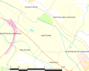
Saint-Rome
- commune in Haute-Garonne, France
- Country:
- Postal Code: 31290
- Coordinates: 43° 24' 53" N, 1° 40' 37" E
- GPS tracks (wikiloc): [Link]
- AboveSeaLevel: 170 м m
- Area: 3.63 sq km
- Population: 50


Gardouch
- commune in Haute-Garonne, France
- Country:
- Postal Code: 31290
- Coordinates: 43° 23' 29" N, 1° 41' 1" E
- GPS tracks (wikiloc): [Link]
- Area: 16.31 sq km
- Population: 1267
- Web site: [Link]


Montgaillard-Lauragais
- commune in Haute-Garonne, France
- Country:
- Postal Code: 31290
- Coordinates: 43° 25' 53" N, 1° 41' 54" E
- GPS tracks (wikiloc): [Link]
- Area: 11.12 sq km
- Population: 732
- Web site: [Link]

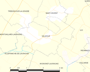
Vallègue
- commune in Haute-Garonne, France
- Country:
- Postal Code: 31290
- Coordinates: 43° 25' 28" N, 1° 45' 16" E
- GPS tracks (wikiloc): [Link]
- Area: 4.18 sq km
- Population: 526
- Web site: [Link]


Renneville
- commune in Haute-Garonne, France
- Country:
- Postal Code: 31290
- Coordinates: 43° 22' 51" N, 1° 43' 25" E
- GPS tracks (wikiloc): [Link]
- Area: 8.42 sq km
- Population: 540


Avignonet-Lauragais
- commune in Haute-Garonne, France
- Country:
- Postal Code: 31290
- Coordinates: 43° 21' 57" N, 1° 47' 20" E
- GPS tracks (wikiloc): [Link]
- AboveSeaLevel: 215 м m
- Area: 40.66 sq km
- Population: 1444
- Web site: [Link]