Villemer (Villemer)

- commune in Seine-et-Marne, France
- Country:

- Postal Code: 77250
- Coordinates: 48° 18' 4" N, 2° 49' 31" E


- GPS tracks (wikiloc): [Link]
- Area: 18.54 sq km
- Population: 733
- Web site: http://www.villemer.fr
- Wikipedia en: wiki(en)
- Wikipedia: wiki(fr)
- Wikidata storage: Wikidata: Q923696
- Wikipedia Commons Category: [Link]
- Freebase ID: [/m/02rsgkm]
- Freebase ID: [/m/02rsgkm]
- GeoNames ID: Alt: [6443903]
- GeoNames ID: Alt: [6443903]
- SIREN number: [217705060]
- SIREN number: [217705060]
- BnF ID: [15275844p]
- BnF ID: [15275844p]
- VIAF ID: Alt: [127032772]
- VIAF ID: Alt: [127032772]
- INSEE municipality code: 77506
- INSEE municipality code: 77506
Shares border with regions:

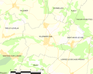
Villemaréchal
- commune in Seine-et-Marne, France
- Country:
- Postal Code: 77710
- Coordinates: 48° 16' 3" N, 2° 52' 6" E
- GPS tracks (wikiloc): [Link]
- Area: 14.23 sq km
- Population: 862
- Web site: [Link]


Épisy
- former commune in Seine-et-Marne, France
- Country:
- Postal Code: 77250
- Coordinates: 48° 20' 3" N, 2° 47' 10" E
- GPS tracks (wikiloc): [Link]
- Area: 7.41 sq km
- Population: 571
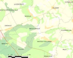
Treuzy-Levelay
- commune in Seine-et-Marne, France
- Country:
- Postal Code: 77710
- Coordinates: 48° 16' 23" N, 2° 48' 49" E
- GPS tracks (wikiloc): [Link]
- Area: 14.1 sq km
- Population: 446


Nonville
- commune in Seine-et-Marne, France
- Country:
- Postal Code: 77140
- Coordinates: 48° 17' 11" N, 2° 47' 17" E
- GPS tracks (wikiloc): [Link]
- Area: 11.43 sq km
- Population: 607
- Web site: [Link]


La Genevraye
- commune in Seine-et-Marne, France
- Country:
- Postal Code: 77690
- Coordinates: 48° 19' 14" N, 2° 44' 47" E
- GPS tracks (wikiloc): [Link]
- Area: 13.16 sq km
- Population: 764


Villecerf
- commune in Seine-et-Marne, France
- Country:
- Postal Code: 77250
- Coordinates: 48° 19' 39" N, 2° 50' 50" E
- GPS tracks (wikiloc): [Link]
- Area: 10.94 sq km
- Population: 714
- Web site: [Link]


Dormelles
- commune in Seine-et-Marne, France
- Country:
- Postal Code: 77130
- Coordinates: 48° 18' 57" N, 2° 54' 3" E
- GPS tracks (wikiloc): [Link]
- Area: 13.02 sq km
- Population: 808
- Web site: [Link]