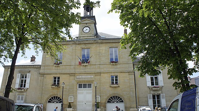
Villers-Franqueux (Villers-Franqueux)

- commune in Marne, France
- Country:

- Postal Code: 51220
- Coordinates: 49° 19' 41" N, 3° 56' 37" E


- GPS tracks (wikiloc): [Link]
- Area: 3.29 sq km
- Population: 297
- Wikipedia en: wiki(en)
- Wikipedia: wiki(fr)
- Wikidata storage: Wikidata: Q1219967
- Wikipedia Commons Category: [Link]
- Freebase ID: [/m/03qdc0k]
- GeoNames ID: Alt: [6436092]
- SIREN number: [215105867]
- BnF ID: [152632221]
- INSEE municipality code: 51633
Shares border with regions:


Loivre
- commune in Marne, France
- Country:
- Postal Code: 51220
- Coordinates: 49° 20' 46" N, 3° 58' 47" E
- GPS tracks (wikiloc): [Link]
- Area: 10.24 sq km
- Population: 1276

Hermonville
- commune in Marne, France
- Country:
- Postal Code: 51220
- Coordinates: 49° 20' 7" N, 3° 54' 31" E
- GPS tracks (wikiloc): [Link]
- Area: 13.3 sq km
- Population: 1476


Pouillon
- commune in Marne, France
- Country:
- Postal Code: 51220
- Coordinates: 49° 18' 51" N, 3° 56' 52" E
- GPS tracks (wikiloc): [Link]
- Area: 2.78 sq km
- Population: 496
- Web site: [Link]

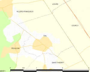
Thil
- commune in Marne, France
- Country:
- Postal Code: 51220
- Coordinates: 49° 18' 55" N, 3° 57' 45" E
- GPS tracks (wikiloc): [Link]
- Area: 2.11 sq km
- Population: 295