Villmergen (Villmergen)
- municipality in Switzerland
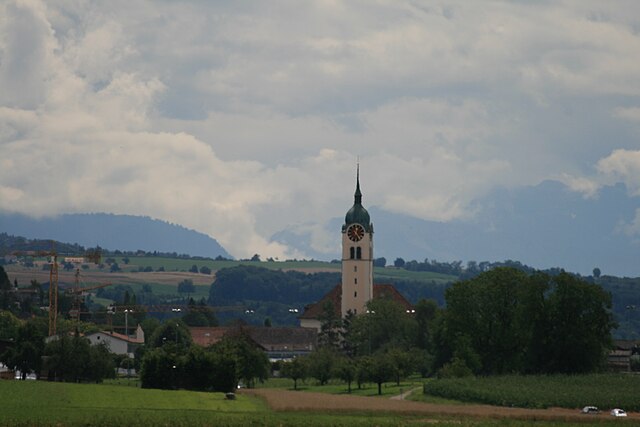
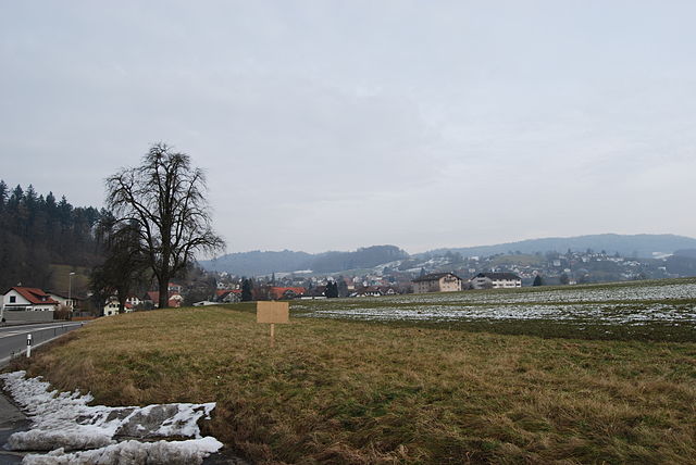
Villmergen, located in the Aargau region of Switzerland, offers a beautiful setting for hiking enthusiasts. While it's a small municipality, it provides access to scenic trails that showcase the charming landscapes of the Swiss countryside.
Key Points for Hiking in Villmergen:
-
Scenic Trails: The area around Villmergen features a mix of forest paths, rolling hills, and pastoral landscapes. You can expect to see a variety of local flora and fauna along the trails.
-
Nearby Nature Reserves: The region is close to natural reserves and protected areas, which offer additional hiking opportunities. You might explore the nearby Reuss river valley or head to the larger forests that surround the village.
-
Difficulty Levels: There are trails suitable for all hiking levels—from easy walks for families to more challenging hikes for experienced hikers. It's advisable to check local maps for recommended routes.
-
Accessibility: Villmergen is well-connected by public transport, making it easy to access various trailheads. The surrounding towns also have lovely walking paths that can be explored.
-
Historical Aspects: While hiking, you might encounter historical sites like old farms and traditional Swiss architecture, adding a cultural dimension to your experience.
-
Weather Considerations: Always check the weather forecast before heading out, as conditions can change quickly in mountainous and rural areas.
-
Local Guidance: Consider visiting the local tourist office or community center for maps and advice on current trail conditions or guided hikes.
When hiking in Villmergen, always remember to adhere to Leave No Trace principles to help preserve the natural beauty of the area for future hikers. Enjoy your adventure!
- Country:

- Postal Code: 5612
- Local Dialing Code: 056
- Licence Plate Code: AG
- Coordinates: 47° 21' 4" N, 8° 14' 28" E


- GPS tracks (wikiloc): [Link]
- AboveSeaLevel: 433 м m
- Area: 11.94 sq km
- Population: 7341
- Web site: http://www.villmergen.ch
- Wikipedia en: wiki(en)
- Wikipedia: wiki(de)
- Wikidata storage: Wikidata: Q64232
- Wikipedia Commons Category: [Link]
- Freebase ID: [/m/0fr0v3]
- GeoNames ID: Alt: [7287479]
- BnF ID: [13332495t]
- VIAF ID: Alt: [157272680]
- OSM relation ID: [1684452]
- Library of Congress authority ID: Alt: [n96085983]
- MusicBrainz area ID: [aed86fd5-042a-44be-b935-f1f7490f7fd1]
- HDS ID: [1679]
- Swiss municipality code: [4080]
Shares border with regions:


Dottikon
- municipality in Switzerland
Dottikon is a charming village located in the canton of Aargau, Switzerland. It sits at the foot of the Jura Mountains, providing access to beautiful hiking trails and scenic landscapes typical of this region. Here’s what you should know about hiking in and around Dottikon:...
- Country:

- Postal Code: 5605
- Local Dialing Code: 056
- Licence Plate Code: AG
- Coordinates: 47° 22' 50" N, 8° 14' 33" E


- GPS tracks (wikiloc): [Link]
- AboveSeaLevel: 405 м m
- Area: 3.89 sq km
- Population: 3873
- Web site: [Link]


Büttikon
- municipality in Switzerland
Büttikon is a charming village located in the canton of Aargau, Switzerland, surrounded by beautiful landscapes and rolling hills, making it a lovely destination for hiking enthusiasts. Here are some details about hiking in and around Büttikon:...
- Country:

- Postal Code: 5619
- Local Dialing Code: 056
- Licence Plate Code: AG
- Coordinates: 47° 19' 42" N, 8° 16' 6" E


- GPS tracks (wikiloc): [Link]
- AboveSeaLevel: 504 м m
- Area: 2.82 sq km
- Population: 981
- Web site: [Link]


Seengen
- municipality in Switzerland
Seengen, located in the canton of Aargau in Switzerland, offers picturesque landscapes and a variety of hiking opportunities suitable for different skill levels. From gentle lakeside walks to more challenging trails in the surrounding hills, there’s something for everyone....
- Country:

- Postal Code: 5707
- Local Dialing Code: 062
- Licence Plate Code: AG
- Coordinates: 47° 19' 45" N, 8° 12' 32" E


- GPS tracks (wikiloc): [Link]
- AboveSeaLevel: 520 м m
- Area: 10.35 sq km
- Population: 3951
- Web site: [Link]


Dintikon
- municipality in Switzerland
Dintikon is a charming village located in the canton of Aargau, Switzerland. It offers picturesque landscapes and various hiking opportunities for outdoor enthusiasts. Here are some key points about hiking in and around Dintikon:...
- Country:

- Postal Code: 5606
- Local Dialing Code: 056
- Licence Plate Code: AG
- Coordinates: 47° 21' 54" N, 8° 13' 45" E


- GPS tracks (wikiloc): [Link]
- AboveSeaLevel: 449 м m
- Area: 3.73 sq km
- Population: 2192
- Web site: [Link]


Egliswil
- municipality in Switzerland
Egliswil is a picturesque village located in Switzerland, nestled in the scenic Cantonal region of Aargau. It's surrounded by stunning landscapes, making it a wonderful destination for hiking enthusiasts....
- Country:

- Postal Code: 5704
- Local Dialing Code: 062
- Licence Plate Code: AG
- Coordinates: 47° 21' 6" N, 8° 11' 25" E


- GPS tracks (wikiloc): [Link]
- AboveSeaLevel: 483 м m
- Area: 6.29 sq km
- Population: 1407
- Web site: [Link]


Hendschiken
- municipality in Switzerland
Hendschiken is a small municipality in the canton of Aargau, Switzerland, located near the Aare River and surrounded by picturesque landscapes. While it may not be a widely known hiking destination, there are certainly some lovely trails in the surrounding area that you can explore....
- Country:

- Postal Code: 5604
- Local Dialing Code: 062
- Licence Plate Code: AG
- Coordinates: 47° 23' 4" N, 8° 12' 57" E


- GPS tracks (wikiloc): [Link]
- AboveSeaLevel: 410 м m
- Area: 3.52 sq km
- Population: 1227
- Web site: [Link]


Wohlen
- municipality in the canton of Aargau, Switzerland
Wohlen, located in the Aargau canton of Switzerland, offers a variety of hiking opportunities amidst picturesque landscapes and charming rural scenery. The region is characterized by rolling hills, lush meadows, and forests, making it a great destination for both casual walkers and more experienced hikers. Here are some highlights for hiking in Wohlen:...
- Country:

- Postal Code: 5610
- Local Dialing Code: 056
- Licence Plate Code: AG
- Coordinates: 47° 21' 2" N, 8° 16' 40" E


- GPS tracks (wikiloc): [Link]
- AboveSeaLevel: 420 м m
- Area: 12.4 sq km
- Population: 16078
- Web site: [Link]

