Virargues (Virargues)

- commune in Cantal, France
- Country:

- Postal Code: 15300
- Coordinates: 45° 7' 30" N, 2° 54' 37" E


- GPS tracks (wikiloc): [Link]
- Area: 11.03 sq km
- Population: 133
- Wikipedia en: wiki(en)
- Wikipedia: wiki(fr)
- Wikidata storage: Wikidata: Q809723
- Wikipedia Commons Category: [Link]
- Freebase ID: [/m/02w6k0j]
- GeoNames ID: Alt: [6427681]
- SIREN number: [211502638]
- BnF ID: [152484331]
- INSEE municipality code: 15263
Shares border with regions:


Celles
- former commune in Cantal, France
- Country:
- Postal Code: 15170
- Coordinates: 45° 6' 54" N, 2° 57' 15" E
- GPS tracks (wikiloc): [Link]
- Area: 18.35 sq km
- Population: 217


Murat
- former commune in Cantal, France
- Country:
- Postal Code: 15300
- Coordinates: 45° 6' 36" N, 2° 52' 7" E
- GPS tracks (wikiloc): [Link]
- Area: 6.47 sq km
- Population: 1833


La Chapelle-d'Alagnon
- commune in Cantal, France
- Country:
- Postal Code: 15300
- Coordinates: 45° 6' 28" N, 2° 53' 47" E
- GPS tracks (wikiloc): [Link]
- Area: 9.2 sq km
- Population: 246

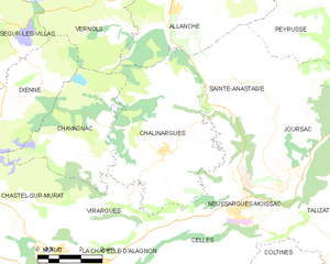
Chalinargues
- former commune in Cantal, France
- Country:
- Postal Code: 15170
- Coordinates: 45° 9' 18" N, 2° 55' 55" E
- GPS tracks (wikiloc): [Link]
- Area: 27.55 sq km
- Population: 427


Chastel-sur-Murat
- former commune in Cantal, France
- Country:
- Postal Code: 15300
- Coordinates: 45° 7' 27" N, 2° 51' 26" E
- GPS tracks (wikiloc): [Link]
- Area: 13.79 sq km
- Population: 118

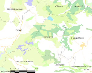
Chavagnac
- former commune in Cantal, France
- Country:
- Postal Code: 15300
- Coordinates: 45° 9' 13" N, 2° 52' 55" E
- GPS tracks (wikiloc): [Link]
- AboveSeaLevel: 1095 м m
- Area: 16.58 sq km
- Population: 108